1980s Maps of Beardstown, Illinois
Explore 5 historic maps of Beardstown from the 1980s. These maps offer a rare glimpse into what life looked like during the 1980s — showing old roads, neighborhoods, homes, and landmarks that have changed or disappeared over time.
Whether you're researching your family's past, planning a metal detecting trip, or studying how Beardstown's landscape evolved across the 1980s, these high-resolution maps are a powerful tool for exploring the history of this region.
- Focus on a specific era: All maps on this page are from the 1980s, giving you a focused view of this time period.
- See what’s changed: Compare century-old streets, trails, and buildings to today's modern landscape using overlays and satellite layers.
- Research with precision: Use these maps for genealogy, historical research, land use analysis, or educational projects.
- View, download, or print: Maps are fully viewable online in high resolution, and can be downloaded or printed for your own records.
Start exploring Beardstown's history through authentic maps from the 1980s. This is your window into the past.
Beardstown, IL maps
(5)- 1981 Map of Beardstown
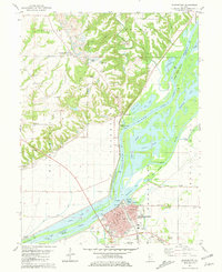 1981 Beardstown1981 Print · USGSBeardstown and the Illinois River bottomlands are captured in the early 1980s as the river and rail lines continue to shape the local economy. Genealogists can locate several family-named burial sites like Bellamy Cem and Gillette Cem or trace the old roads near Pleasant View.
 - 1983 Map of Arenzville West
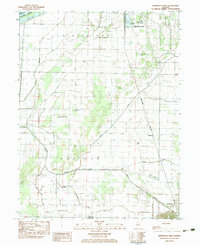 1983 Arenzville West1983 Print · USGSCass County agriculture and river-town life meet in the early eighties along the Illinois River and eastern bluffs. Genealogists and researchers can trace family landmarks like St Peters Ch, Hackman Cem, and the old Townhall near the railroad.2 unique versions available
 - 1985 Map of Macomb
 1985 Macomb1985 Print · USGSWest Central Illinois in the mid-eighties shows a robust network of river towns and rail corridors spanning from the Illinois River to the Lamoine. Genealogists and historians can trace the foundations of Macomb, find rural landmarks like Pennington Point, or locate early conservation sites like Argyle Lake State Park.
 - 1985 Map of Meredosia, 1988 Print
 1985 Meredosia1988 Print · USGSWest Central Illinois in the mid-eighties was a landscape of deep-rooted river towns and historic educational institutions. Genealogists and historians can trace family ties through Diamond Grove Cem, locate MacMurray College in Jacksonville, or study the river engineering at La Grange Lock and Dam.
 - 1989 Map of Macomb
 1989 Macomb1989 Print · USGSWest Central Illinois in the late eighties shows a landscape of river-bottom conservation and rail-town commerce. Researchers can trace the extensive wetlands of the Illinois River or locate historic transport hubs in Macomb, Colchester, and Beardstown.
End of results
Showing maps 1-5 of 5
Top cities near Beardstown
- Rushville historical maps
- Virginia historical maps
- Meredosia historical maps
- Bluff Springs historical maps
- Chapin historical maps
- Hagener historical maps
See more
Top neighborhoods of Beardstown
Frequently asked questions
- What are the different types of historical maps available for Beardstown?
- What is the oldest map of Beardstown?
- Where can I purchase historical maps of Beardstown for my home or office?
- Where can I download high-res historical maps of Beardstown?
- Are there historical topographic maps available for Beardstown?
- Is there historical aerial imagery available for Beardstown?
- Where are historical maps of Beardstown sourced from?