1900s (20th Century) Maps of Tomlinson, Illinois
Explore 10 historic maps of Tomlinson from the 1900s (20th Century). These maps offer a rare glimpse into what life looked like during the 1900s — showing old roads, neighborhoods, homes, and landmarks that have changed or disappeared over time.
Whether you're researching your family's past, planning a metal detecting trip, or studying how Tomlinson's landscape evolved across the 1900s, these high-resolution maps are a powerful tool for exploring the history of this region.
- Focus on a specific era: All maps on this page are from the 1900s, giving you a focused view of this time period.
- See what’s changed: Compare century-old streets, trails, and buildings to today's modern landscape using overlays and satellite layers.
- Research with precision: Use these maps for genealogy, historical research, land use analysis, or educational projects.
- View, download, or print: Maps are fully viewable online in high resolution, and can be downloaded or printed for your own records.
Start exploring Tomlinson's history through authentic maps from the 1900s. This is your window into the past.
Tomlinson, IL maps
(10)- 1924 Map of Paxton, 1953 Print
 1924 Paxton1953 Print · USGSEast-central Illinois comes into focus during the mid-twenties as the rail lines and early airfields transformed the prairie. Researchers can locate dozens of family-named schools like Lily Dell School and trace the original layout of Chanute Flying Field.
 - 1927 Map of Paxton
 1927 Paxton1927 Print · USGSIllinois prairie life in the mid-twenties is captured here through a dense network of township schools and the rise of military aviation. Genealogists and local historians can trace family locations near Chanute Flying Field or find long-standing rural landmarks like Lily Dell School and Glen Cemetery.2 unique versions available
 - 1949 Map of Paxton
 1949 Paxton1949 Print · USGSCentral Illinois thrived as a rail and military corridor in the mid-1920s, anchored by the crossroads of two major rail lines. Researchers can trace the early footprint of Chanute Flying Field and locate dozens of vanished rural schoolhouses like Trickel Grove School and Farmersville School.
 - 1957 Map of Paxton, 1958 Print
 1957 Paxton1958 Print · USGSPost-war central Illinois thrives along the rail lines and at Chanute Air Force Base. Researchers can trace family roots at St Alfreds Chapel or locate several abandoned country schools like Moffett Sch (Abandoned).2 unique versions available
 - 1958 Map of Peoria, 1969 Print
 1958 Peoria1969 Print · USGSCentral Illinois thrived as a hub of education and transport during the late sixties, as the new interstate system began to reshape the prairie. Genealogists and historians can trace local landmarks like Springdale Cem, Bradley University, and the sprawling grounds of Chanute AFB.4 unique versions available
 - 1961 Map of Peoria
 1961 Peoria1961 Print · USGSCentral Illinois thrived at the intersection of river trade and rail power during the late fifties. Genealogists and local historians can trace the rail networks of the Illinois Central and Wabash, alongside landmarks like Chanute AFB and Weldon Springs State Park.
 - 1963 Map of Peoria
 1963 Peoria1963 Print · USGSCentral Illinois thrived as a rail and highway crossroads during the early sixties, centered on the bustling Illinois River valley. Genealogists and historians can trace the mid-century layout of Peoria, locate the grounds of Chanute Air Force Base, and follow historic lines like the Toledo Peoria and Western Railway.
 - 1984 Map of Rantoul, 1985 Print
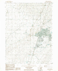 1984 Rantoul1985 Print · USGSChampaign County in the mid-eighties centers on the expanding village of Rantoul and the active operations at Chanute Air Force Base. Researchers can trace old property lines near Ludlow Cem or follow the Illinois Central Gulf rail line past Thomasboro.
 - 1985 Map of Champaign, 1986 Print
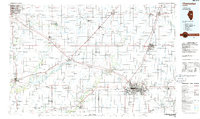 1985 Champaign1986 Print · USGSThe Illinois prairie comes alive in this mid-eighties survey of the vital rail corridor between Bloomington and Champaign. Genealogists and historians can trace the development of township hubs like Saybrook and Bellflower or locate Chanute Air Force Base and the Sangamon River.2 unique versions available
 - 1990 Map of Peoria
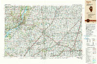 1990 Peoria1990 Print · USGSCentral Illinois at the start of the nineties reveals a landscape of industrial river towns and sprawling university campuses. Researchers can trace the legacy of major institutions like Chanute Air Force Base and the University of Illinois alongside regional landmarks such as Sand Ridge State Forest.
End of results
Showing maps 1-10 of 10
Top cities near Tomlinson
- Champaign historical maps
- Urbana historical maps
- Rantoul historical maps
- Mahomet historical maps
- Paxton historical maps
- Gibson City historical maps
See more
Frequently asked questions
- What are the different types of historical maps available for Tomlinson?
- What is the oldest map of Tomlinson?
- Where can I purchase historical maps of Tomlinson for my home or office?
- Where can I download high-res historical maps of Tomlinson?
- Are there historical topographic maps available for Tomlinson?
- Is there historical aerial imagery available for Tomlinson?
- Where are historical maps of Tomlinson sourced from?