1930s Maps of Coles County, Illinois
Explore 7 historic maps of Coles County from the 1930s. These maps offer a rare glimpse into what life looked like during the 1930s — showing old roads, neighborhoods, homes, and landmarks that have changed or disappeared over time.
Whether you're researching your family's past, planning a metal detecting trip, or studying how Coles County's landscape evolved across the 1930s, these high-resolution maps are a powerful tool for exploring the history of this region.
- Focus on a specific era: All maps on this page are from the 1930s, giving you a focused view of this time period.
- See what’s changed: Compare century-old streets, trails, and buildings to today's modern landscape using overlays and satellite layers.
- Research with precision: Use these maps for genealogy, historical research, land use analysis, or educational projects.
- View, download, or print: Maps are fully viewable online in high resolution, and can be downloaded or printed for your own records.
Start exploring Coles County's history through authentic maps from the 1930s. This is your window into the past.
Coles County, IL maps
(7)- 1933 Map of Toledo, 1958 Print
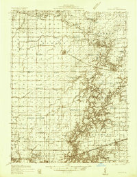
 1933 Toledo1958 Print · USGSEast-central Illinois during the early thirties is captured here as a landscape of river-valley crossings and small-town rail hubs. Genealogists can trace family roots through numerous rural landmarks like Unity Chapel, Bell Cem, and the historic Lincoln Log Cabin State Park.2 unique versions available
 - 1934 Map of Mattoon, 1967 Print
 1934 Mattoon1967 Print · USGSThe rail hubs and rural townships of East Central Illinois are captured here in the mid-1930s. Genealogists and local historians can trace the foundations of Mattoon and Neoga while locating family landmarks like Old Bethel Ch or the Little Brick Sch.2 unique versions available
 - 1935 Map of Arcola
 1935 Arcola1935 Print · USGSCentral Illinois farming communities thrived along the Illinois Central and Pennsylvania rail lines in the 1930s. Genealogists can trace family roots through numerous rural landmarks like Yoder Cem, Quinn Chapel, and Pulltight Sch.3 unique versions available
 - 1936 Map of Oakland
 1936 Oakland1936 Print · USGSColes and Douglas Counties in the mid-1930s exhibit a landscape deeply connected by the Embarrass River and the Pennsylvania railroad. Genealogists can trace hundreds of small family landmarks, from Patsy Mitchell Cem to the scores of local schoolhouses like Boneset Sch and Seven Hickory Sch.5 unique versions available
 - 1936 Map of Casey
 1936 Casey1936 Print · USGSEast-central Illinois comes into focus in the mid-thirties as a hub of rail transport and early energy production. Genealogists can trace family names through dozens of rural sites, from Pikes Peak Ch to the Tank Farm and Oilfield settlement.
 - 1937 Map of Mattoon
 1937 Mattoon1937 Print · USGSThe rail hubs of Mattoon and Neoga are shown in the late 1930s, surrounded by a dense network of country schools and family cemeteries. Trace ancestral roots at Aetna Etna PO, Johnstown, or the many rural schoolhouses like South Loxa Sch.3 unique versions available
 - 1938 Map of Toledo
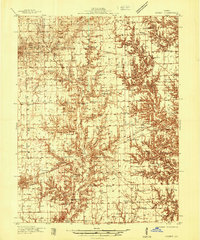
 1938 Toledo1938 Print · USGSCentral Illinois at the height of the New Deal era reveals a landscape of family farms and river-bottom timber. Genealogists can trace family landmarks like Tippett Cem, Unity Chapel, and numerous schools including Little Brick Sch.
End of results
Showing maps 1-7 of 7
Top cities of Coles County
- Charleston historical maps
- Mattoon historical maps
- Paradise historical maps
- Oakland historical maps
- Hutton historical maps
- Ashmore historical maps
See more
Frequently asked questions
- What are the different types of historical maps available for Coles County?
- What is the oldest map of Coles County?
- Where can I purchase historical maps of Coles County for my home or office?
- Where can I download high-res historical maps of Coles County?
- Are there historical topographic maps available for Coles County?
- Is there historical aerial imagery available for Coles County?
- Where are historical maps of Coles County sourced from?