Old Maps of Coles County, Illinois for Academic Research
Study the evolution of Coles County with 149 high-resolution historic maps. Whether you're teaching, researching, or modeling changes in land use, these maps provide essential visual documentation of urban, environmental, and geographic change.
- Analyze long-term change: Track patterns in development, transportation, and natural features.
- Ideal for environmental or urban studies: Support academic projects with primary historical map data.
- Use in the classroom or lab: Educators and researchers rely on these maps to bring historical context to life.
These maps are a powerful tool for teaching, research, and visualizing how Coles County has changed over the decades.
Coles County, IL maps
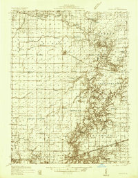
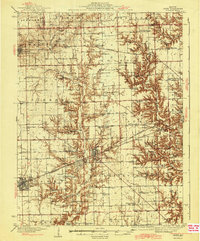
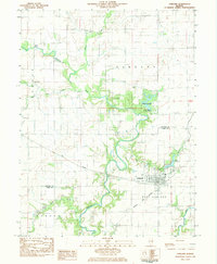
(149)- 1933 Map of Toledo, 1958 Print
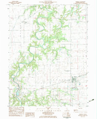
 1933 Toledo1958 Print · USGSEast-central Illinois during the early thirties is captured here as a landscape of river-valley crossings and small-town rail hubs. Genealogists can trace family roots through numerous rural landmarks like Unity Chapel, Bell Cem, and the historic Lincoln Log Cabin State Park.2 unique versions available
 - 1934 Map of Mattoon, 1967 Print
 1934 Mattoon1967 Print · USGSThe rail hubs and rural townships of East Central Illinois are captured here in the mid-1930s. Genealogists and local historians can trace the foundations of Mattoon and Neoga while locating family landmarks like Old Bethel Ch or the Little Brick Sch.2 unique versions available
 - 1935 Map of Arcola
 1935 Arcola1935 Print · USGSCentral Illinois farming communities thrived along the Illinois Central and Pennsylvania rail lines in the 1930s. Genealogists can trace family roots through numerous rural landmarks like Yoder Cem, Quinn Chapel, and Pulltight Sch.3 unique versions available
 - 1936 Map of Oakland
 1936 Oakland1936 Print · USGSColes and Douglas Counties in the mid-1930s exhibit a landscape deeply connected by the Embarrass River and the Pennsylvania railroad. Genealogists can trace hundreds of small family landmarks, from Patsy Mitchell Cem to the scores of local schoolhouses like Boneset Sch and Seven Hickory Sch.5 unique versions available
 - 1936 Map of Casey
 1936 Casey1936 Print · USGSEast-central Illinois comes into focus in the mid-thirties as a hub of rail transport and early energy production. Genealogists can trace family names through dozens of rural sites, from Pikes Peak Ch to the Tank Farm and Oilfield settlement.
 - 1937 Map of Mattoon
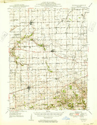
 1937 Mattoon1937 Print · USGSThe rail hubs of Mattoon and Neoga are shown in the late 1930s, surrounded by a dense network of country schools and family cemeteries. Trace ancestral roots at Aetna Etna PO, Johnstown, or the many rural schoolhouses like South Loxa Sch.3 unique versions available
 - 1938 Map of Toledo
 1938 Toledo1938 Print · USGSCentral Illinois at the height of the New Deal era reveals a landscape of family farms and river-bottom timber. Genealogists can trace family landmarks like Tippett Cem, Unity Chapel, and numerous schools including Little Brick Sch.
 - 1940 Map of Arcola
 1940 Arcola1940 Print · USGSThe Douglas and Coles County borderlands come alive in this pre-war portrait of central Illinois agricultural life. Researchers can trace dozens of rural school sites such as Pulltight Sch and Little Red Sch, alongside old rail corridors like the Illinois Central.
 - 1942 Map of Oakland
 1942 Oakland1942 Print · USGSCentral Illinois prairie life is captured here in the early 1940s as the rail-and-river economy flourished. You can trace family roots at the Patsy Mitchell Cem or locate old schoolhouses like Jack Oak Sch and Seven Hickory Sch.2 unique versions available
 - 1942 Map of Casey, 1965 Print
 1942 Casey1965 Print · USGSEast-central Illinois comes to life in this mid-century survey of the rail and road networks connecting Casey and Martinsville. Genealogists can trace family legacies through numerous landmarks like Enlow Cem, Willis Chapel, and School No 3.2 unique versions available
 - 1943 Map of Casey
 1943 Casey1943 Print · USGSEastern Illinois during the late thirties and early forties reveals a landscape of railroad towns and emerging oil infrastructure. Genealogists and researchers can trace dozens of rural landmarks, from the Abraham Lincoln Sch to the industrial TANK FARM and the Airway Beacon near Martinsville.2 unique versions available
 - 1946 Map of Kansas, 1977 Print
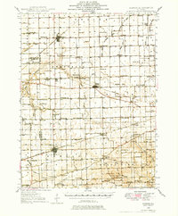 1946 Kansas1977 Print · USGSThe intersection of the New York Central and Chicago and St Louis railroads defines this Illinois prairie landscape shortly after the war. Researchers can trace rural lineages through numerous country schools and cemeteries like College Sch, Shields Cem, and Redmon.
 - 1949 Map of Kansas
 1949 Kansas1949 Print · USGSEastern Illinois at the end of the 1940s reveals a robust landscape of rail-connected towns and country schools. Genealogists can trace family names at Shields Cem or locate community hubs like Embarrass Ch and the settlement of Redmon.2 unique versions available
 - 1953 Map of Indianapolis, 1965 Print
 1953 Indianapolis1965 Print · USGSCentral Indiana and the Illinois borderlands are captured in the mid-sixties, showing the growth of Indianapolis and its industrial rail corridors. Genealogists and historians can trace the development of outlying towns like Zionsville or Beech Grove and find landmarks such as Atterbury AAF and Turkey Run State Park.4 unique versions available
 - 1956 Map of Indianapolis
 1956 Indianapolis1956 Print · USGSCentral Indiana in the mid-fifties is captured during a period of industrial growth and military presence. Genealogists and historians can trace the rail networks of the New York Central or locate regional landmarks like Fort Benjamin Harrison and Camp Atterbury.
 - 1957 Map of Indianapolis
 1957 Indianapolis1957 Print · USGSCentral Indiana in the mid-fifties is captured here as a crossroads of major rail lines and nascent federal highways. Genealogists and historians can trace family-named ridges like Poplar Ridge or locate strategic sites like Camp Atterbury and Speedway.2 unique versions available
 - 1958 Map of Decatur, 1971 Print
 1958 Decatur1971 Print · USGSCentral Illinois in the mid-twentieth century shows a landscape defined by industrial rail hubs and the creation of large reservoirs. Researchers can trace historic corridors like the Penn Central or locate landmarks such as Lincoln Log Cabin State Park and Lake Springfield.3 unique versions available
 - 1961 Map of Decatur
 1961 Decatur1961 Print · USGSCentral Illinois in the late fifties was a bustling corridor of rail lines and prairie commerce centered on the state capital. Genealogists and historians can trace the intricate connections between Springfield, Decatur, and dozens of smaller settlements like Nokomis and Arcola.2 unique versions available
 - 1962 Map of Indianapolis
 1962 Indianapolis1962 Print · USGSCentral Indiana and the Illinois borderlands are captured here in the early sixties, showing the region's dense rail networks and growing urban centers. Genealogists and historians can locate family-named landmarks and institutions like Crown Hill Cem, Indiana University, and the Indianapolis Motor Speedway.
 - 1982 Map of Charleston North, 1983 Print
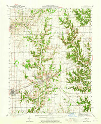
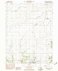 1982 Charleston North1983 Print · USGSColes County at the start of the 1980s shows a landscape of productive prairie farmland and small rail-stop settlements. Genealogists and local historians can locate early burial grounds like Winkleblack Cem and family-named landmarks such as Cassell Creek.
 - 1982 Map of Ashmore, 1983 Print
 1982 Ashmore1983 Print · USGSColes County in the early 1980s is captured here as a landscape of prairie agriculture and winding river valleys. Researchers can locate numerous family burial sites like St Omer Cem or trace the path of the Embarras River to the Airtight Bridge.
 - 1982 Map of Kansas, 1983 Print
 1982 Kansas1983 Print · USGSThe eastern Illinois prairie around Kansas is shown here in the early eighties, where the CONRAIL railroad still defined the town's orientation. Researchers can trace numerous family burial grounds and country landmarks like Shields Cem, Harmony Ch, and the North Fork Embarras River.
 - 1982 Map of Brocton, 1983 Print
 1982 Brocton1983 Print · USGSThe village of Brocton and its neighboring hamlets of Isabel and Borton are captured in the early 1980s as vital rail-and-river communities. Researchers can trace the agricultural landscape through family-named landmarks like Zimmerman Cem, Scott Cem, and the Ewing Landing Strip.
 - 1982 Map of Hindsboro, 1983 Print
 1982 Hindsboro1983 Print · USGSDouglas and Coles counties are shown in the early eighties as the agricultural landscape of East Central Illinois continued to modernize. Researchers can trace rural lineages through the locations of Hindsboro, Kemp, and the Mt Gilead Ch near the Embarras River.
 - 1982 Map of Oakland, 1983 Print
 1982 Oakland1983 Print · USGSThe rail-and-river landscape of the Illinois prairie is captured here in the early eighties. Genealogists and local historians can trace family plots at Pleasant Grove Cem and Rosedale Cem or locate old crossings like Barnett Bridge.
Showing maps 1-25 of 149
Top cities of Coles County
- Charleston historical maps
- Mattoon historical maps
- Paradise historical maps
- Oakland historical maps
- Hutton historical maps
- Ashmore historical maps
See more
Frequently asked questions
- What are the different types of historical maps available for Coles County?
- What is the oldest map of Coles County?
- Where can I purchase historical maps of Coles County for my home or office?
- Where can I download high-res historical maps of Coles County?
- Are there historical topographic maps available for Coles County?
- Is there historical aerial imagery available for Coles County?
- Where are historical maps of Coles County sourced from?