1990s Maps of Coles County, Illinois
Explore 18 historic maps of Coles County from the 1990s. These maps offer a rare glimpse into what life looked like during the 1990s — showing old roads, neighborhoods, homes, and landmarks that have changed or disappeared over time.
Whether you're researching your family's past, planning a metal detecting trip, or studying how Coles County's landscape evolved across the 1990s, these high-resolution maps are a powerful tool for exploring the history of this region.
- Focus on a specific era: All maps on this page are from the 1990s, giving you a focused view of this time period.
- See what’s changed: Compare century-old streets, trails, and buildings to today's modern landscape using overlays and satellite layers.
- Research with precision: Use these maps for genealogy, historical research, land use analysis, or educational projects.
- View, download, or print: Maps are fully viewable online in high resolution, and can be downloaded or printed for your own records.
Start exploring Coles County's history through authentic maps from the 1990s. This is your window into the past.
Coles County, IL maps
(18)- 1998 Map of Kansas, 2002 Print
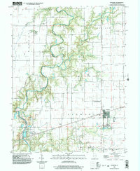
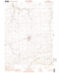 1998 Kansas2002 Print · USGSThe rural border of Edgar and Coles counties is captured here in the late 1990s, centered on the village of Kansas. Local historians can trace a significant density of rural burial sites and churches including Harmony Ch, Shields Cem, and Wilhoit Cem.
 - 1998 Map of Mattoon East, 2002 Print
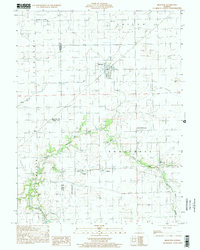
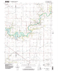
 1998 Mattoon East2002 Print · USGSThe eastern edge of Mattoon and the agricultural heart of Coles County are shown here at the turn of the millennium. Researchers can locate the small settlements of Lerna and Loxa or trace the winding paths of Kickapoo Creek and Indian Creek.
 - 1998 Map of Arcola, 2002 Print
 1998 Arcola2002 Print · USGSThe Douglas and Coles county line area is shown in the late 1990s as a productive landscape of oil fields and prairie towns. Trace family roots at Township Cemetery or explore landmarks like the Cooks Mills Consolidated Oil Field and Galton.
 - 1998 Map of Mattoon West, 2002 Print
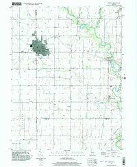
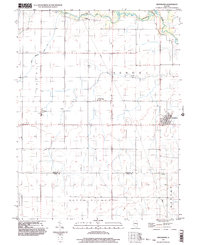
 1998 Mattoon West2002 Print · USGSMattoon and the prairie townships of Coles County are captured here at the close of the millennium. Local historians can trace the development of Lake Land Jr College and old rail stops like Gays and Etna alongside the waters of Paradise Lake.
 - 1998 Map of Toledo, 2002 Print
 1998 Toledo2002 Print · USGSCumberland County at the close of the century shows a landscape where the Embarras River winds between established towns and quiet rural townships. Genealogists and historians can trace the Old Railroad Grade or locate family sites near Graveyard Hill and Janesville.
 - 1998 Map of Brocton, 2002 Print
 1998 Brocton2002 Print · USGSThe prairie of Edgar and Douglas counties was well-established by the late 1990s, centered on the village of Brocton. Genealogists can trace family names at Zimmerman Cem or Scott Cem and locate the small settlement of Isabel.
 - 1998 Map of Westfield East, 2002 Print
 1998 Westfield East2002 Print · USGSClark County and the surrounding townships are captured in the late twentieth century as agriculture and small-scale industry defined the landscape. Genealogists can trace family roots through Cleone, Oilfield, and scattered cemeteries near the Embarras River.
 - 1998 Map of Humboldt, 2003 Print
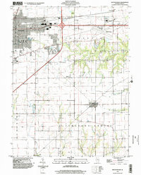
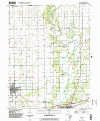
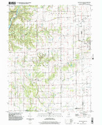
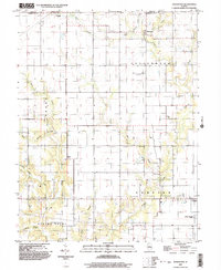
 1998 Humboldt2003 Print · USGSColes County at the close of the twentieth century shows a landscape defined by prairie drainage and rail transit. Genealogists and local historians can trace family plots at Township Cem or locate the community foundations of Humboldt and Dorans.
 - 1998 Map of Oakland, 2003 Print
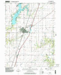
 1998 Oakland2003 Print · USGSThe Embarras River valley near the Coles and Douglas county line is captured here in the late 1990s as it winds past Oakland. Genealogists and researchers can locate several family burial grounds like Rosedale Cem and Berry Cem or trace the grounds of the Prairie Observatory.
 - 1998 Map of Westfield West, 2003 Print
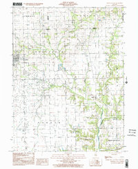
 1998 Westfield West2003 Print · USGSThe prairie and timber lands of east-central Illinois are shown here in the late twentieth century as the Embarras River bypasses Charleston. Researchers can trace rural cemetery sites and old industrial markers like the Mill near Westfield or the Gas Fields Creek drainage.
 - 1998 Map of Arthur, 2003 Print
 1998 Arthur2003 Print · USGSArthur and its surrounding prairie landscape are documented here at the close of the twentieth century, showing a unique intersection of faith-based schooling and heavy industry. Genealogists and historians can trace family-named sites like Yoder Cemetery and the German School alongside the active Cooks Mills Oil Field.
 - 1998 Map of Cooks Mills, 2003 Print
 1998 Cooks Mills2003 Print · USGSCentral Illinois at the end of the twentieth century reveals a landscape shaped by the Kaskaskia River and the local energy industry. Researchers can trace rural cemeteries and church sites like Quinn Chapel or locate active oil wells and the Daily Landing Strip.
 - 1998 Map of Johnstown, 2003 Print
 1998 Johnstown2003 Print · USGSThe borderlands of Cumberland and Coles counties are captured in the late 1990s, revealing a landscape of rural townships and winding creeks. Genealogists and local historians can trace family-named landmarks and small settlements like Trilla, Johnstown, and Neal.
 - 1998 Map of Hindsboro, 2003 Print
 1998 Hindsboro2003 Print · USGSThe eastern Illinois prairie near the Douglas and Coles county line is captured in the late nineties, showcasing a meticulously gridded agricultural landscape. Genealogists can trace family footprints near Hindsboro, Filson, and the rural Mt Gilead Ch.
 - 1998 Map of Neoga, 2003 Print
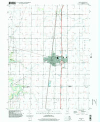
 1998 Neoga2003 Print · USGSNeoga and the surrounding prairie are captured here in the late 1990s as a crossroads of rail and road. Researchers can trace the path of the Illinois Central Railroad and find local landmarks like the Racetrack and Lake Mattoon.
 - 1998 Map of Charleston South, 2003 Print
 1998 Charleston South2003 Print · USGSSouth of the city at the turn of the millennium, this area shows the historic sites and river valleys of Coles and Cumberland Counties. Genealogists can trace family connections in Campbell (Farmington) or locate the Lincoln Log Cabin State Historic Site.
 - 1998 Map of Ashmore, 2003 Print
 1998 Ashmore2003 Print · USGSColes County at the end of the century reveals a landscape defined by the winding Embarras River and its rural townships. Family historians can trace local roots through numerous sites like St Omer Cem, Brooks Cem, and the historic Airtight Bridge.
 - 1998 Map of Charleston North, 2003 Print
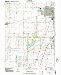
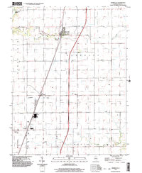
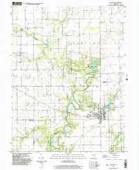
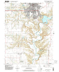
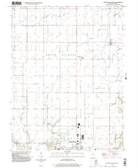 1998 Charleston North2003 Print · USGSThe northern outskirts of Charleston and the surrounding prairie townships are captured here in the late 1990s. Genealogists and local historians can trace family locations near North Union Ch, Mound Cem, and the small agricultural settlements of Fairgrange and Bushton.
End of results
Showing maps 1-18 of 18
Top cities of Coles County
- Charleston historical maps
- Mattoon historical maps
- Paradise historical maps
- Oakland historical maps
- Hutton historical maps
- Ashmore historical maps
See more
Frequently asked questions
- What are the different types of historical maps available for Coles County?
- What is the oldest map of Coles County?
- Where can I purchase historical maps of Coles County for my home or office?
- Where can I download high-res historical maps of Coles County?
- Are there historical topographic maps available for Coles County?
- Is there historical aerial imagery available for Coles County?
- Where are historical maps of Coles County sourced from?