Old Maps of Bloom Township, Illinois for Academic Research
Study the evolution of Bloom Township with 52 high-resolution historic maps. Whether you're teaching, researching, or modeling changes in land use, these maps provide essential visual documentation of urban, environmental, and geographic change.
- Analyze long-term change: Track patterns in development, transportation, and natural features.
- Ideal for environmental or urban studies: Support academic projects with primary historical map data.
- Use in the classroom or lab: Educators and researchers rely on these maps to bring historical context to life.
These maps are a powerful tool for teaching, research, and visualizing how Bloom Township has changed over the decades.
Bloom Township, IL maps
(52)- 1892 Map of Calumet
 1892 Calumet1892 Print · USGSThe industrial corridor south of Chicago is captured in the late nineteenth century as rail lines and rivers shaped new towns. Genealogists can trace family roots through early settlements like Pullman, Blue Island, and the South Lawn Harvey P.O. at a time of rapid growth.
 - 1893 Map of Calumet
 1893 Calumet1893 Print · USGSSouthern Cook County and the Indiana borderlands are captured here during a period of massive rail and industrial growth. Trace the footprints of historic company towns and transit hubs like Pullman, Blue Island, and Hammond before the landscape was fully urbanized.
 - 1900 Map of Calumet
 1900 Calumet1900 Print · USGSSouthern Cook County and the Indiana borderlands are captured here at the peak of the rail era, showing a landscape of burgeoning industrial towns and complex rail junctions. Researchers can trace the layout of the historic company town of Pullman, the growth of Hammond, and the early footprints of Blue Island and Harvey.
 - 1901 Map of Calumet
 1901 Calumet1901 Print · USGSSouthern Chicago and the Calumet region are captured at the peak of their industrial expansion at the turn of the century. Genealogists and historians can trace the growth of rail-side towns like Pullman, Blue Island, and Hegewisch and locate landmarks like the Glenwood Industrial School.5 unique versions available
 - 1929 Map of Calumet City
 1929 Calumet City1929 Print · USGSThe Calumet region during the late twenties shows a landscape transitioning from rural townships to industrial hubs. Genealogists and historians can trace the early rail networks, numerous family-named cemeteries like Oak Hill Cem, and local landmarks such as the Brickyard and Sunnybrook School.3 unique versions available
 - 1929 Map of Harvey
 1929 Harvey1929 Print · USGSSouthern Cook County emerges as a major rail and residential hub in the late twenties. Genealogists and historians can trace the development of Markham Yards, find the Glenwood Manual Training School, and locate St Johns Sch and local cemeteries.4 unique versions available
 - 1929 Map of Dyer, 1946 Print
 1929 Dyer1946 Print · USGSThe industrial suburbs and agricultural lands of the Illinois-Indiana border are captured here in the late 1920s. Researchers can trace the path of the Lincoln Highway and locate long-standing landmarks like the Cats Corner School or Strassburg School.
 - 1930 Map of Dyer
 1930 Dyer1930 Print · USGSThe Illinois-Indiana borderlands appear in the late twenties during a period of industrial and automotive growth. Genealogists and local historians can trace early schoolhouse locations like Cats Corner School and the path of the famous Lincoln Highway near Dyer.
 - 1930 Map of Steger
 1930 Steger1930 Print · USGSThe southern outskirts of Chicago thrived as a rail and industrial nexus in the late twenties. Genealogists and historians can trace the early footprints of South Chicago Heights and Matteson, locating landmarks like St Annes Church and the Calvary Cemetery.2 unique versions available
 - 1949 Map of Crete
 1949 Crete1949 Print · USGSWill County and the surrounding borderlands are captured here in the late 1940s as a busy intersection of rail and road. Genealogists can locate dozens of country schools and churches like Beebe Grove Sch, St Annes Ch, and Crete Cem.
 - 1953 Map of Steger, 1955 Print
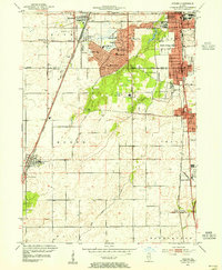 1953 Steger1955 Print · USGSSouthern Cook and Will Counties are shown in the early fifties as new suburban developments began to reshape the prairie landscape. Genealogists can trace family roots through numerous local landmarks, including Lincoln Fields Sta, Adams Cem, and the Sauk Trail Sch.4 unique versions available
 - 1953 Map of Calumet City, 1955 Print
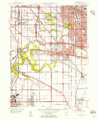 1953 Calumet City1955 Print · USGSThe Calumet region during the early fifties shows a burgeoning industrial and suburban landscape spanning the Illinois Indiana state line. Trace the development of local neighborhoods and infrastructure from Chicago Hammond Airport to the Thornton Junction rail hub.
 - 1953 Map of Harvey, 1955 Print
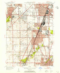 1953 Harvey1955 Print · USGSSouthern Cook County experiences a mid-century suburban surge centered on the rail corridors of Harvey and Homewood. Genealogists and historians can trace family roots through numerous sites like the Oak Forest Infirmary, Markham Yard, and St Johns Sch.
 - 1953 Map of Dyer, 1955 Print
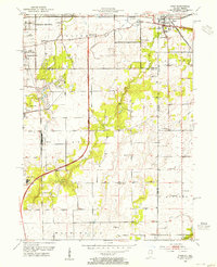 1953 Dyer1955 Print · USGSThe Illinois-Indiana border during the early fifties reveals a landscape of growing suburbs and traditional crossroads. Researchers can trace historic family roots at Eagle Lake Cem or locate lost landmarks like Klemme Sch and Lincoln Fields.
 - 1953 Map of Chicago, 1964 Print
 1953 Chicago1964 Print · USGSThe southern Lake Michigan shoreline was rapidly modernizing in the mid-fifties, balancing heavy industry with its famous academic centers. Researchers can trace the footprints of Notre Dame University or locate vanished sites like the Kingsbury Ordnance Plant and Meigs Field.5 unique versions available
 - 1957 Map of Chicago
 1957 Chicago1957 Print · USGSThe industrial heartland and southern Great Lakes shoreline are captured here during the peak of mid-century growth. Researchers can trace the massive Gary Steel Works, the grounds of the University of Notre Dame, and the early paths of the Tri-State Tollway.
 - 1960 Map of Calumet City, 1962 Print
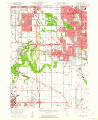 1960 Calumet City1962 Print · USGSGreater Chicago's southeastern industrial corridor meets the Indiana state line in this early 1960s survey of burgeoning suburbs and rail hubs. Researchers can trace family roots at Holy Cross Cemetery, locate the old Chicago Hammond Airport, or study the rail network of the Grand Trunk and Monon lines.
 - 1962 Map of Dyer, 1964 Print
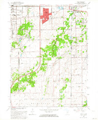 1962 Dyer1964 Print · USGSThe Illinois-Indiana borderland comes alive in the early sixties as suburban growth from Sauk Village meets the rural crossroads of Lake County. Local historians can trace the paths of the Sauk Trail and find family-named landmarks like Katz Corner Sch and St Johns Ch.2 unique versions available
 - 1963 Map of Harvey, 1965 Print
 1963 Harvey1965 Print · USGSSouth Chicago's suburban expansion is in full swing during the early sixties, as residential grids fill the spaces between historic rail lines. Genealogists can locate family sites at St Gabriel Cemetery or Mt Glenwood Cem, while tracing the growth of Harvey, Markham, and Flossmoor.3 unique versions available
 - 1968 Map of Calumet City, 1970 Print
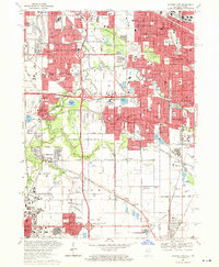 1968 Calumet City1970 Print · USGSThe Illinois-Indiana borderlands reached a peak of industrial and suburban development in the late sixties. Researchers can trace the massive rail networks of the Penn Central and find local landmarks like St Margarets Hospital and the Chicago-Hammond Airport.4 unique versions available
 - 1980 Map of Chicago
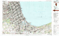 1980 Chicago1980 Print · USGSThe Chicago metropolitan area and the industrial shores of Northwest Indiana are captured here at the start of the 1980s. Genealogists and local historians can trace the vast urban landscape through landmarks like Loyola University, St Casimir Cemetery, and the busy docks of Calumet Harbor.
 - 1984 Map of Kankakee, 1985 Print
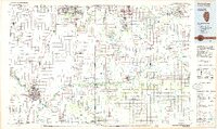 1984 Kankakee1985 Print · USGSThe Illinois-Indiana borderlands appear here in the early eighties as a landscape of river-centered towns and vast managed wetlands. Genealogists and local historians can trace the grounds of the Kankakee State Hospital, the campus of Olivet Nazarene College, and the sprawling Beaver Lake Wildlife Refuge.
 - 1990 Map of Dyer, 1991 Print
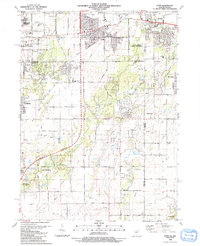 1990 Dyer1991 Print · USGSSuburban development meets the rural prairie at the Illinois and Indiana border in the early nineties. Researchers can trace family sites from Sauk Village to Dyer, including St James Cem and the small settlement of Kreitzburg.
 - 1990 Map of Steger, 1991 Print
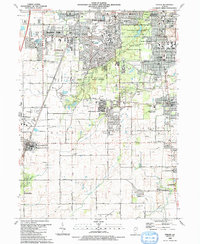 1990 Steger1991 Print · USGSThe south Chicago suburbs of Will and Cook Counties appear in full growth during the late twentieth century. Genealogists and local historians can trace family locations through sites like Evergreen Hill Cem, S Liborius Sch, and the Balmoral Park Racetrack.
 - 1991 Map of Kankakee
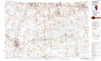 1991 Kankakee1991 Print · USGSThe Illinois-Indiana borderlands come into focus during the early nineties, centered on the growing Kankakee valley and its sprawling drainage systems. Trace the rail-and-river economy through landmarks like the Wilton Railroad Grade, the Manteno State Hospital, and the historic Old Pioneer Cem.
Showing maps 1-25 of 52
Top cities near Bloom Township
- Chicago historical maps
- Hammond historical maps
- Gary historical maps
- Oak Lawn historical maps
- Orland Park historical maps
- Tinley Park historical maps
See more
Top neighborhoods of Bloom Township
- Chicago Heights historical maps
- Sauk Village historical maps
- Lynwood historical maps
- Glenwood historical maps
- Olympia Fields historical maps
- South Chicago Heights historical maps
See more
Frequently asked questions
- What are the different types of historical maps available for Bloom Township?
- What is the oldest map of Bloom Township?
- Where can I purchase historical maps of Bloom Township for my home or office?
- Where can I download high-res historical maps of Bloom Township?
- Are there historical topographic maps available for Bloom Township?
- Is there historical aerial imagery available for Bloom Township?
- Where are historical maps of Bloom Township sourced from?