1980s Maps of Redmon, Illinois
Explore 2 historic maps of Redmon from the 1980s. These maps offer a rare glimpse into what life looked like during the 1980s — showing old roads, neighborhoods, homes, and landmarks that have changed or disappeared over time.
Whether you're researching your family's past, planning a metal detecting trip, or studying how Redmon's landscape evolved across the 1980s, these high-resolution maps are a powerful tool for exploring the history of this region.
- Focus on a specific era: All maps on this page are from the 1980s, giving you a focused view of this time period.
- See what’s changed: Compare century-old streets, trails, and buildings to today's modern landscape using overlays and satellite layers.
- Research with precision: Use these maps for genealogy, historical research, land use analysis, or educational projects.
- View, download, or print: Maps are fully viewable online in high resolution, and can be downloaded or printed for your own records.
Start exploring Redmon's history through authentic maps from the 1980s. This is your window into the past.
Redmon, IL maps
(2)- 1982 Map of Redmon, 1983 Print
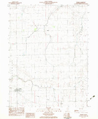 1982 Redmon1983 Print · USGSEdgar County settlement and rural drainage are captured here in the early 1980s. Local researchers can trace the rail-side growth of Redmon or locate smaller points like Garland and Mays set among the forks of Brouilletts Cr and Sugar Creek.
 - 1986 Map of Paris
 1986 Paris1986 Print · USGSThe Illinois-Indiana borderlands thrive in the mid-1980s as a hub of river-side industry and fertile farmland. Genealogists and historians can trace rail-centered settlements like Chrisman and Metcalf, or locate family sites at the Quaker Cem and Bethel Ch.2 unique versions available
End of results
Showing maps 1-2 of 2
Top cities near Redmon
- Paris historical maps
- Marshall historical maps
- Chrisman historical maps
- Oakland historical maps
- Newman historical maps
- Kansas historical maps
See more
Frequently asked questions
- What are the different types of historical maps available for Redmon?
- What is the oldest map of Redmon?
- Where can I purchase historical maps of Redmon for my home or office?
- Where can I download high-res historical maps of Redmon?
- Are there historical topographic maps available for Redmon?
- Is there historical aerial imagery available for Redmon?
- Where are historical maps of Redmon sourced from?