Old Maps of Fayette County, Illinois for Genealogy
Trace your family roots with 179 historic maps of Fayette County. These high-res maps reveal old neighborhoods, homesites, landmarks, and streets — helping you uncover where your ancestors lived and how the area evolved over time.
- Explore historic neighborhoods: Identify where your relatives may have lived in the 1800s or 1900s.
- Compare maps over time: Trace the changes in streets, buildings, and landmarks for multi-generational research.
- Perfect for genealogy & ancestry research: Used by family historians and researchers to map out lineage and migration.
These maps are an incredible resource for exploring your personal connection to Fayette County's past.
Fayette County, IL maps
(179)- 1910 Map of Carlyle
 1910 Carlyle1910 Print · USGSClinton County and the Kaskaskia River valley are captured here at a peak of rural development in the Edwardian era. Genealogists can trace a dense network of family-named landmarks including Hull School, McKendree Chapel, and the river crossing at Colmers Ferry.2 unique versions available
 - 1914 Map of Centralia
 1914 Centralia1914 Print · USGSSouthern Illinois at the peak of the rail era shows a landscape of busy junctions and tightly-knit rural school districts. Genealogists and historians can trace family locations near landmarks like Possumtrot School, Fikes Hill, and the bustling yards of Centralia.3 unique versions available
 - 1932 Map of Greenville
 1932 Greenville1932 Print · USGSThis Illinois landscape in the early thirties reveals a bustling agricultural and rail network centered on Greenfield. Genealogists can trace family roots through numerous country burial grounds like Stultz Cem and historic schools such as Oakland Sch.
 - 1935 Map of Centralia, 1958 Print
 1935 Centralia1958 Print · USGSCentralia and the surrounding Marion County townships thrived as a major railroad crossroads in the mid-1930s. Researchers can locate dozens of localized rural schoolhouses like Red Stripe and Possumtrot School or trace the early paths of the Illinois Central through Sandoval and Odin.
 - 1939 Map of Greenville, 1957 Print
 1939 Greenville1957 Print · USGSBond County and the surrounding prairies are captured here in the late thirties, showing a rural economy built on the Pennsylvania railroad and local post offices. Trace the sites of vanished schoolhouses like Pleasant View Sch and old burial grounds such as Dunkard Cem or Mt Moriah Cem.2 unique versions available
 - 1941 Map of St. Elmo, 1958 Print
 1941 St. Elmo1958 Print · USGSThe Illinois counties of Fayette, Shelby, and Effingham are mapped here in the early 1940s at the height of their rail-and-refinery era. Genealogists and historians can trace numerous country schools like Martin Box Sch and churches like Crums Chapel near the Carter Refinery.2 unique versions available
 - 1943 Map of Greenville
 1943 Greenville1943 Print · USGSBond County's rail-and-river network is fully detailed in the early 1940s, showing the intersection of major lines through the region. Researchers can trace family roots at Dunkard Cem or locate community hubs like Wisetown Beaver Creek P O and the CCC Camp.2 unique versions available
 - 1944 Map of Ramsey, 1976 Print
 1944 Ramsey1976 Print · USGSFayette County communities like Ramsey and Bingham thrive along the intersection of the Illinois Central and other major rail lines during the 1940s. Genealogists can trace family roots through numerous rural landmarks like Bayle City P O, Halford Chapel, and Hoffman Cem.
 - 1945 Map of St. Elmo
 1945 St. Elmo1945 Print · USGSFayette and Effingham counties are seen here in the 1940s at a peak of rail and river industry. Genealogists and historians can trace family locations near Saint Elmo, locate the Carter Refinery, or find rural landmarks like Crums Chapel and Meyers Cem.2 unique versions available
 - 1945 Map of Kinmundy, 1965 Print
 1945 Kinmundy1965 Print · USGSThe rural borderlands of Fayette and Marion Counties are shown at the end of the war, when small farming communities still thrived around rail junctions. You can trace family roots at St Johns Ch or locate forgotten sites like Old Loogootee Sch and Gray Cem.2 unique versions available
 - 1945 Map of Vandalia, 1969 Print
 1945 Vandalia1969 Print · USGSMid-century Fayette County life centered on the Kaskaskia River and the rail-connected hub of Vandalia. Genealogists can trace family names through dozens of rural landmarks, from the Mc Inturff Cem to school sites like Clover College Sch and Elm Grove Sch.
 - 1946 Map of Ramsey
 1946 Ramsey1946 Print · USGSCentral Illinois rail-and-river life thrives mid-century as the Kaskaskia River winds past a dense network of country schoolhouses. Genealogists and local historians can trace family roots at Shed Cem, Bayle City P O, and the Illinois State Penal Farm.2 unique versions available
 - 1947 Map of Vandalia
 1947 Vandalia1947 Print · USGSThe Kaskaskia River valley in the post-war era shows a landscape of busy rail junctions and rural school districts. Genealogists can trace family names through dozens of landmarks like Evans Cem, Clover College Sch, and the community of Hagarstown.
 - 1947 Map of Kinmundy
 1947 Kinmundy1947 Print · USGSMarion and Fayette counties are captured here just after the war, showing a rural landscape anchored by a dense network of farm-to-market railroads. Genealogists can trace family footprints through numerous small schools and cemeteries, from Farina and St Peter to Shanghai Sch and Cumberland Cem.2 unique versions available
 - 1947 Map of Hillsboro, 1963 Print
 1947 Hillsboro1963 Print · USGSMid-century Montgomery County centers on the rail and water networks around Hillsboro and Coffeen. Local historians can trace dozens of rural landmarks, from the County Farm and Sycamore School to small family plots like McCord Cem and Taylor Cem.
 - 1948 Map of Carlyle
 1948 Carlyle1948 Print · USGSCarlyle and the Kaskaskia River valley are captured in the late 1940s, showing a landscape of river-bend lakes and thriving rail towns. Researchers can trace the heritage of local families at McKendree Chapel, The Mound School, and the State Fish Hatchery.
 - 1949 Map of Hillsboro
 1949 Hillsboro1949 Print · USGSMontgomery County in the late 1940s is captured here at a peak of rail-driven industry and small-town growth. Genealogists and historians can trace the many rural schools and family cemeteries that dotted the landscape, from Taylor Springs to Fillmore and the Shiloh Ch.2 unique versions available
 - 1956 Map of Edgewood, 1957 Print
 1956 Edgewood1957 Print · USGSRailroad junctions and rising oil fields define this mid-century look at the Clay and Effingham county lines. Genealogists can trace family names at St Ann Cem, Keen Chapel, and the settlement of La Clede along the ILLINOIS CENTRAL tracks.2 unique versions available
 - 1958 Map of Decatur, 1971 Print
 1958 Decatur1971 Print · USGSCentral Illinois in the mid-twentieth century shows a landscape defined by industrial rail hubs and the creation of large reservoirs. Researchers can trace historic corridors like the Penn Central or locate landmarks such as Lincoln Log Cabin State Park and Lake Springfield.3 unique versions available
 - 1958 Map of Belleville, 1973 Print
 1958 Belleville1973 Print · USGSSouthern Illinois during the mid-twentieth century reveals a landscape of industrial growth and massive new reservoirs. Genealogists and historians can trace the paths of the Illinois Central RR through towns like Centralia or locate landmarks such as Emerald Mound and the Looking Glass Prairie.3 unique versions available
 - 1961 Map of Decatur
 1961 Decatur1961 Print · USGSCentral Illinois in the late fifties was a bustling corridor of rail lines and prairie commerce centered on the state capital. Genealogists and historians can trace the intricate connections between Springfield, Decatur, and dozens of smaller settlements like Nokomis and Arcola.2 unique versions available
 - 1962 Map of Belleville
 1962 Belleville1962 Print · USGSSouthern Illinois in the late fifties reveals a landscape of industrial growth and ancient landmarks before the full expansion of the interstate system. Genealogists can trace family names and rural post offices near Centralia, Salem, and the historic Monks Mound.
 - 1969 Map of Boulder, 1971 Print
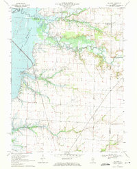 1969 Boulder1971 Print · USGSClinton County and the surrounding river bottoms are captured here in the late sixties as the newly formed Carlyle Reservoir altered the landscape. Genealogists can trace numerous family burial sites like Old Carter Cem and Hawkins Cem near the oil derricks of the Patoka Field.
 - 1969 Map of Keyesport, 1971 Print
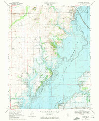 1969 Keyesport1971 Print · USGSThe Kaskaskia River valley in the late sixties reveals a landscape shaped by the new reservoir and recreational growth. Genealogists and local historians can locate McKendree Cem, trace the Burlington Northern line, and see the Keyesport Oil Field.2 unique versions available
 - 1974 Map of Vandalia, 1977 Print
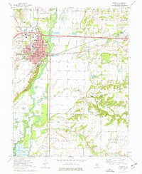 1974 Vandalia1977 Print · USGSVandalia and the Kaskaskia River valley are captured in the mid-seventies, showing the intersection of state history and river navigation. Genealogists and local historians can trace legacy sites like Old State Cem, Luster Chapel, and the Vandalia Correctional Center.
Showing maps 1-25 of 179
Top cities of Fayette County
- Vandalia historical maps
- Avena historical maps
- St. Elmo historical maps
- Ramsey historical maps
- La Clede historical maps
- Brownstown historical maps
See more
Frequently asked questions
- What are the different types of historical maps available for Fayette County?
- What is the oldest map of Fayette County?
- Where can I purchase historical maps of Fayette County for my home or office?
- Where can I download high-res historical maps of Fayette County?
- Are there historical topographic maps available for Fayette County?
- Is there historical aerial imagery available for Fayette County?
- Where are historical maps of Fayette County sourced from?