Old Maps of Ford County, Illinois for Metal Detecting
Plan your next treasure hunt with 111 historic maps of Ford County. Find old homesites, ghost towns, trails, and gathering spots that may be lost to time — perfect for identifying promising metal detecting locations.
- Locate forgotten sites: Uncover places like long-lost settlements, abandoned rail lines, or gathering spots.
- Plan better hunts: Use map overlays combined with LiDAR or satellite views to narrow in on historically rich areas.
- Made for detectorists: Thousands of hobbyists use these maps to discover relics, coins, and hidden history.
Use these historic maps to boost your research and find new opportunities beneath the surface of Ford County.
Ford County, IL maps
(111)- 1924 Map of Paxton, 1953 Print
 1924 Paxton1953 Print · USGSEast-central Illinois comes into focus during the mid-twenties as the rail lines and early airfields transformed the prairie. Researchers can locate dozens of family-named schools like Lily Dell School and trace the original layout of Chanute Flying Field.
 - 1927 Map of Paxton
 1927 Paxton1927 Print · USGSIllinois prairie life in the mid-twenties is captured here through a dense network of township schools and the rise of military aviation. Genealogists and local historians can trace family locations near Chanute Flying Field or find long-standing rural landmarks like Lily Dell School and Glen Cemetery.2 unique versions available
 - 1928 Map of Gibson City
 1928 Gibson City1928 Print · USGSCentral Illinois farming life is captured here in the late 1920s, dominated by the major rail junction at Gibson City. Genealogists can locate dozens of country schools like Scotland School and Caledonia School along the Sangamon River.2 unique versions available
 - 1936 Map of Potomac
 1936 Potomac1936 Print · USGSThe rural prairie of Vermilion County thrives as a rail-and-river economy during the mid-1930s. Researchers can trace dozens of country schools and family-named landmarks like St Lawrence Ch, Rankin Union Cem, and river crossings at Bass Ford.3 unique versions available
 - 1944 Map of Piper City
 1944 Piper City1944 Print · USGSEast-central Illinois was a landscape of thriving rural school districts and critical rail junctions during the 1940s. Genealogists can locate dozens of family-named landmarks and schools such as Graham Sch and Taylor Sch alongside the Illinois Central tracks.2 unique versions available
 - 1947 Map of Piper City
 1947 Piper City1947 Print · USGSFord County and the surrounding prairie are captured here in the mid-1940s, showing a landscape defined by rail transport and township schools. Genealogists can locate family landmarks like Milks Grove Ch, the Town Hall, and dozens of named country schools.
 - 1947 Map of Sibley, 1965 Print
 1947 Sibley1965 Print · USGSCentral Illinois prairie life is captured here in the late 1940s, showing a landscape defined by rail junctions and rural schoolhouses. Trace the Wabash RR through Sibley or find family landmarks like Mt Hope Cem and Happy Home Sch.2 unique versions available
 - 1948 Map of Buckley
 1948 Buckley1948 Print · USGSThe Illinois prairie of the late 1940s reveals a rural landscape still revolving around the village schoolhouse and the Illinois Central rail line. Trace family roots and vanished landmarks across Piper City, Thawville, and dozens of rural schools like Shute Sch or Zahn Sch.
 - 1949 Map of Buckley
 1949 Buckley1949 Print · USGSEast-central Illinois farm country thrived alongside the Illinois Central railroad just after the war, when small towns and family farms defined the prairie. Researchers can locate dozens of country schoolhouses like Willow Grove Sch and Larkin Sch, or trace the path of the North Fork Vermilion River near Thawville.2 unique versions available
 - 1949 Map of Paxton
 1949 Paxton1949 Print · USGSCentral Illinois thrived as a rail and military corridor in the mid-1920s, anchored by the crossroads of two major rail lines. Researchers can trace the early footprint of Chanute Flying Field and locate dozens of vanished rural schoolhouses like Trickel Grove School and Farmersville School.
 - 1949 Map of Sibley
 1949 Sibley1949 Print · USGSThe Illinois prairie of Ford and McLean counties is captured here in the late 1940s, a time when rail lines and country schoolhouses still anchored the rural community. Genealogists can locate family names at Mt Hope Cem and trace vanished landmarks like Cropsey Sch or Allen Sch.2 unique versions available
 - 1953 Map of Danville, 1965 Print
 1953 Danville1965 Print · USGSIndiana and Illinois crossroads come to life in this mid-century survey as the interstate era begins to reshape the river-and-rail landscape. Genealogists and collectors can trace the historic paths of the Nickel Plate railroad or locate smaller communities like Veedersburg, Goodland, and Bismarck.3 unique versions available
 - 1955 Map of Danville
 1955 Danville1955 Print · USGSThe Indiana-Illinois borderlands during the mid-fifties reveal a landscape of thriving rail hubs and university towns. Researchers can trace the legacy of Purdue University, the Tippecanoe Battlefield, and the path of the Pennsylvania RR.
 - 1956 Map of Danville
 1956 Danville1956 Print · USGSMid-century Indiana and Illinois are captured here as the river-and-rail economy evolved into the modern highway era. Researchers can trace ancestral roots and old transport lines through Logansport, Battle Ground, and the dams at Lake Shafer.
 - 1957 Map of Paxton, 1958 Print
 1957 Paxton1958 Print · USGSPost-war central Illinois thrives along the rail lines and at Chanute Air Force Base. Researchers can trace family roots at St Alfreds Chapel or locate several abandoned country schools like Moffett Sch (Abandoned).2 unique versions available
 - 1957 Map of Gibson City, 1958 Print
 1957 Gibson City1958 Print · USGSMid-century Ford and Champaign Counties are mapped here at the height of the railroad era. Genealogists can trace family names through landmarks like Walker Ch, Oregon Cem, and several schoolhouses like the Mounts Sch or the Blackford Sch.2 unique versions available
 - 1957 Map of Potomac, 1958 Print
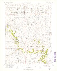 1957 Potomac1958 Print · USGSVermilion County rural life is captured here in the late fifties, showing a landscape defined by rail lines and river crossings. Trace family history through dozens of landmarks like St Lawrence Cem, Selsor Ford, and the Science Hill Sch.2 unique versions available
 - 1958 Map of Peoria, 1969 Print
 1958 Peoria1969 Print · USGSCentral Illinois thrived as a hub of education and transport during the late sixties, as the new interstate system began to reshape the prairie. Genealogists and historians can trace local landmarks like Springdale Cem, Bradley University, and the sprawling grounds of Chanute AFB.4 unique versions available
 - 1961 Map of Peoria
 1961 Peoria1961 Print · USGSCentral Illinois thrived at the intersection of river trade and rail power during the late fifties. Genealogists and local historians can trace the rail networks of the Illinois Central and Wabash, alongside landmarks like Chanute AFB and Weldon Springs State Park.
 - 1963 Map of Peoria
 1963 Peoria1963 Print · USGSCentral Illinois thrived as a rail and highway crossroads during the early sixties, centered on the bustling Illinois River valley. Genealogists and historians can trace the mid-century layout of Peoria, locate the grounds of Chanute Air Force Base, and follow historic lines like the Toledo Peoria and Western Railway.
 - 1982 Map of Gibson City West, 1983 Print
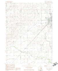 1982 Gibson City West1983 Print · USGSFord County farmland and the rail hub of Gibson City are documented here in the early 1980s. Researchers can locate specific local landmarks like Township Cem, the old Drive-in Theater, and the rural sidings at Harpster.
 - 1983 Map of Gibson City East
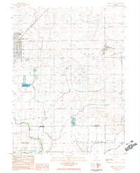 1983 Gibson City East1983 Print · USGSFord County farmland and the rail crossroads at Gibson City are captured here in the early eighties. Genealogists can locate family sites like Oregon Cem, Pontoppidan Ch, and the village of Elliott along the Norfolk and Western line.
 - 1984 Map of Paxton, 1985 Print
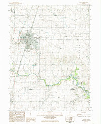 1984 Paxton1985 Print · USGSIn the mid-1980s, the Illinois prairie around Paxton remained a critical rail junction and agricultural center. Family historians can locate several rural burial grounds including Trickle Grove Cem and Webber Cem, or trace the course of the Middle Fork Vermilion River.
 - 1984 Map of Danville, 1985 Print
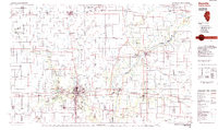 1984 Danville1985 Print · USGSEastern Illinois and western Indiana meet here in the mid-1980s, centered on the river forks and rail lines surrounding the industrial hub of Danville. Researchers can trace old transport routes and rural landmarks like Rossville Junction, Hope Ch, and the Univ of Ill Radio Telescope.
 - 1984 Map of Perdueville, 1985 Print
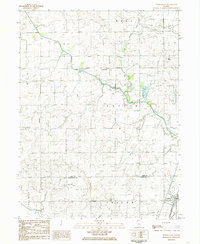 1984 Perdueville1985 Print · USGSThe rural border of Ford and Champaign Counties comes into focus in the mid-1980s, showcasing an era of active rail transit and prairie drainage. Genealogists can locate family landmarks like Meharry Cem and Foster Cemetery near the tracks of the Norfolk and Western railroad.
Showing maps 1-25 of 111
Top cities of Ford County
- Paxton historical maps
- Gibson City historical maps
- Piper City historical maps
- Melvin historical maps
- Roberts historical maps
- Elliott historical maps
See more
Frequently asked questions
- What are the different types of historical maps available for Ford County?
- What is the oldest map of Ford County?
- Where can I purchase historical maps of Ford County for my home or office?
- Where can I download high-res historical maps of Ford County?
- Are there historical topographic maps available for Ford County?
- Is there historical aerial imagery available for Ford County?
- Where are historical maps of Ford County sourced from?