Old Maps of Henry County, Illinois for Hiking & Exploration
Hike through history with 181 historic maps of Henry County. Explore old trails, ghost towns, and forgotten backroads — perfect for outdoor adventurers and local explorers.
- Rediscover forgotten places: Map out old mining camps, roads, and footpaths that no longer exist on modern maps.
- Layer with modern tools: Combine with LiDAR or satellite views to plan hikes through historical terrain.
- Made for exploration: Popular among hikers, overlanders, and local history lovers.
Use these maps to find adventure and explore the hidden past of Henry County.
Henry County, IL maps
(181)- 1892 Map of Leclaire
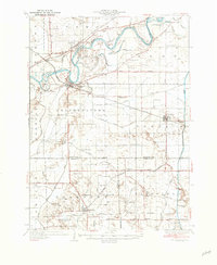
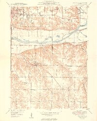
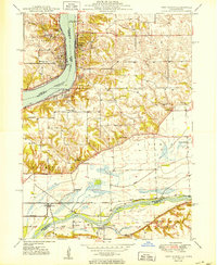
 1892 Leclaire1892 Print · USGSThe Mississippi River border between Iowa and Illinois comes alive in the 1890s, before modern locks reshaped the shoreline. Genealogists and historians can trace riverside settlements like Leclaire, Port Byron, and the railroad junction at Watertown.
 - 1893 Map of Leclaire
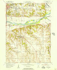
 1893 Leclaire1893 Print · USGSThe riverfronts of Scott County and Rock Island County thrived in the late nineteenth century as vital hubs for steamboats and steam rail. Researchers can trace the early grids of Leclaire, Port Byron, and Valley City alongside the sprawling banks of the Mississippi River.4 unique versions available
 - 1899 Map of Clinton
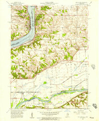
 1899 Clinton1899 Print · USGSThe Mississippi River valley comes alive in the late 1890s, capturing the river-and-rail economy of Iowa and Illinois before modern channelization. Genealogists and historians can trace early townships and river landings, finding precise locations for Low Moor, Folletts, and Pink Prairie.5 unique versions available
 - 1929 Map of Annawan, 1966 Print
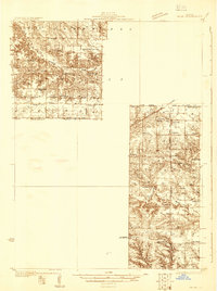
 1929 Annawan1966 Print · USGSHenry and Bureau County life in the late 1920s was shaped by the engineering of the Illinois and Mississippi Canal and busy rail corridors. Researchers can trace dozens of rural schoolhouses and family sites like Brandenburg Corners, Kedron, and Francis Park.2 unique versions available
 - 1931 Map of Galva
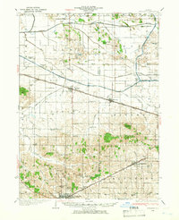
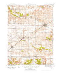
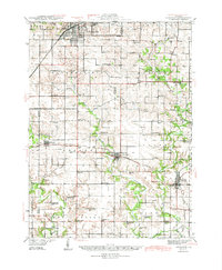
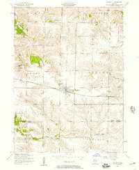
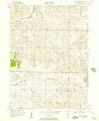
 1931 Galva1931 Print · USGSThe Henry and Knox County borderlands are mapped here in the early 1930s, showing a thriving network of rural townships and rail corridors. Researchers can locate dozens of country schools and churches, from Swamp College Sch to the North Ontario Ch and the Galva Cem.
 - 1932 Map of Prophetstown
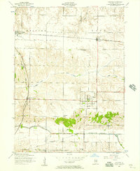
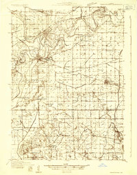 1932 Prophetstown1932 Print · USGSProphetstown and the Rock River valley are depicted here in the early 1930s, showing a rural landscape crisscrossed by an extensive system of drainage ditches and canals. Researchers can locate dozens of small schools and local landmarks, including Hamilton Grave Sch, the Lyndon Cemetery, and Denrock Station.
 - 1932 Map of Annawan
 1932 Annawan1932 Print · USGSHenry and Bureau counties are captured here in the early thirties, showing a landscape shaped by the Illinois and Mississippi Canal. Genealogists can locate dozens of rural landmarks, from Brandenburg Corners to schools like Kuster Sch and Fairview Ch.
 - 1934 Map of Geneseo
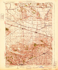
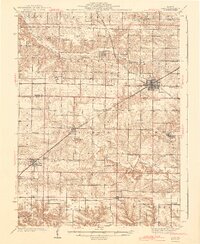
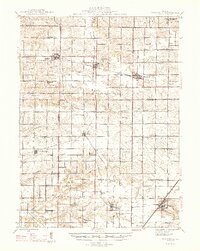
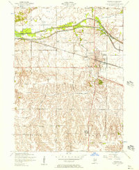
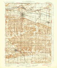 1934 Geneseo1934 Print · USGSHenry County thrived in the early 1930s as a vital corridor of rail and canal commerce. Researchers can trace the legacy of local education and faith through landmarks like Munson Center Sch, Grace Ch, and the many locks along the Mississippi Canal.2 unique versions available
 - 1936 Map of Prophetstown
 1936 Prophetstown1936 Print · USGSWhiteside and Henry counties are shown in the mid-1930s, defined by the Rock River and a dense network of prairie schoolhouses. Trace the Hooppole Yorktown and Tampico RR or find local landmarks like Thunderbolt Hill and St Marys Ch.3 unique versions available
 - 1937 Map of Orion
 1937 Orion1937 Print · USGSHenry County and Mercer County are captured here in the late 1930s, showing a landscape of small agricultural hubs connected by a dense rail network. Genealogists can trace family footprints through dozens of rural schools like Washington Sch and landmarks like the Valhalla Cemetery.2 unique versions available
 - 1940 Map of Galva, 1957 Print
 1940 Galva1957 Print · USGSHenry and Knox counties are captured here as a bustling railroad landscape in the early 1940s. Genealogists can trace the rural school and church networks of the era, from the uniquely named Swamp College Sch to the settlement at Bishop Hill.2 unique versions available
 - 1944 Map of Galva
 1944 Galva1944 Print · USGSNorthwestern Illinois farmland is captured in the 1940s as a thriving network of rail towns and country schools. Genealogists can locate family landmarks like Piatt Cem or trace the early layout of historic Bishop Hill and Galva.2 unique versions available
 - 1944 Map of Kewanee
 1944 Kewanee1944 Print · USGSHenry and Stark Counties in the 1940s show a landscape of thriving rail towns and closely spaced country schoolhouses. Genealogists can locate family-named landmarks like Cavanagh Cem and Bumble Bee Sch along the Spoon River valley.3 unique versions available
 - 1947 Map of Woodhull
 1947 Woodhull1947 Print · USGSThe Illinois prairie at mid-century reveals a dense network of family farms and rural institutions near the Henry and Knox county lines. Genealogists can trace ancestral sites through dozens of named schools and cemeteries like Prairie Flower Sch and Oxford Cem.2 unique versions available
 - 1949 Map of Coal Valley
 1949 Coal Valley1949 Print · USGSThe Rock River valley was a hub of coal mining and transit in the late 1940s as the Moline area expanded eastward. Local researchers can trace family landmarks and industry at Black Hawk Mine, the Illinois and Mississippi Canal, and Kingdom Sch.2 unique versions available
 - 1949 Map of Port Byron, 1954 Print
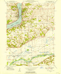 1949 Port Byron1954 Print · USGSThe confluence of the Mississippi and Rock Rivers defined the mid-century economy of these Illinois and Iowa river towns. Genealogists and local historians can trace rural school districts and family burial grounds including Leafy Bower Sch, Edwards Cem, and Zion Ch.2 unique versions available
 - 1950 Map of Port Byron
 1950 Port Byron1950 Print · USGSThe Illinois-Iowa border along the Mississippi River thrives as a rail and river hub at the middle of the twentieth century. Local historians can trace family roots through numerous rural landmarks like Shake-Rag Sch, St Johns Cem, and Rapids City.
 - 1952 Map of Erie, 1953 Print
 1952 Erie1953 Print · USGSWhiteside and Henry counties are mapped here in the early fifties, showing a rural river-bound landscape along the Rock River. Local historians can trace family roots at Pink Prairie Cem or locate the site of the Old Stage Line Monument and Kingsbury Sch.2 unique versions available
 - 1953 Map of Coal Valley, 1956 Print
 1953 Coal Valley1956 Print · USGSThe Illinois-Iowa border region in the early fifties shows a landscape of river-side industry and emerging suburbs. Genealogists and historians can trace family locations near the Black Hawk Mine, rural Kingdom School, or the small settlements of Crampton and Warner.3 unique versions available
 - 1953 Map of Nekoma, 1957 Print
 1953 Nekoma1957 Print · USGSNekoma and the surrounding prairie are captured here in the early 1950s as a thriving rail-side agricultural community. Genealogists and local historians can trace family roots through landmarks like Piatt Cemetery, North Ontario Church, and the River Side School.2 unique versions available
 - 1953 Map of Woodhull, 1957 Print
 1953 Woodhull1957 Print · USGSWoodhull and the surrounding Henry County farmlands are captured here in the early fifties, centered on the Chicago Burlington and Quincy rail line. Genealogists can locate family sites near Bethany Church, Summit Level Cemetery, and Alwood High School.2 unique versions available
 - 1953 Map of Port Byron, 1957 Print
 1953 Port Byron1957 Print · USGSThe Mississippi and Rock Rivers converge in the 1950s, defining a landscape of active rail lines and riverfront towns. Researchers can trace historic family burial sites and rural schoolhouses like Yost Cemetery, Friedens Church, and Sycamore School.3 unique versions available
 - 1953 Map of German Corner, 1957 Print
 1953 German Corner1957 Print · USGSHenry County farmland in the mid-1950s appears here as a meticulous grid of township life and rural community centers. Family historians can locate dozens of localized landmarks like Zion Cemetery, the Brandon School, and the namesake junction at German Corner.2 unique versions available
 - 1953 Map of Geneseo, 1957 Print
 1953 Geneseo1957 Print · USGSGeneseo and the surrounding Henry County townships are captured here in the early fifties during a period of agricultural and rail-centered stability. Genealogists and historians can locate rural landmarks like Wildermuth School, the Illinois and Mississippi Canal, and Edford Cemetery.2 unique versions available
 - 1953 Map of Andover, 1957 Print
 1953 Andover1957 Print · USGSHenry County is shown in the early 1950s as a landscape of established rail towns and rural school districts. Researchers can locate family landmarks such as the Jenny Lind Church, the Home for children, and local hubs like Lynn Center and Osco.2 unique versions available
Showing maps 1-25 of 181
Top cities of Henry County
- Kewanee historical maps
- Geneseo historical maps
- Colona historical maps
- Galva historical maps
- Cambridge historical maps
- Orion historical maps
See more
Frequently asked questions
- What are the different types of historical maps available for Henry County?
- What is the oldest map of Henry County?
- Where can I purchase historical maps of Henry County for my home or office?
- Where can I download high-res historical maps of Henry County?
- Are there historical topographic maps available for Henry County?
- Is there historical aerial imagery available for Henry County?
- Where are historical maps of Henry County sourced from?