1900s (20th Century) Maps of Kewanee, Illinois
Explore 8 historic maps of Kewanee from the 1900s (20th Century). These maps offer a rare glimpse into what life looked like during the 1900s — showing old roads, neighborhoods, homes, and landmarks that have changed or disappeared over time.
Whether you're researching your family's past, planning a metal detecting trip, or studying how Kewanee's landscape evolved across the 1900s, these high-resolution maps are a powerful tool for exploring the history of this region.
- Focus on a specific era: All maps on this page are from the 1900s, giving you a focused view of this time period.
- See what’s changed: Compare century-old streets, trails, and buildings to today's modern landscape using overlays and satellite layers.
- Research with precision: Use these maps for genealogy, historical research, land use analysis, or educational projects.
- View, download, or print: Maps are fully viewable online in high resolution, and can be downloaded or printed for your own records.
Start exploring Kewanee's history through authentic maps from the 1900s. This is your window into the past.
Kewanee, IL maps
(8)- 1929 Map of Annawan, 1966 Print
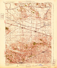
 1929 Annawan1966 Print · USGSHenry and Bureau County life in the late 1920s was shaped by the engineering of the Illinois and Mississippi Canal and busy rail corridors. Researchers can trace dozens of rural schoolhouses and family sites like Brandenburg Corners, Kedron, and Francis Park.2 unique versions available
 - 1932 Map of Annawan
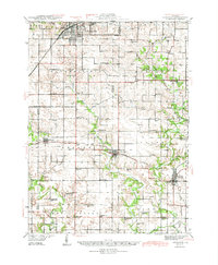
 1932 Annawan1932 Print · USGSHenry and Bureau counties are captured here in the early thirties, showing a landscape shaped by the Illinois and Mississippi Canal. Genealogists can locate dozens of rural landmarks, from Brandenburg Corners to schools like Kuster Sch and Fairview Ch.
 - 1944 Map of Kewanee
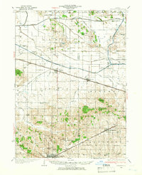
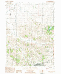
 1944 Kewanee1944 Print · USGSHenry and Stark Counties in the 1940s show a landscape of thriving rail towns and closely spaced country schoolhouses. Genealogists can locate family-named landmarks like Cavanagh Cem and Bumble Bee Sch along the Spoon River valley.3 unique versions available
 - 1958 Map of Aurora, 1969 Print
 1958 Aurora1969 Print · USGSNorthern Illinois in the late fifties shows a landscape of powerful river industry and expanding transport corridors. Genealogists and historians can trace the development of Aurora and Joliet or locate sites like the Elwood Ordnance Plant and Starved Rock.3 unique versions available
 - 1961 Map of Aurora
 1961 Aurora1961 Print · USGSNorthern Illinois at the height of the post-war era reveals a landscape of massive industrial works and thriving river towns. Genealogists and historians can trace the paths of the Lincoln Highway or locate long-standing landmarks like the Green River Ordnance Plant and Starved Rock State Park.
 - 1983 Map of Kewanee South, 1984 Print
 1983 Kewanee South1984 Print · USGSKewanee and the surrounding prairies of Henry and Stark Counties are shown in the early 1980s as the city expands southward into Wethersfield. Researchers can trace local genealogy and civic growth through sites like Evergreen Memory Garden, Visitation School, and the Burlington Northern rail line.2 unique versions available
 - 1983 Map of Kewanee North, 1984 Print
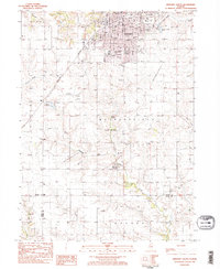
 1983 Kewanee North1984 Print · USGSThe northern outskirts of Kewanee and the rural townships of Henry County are captured here in the early 1980s. Genealogists can locate family landmarks like St Michael Cem, Fairview Ch, and the rural crossroads at Brandenburg Corners.
 - 1985 Map of Kewanee
 1985 Kewanee1985 Print · USGSNorth-central Illinois in the mid-eighties shows a landscape of river-valley industry and prairie transit. Researchers can trace family roots through Evergreen Memory Garden or follow the historic Hennepin Canal past Tiskilwa and Wyanet.2 unique versions available
End of results
Showing maps 1-8 of 8
Top cities near Kewanee
- Geneseo historical maps
- Galva historical maps
- Wyoming historical maps
- Toulon historical maps
- Osceola historical maps
- Atkinson historical maps
See more
Frequently asked questions
- What are the different types of historical maps available for Kewanee?
- What is the oldest map of Kewanee?
- Where can I purchase historical maps of Kewanee for my home or office?
- Where can I download high-res historical maps of Kewanee?
- Are there historical topographic maps available for Kewanee?
- Is there historical aerial imagery available for Kewanee?
- Where are historical maps of Kewanee sourced from?