Old Maps of Orion, Illinois for Hiking & Exploration
Hike through history with 20 historic maps of Orion. Explore old trails, ghost towns, and forgotten backroads — perfect for outdoor adventurers and local explorers.
- Rediscover forgotten places: Map out old mining camps, roads, and footpaths that no longer exist on modern maps.
- Layer with modern tools: Combine with LiDAR or satellite views to plan hikes through historical terrain.
- Made for exploration: Popular among hikers, overlanders, and local history lovers.
Use these maps to find adventure and explore the hidden past of Orion.
Orion, IL maps
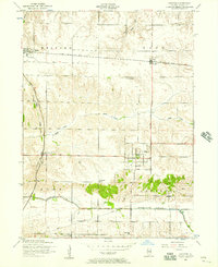
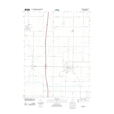
(20)- 1937 Map of Orion
 1937 Orion1937 Print · USGSHenry County and Mercer County are captured here in the late 1930s, showing a landscape of small agricultural hubs connected by a dense rail network. Genealogists can trace family footprints through dozens of rural schools like Washington Sch and landmarks like the Valhalla Cemetery.2 unique versions available
 - 1953 Map of Andover, 1957 Print
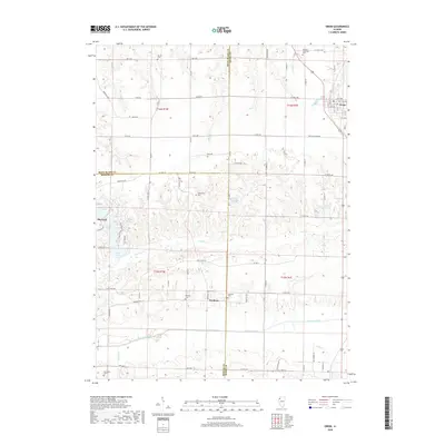
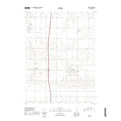
 1953 Andover1957 Print · USGSHenry County is shown in the early 1950s as a landscape of established rail towns and rural school districts. Researchers can locate family landmarks such as the Jenny Lind Church, the Home for children, and local hubs like Lynn Center and Osco.2 unique versions available
 - 1953 Map of Orion, 1957 Print
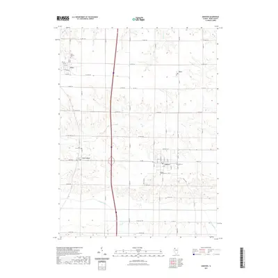
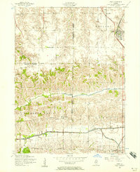 1953 Orion1957 Print · USGSThe tri-county border of Henry, Rock Island, and Mercer counties appears in the early fifties as a landscape of rural schools and coal works. Researchers can trace family sites at Beulah Church, the Long View Mine, and the Rural Town Hall School.3 unique versions available
 - 1958 Map of Davenport, 1968 Print
 1958 Davenport1968 Print · USGSEastern Iowa and western Illinois thrive along the river during the late fifties, defined by the industrial Quad Cities and a robust rail network. Genealogists can trace family roots through settlements like Oasis and Stanwood or along the Cedar River.2 unique versions available
 - 1961 Map of Davenport
 1961 Davenport1961 Print · USGSThe Quad Cities and the eastern Iowa riverlands are captured here in the early sixties, showing the region's transition into a modern industrial and transit hub. Genealogists and historians can trace the paths of major railroads and find river landmarks like Rock Island Arsenal, Huron Island, and the Coralville Reservoir.
 - 1962 Map of Davenport
 1962 Davenport1962 Print · USGSThe Quad Cities and the Mississippi River corridor are shown at their industrial peak just before the interstate era fully transformed the region. Researchers can trace the sprawling rail networks of the Chicago Rock Island and Pacific and find landmarks like the Rock Island Arsenal and Wild Cat Den State Park.
 - 1984 Map of Aledo, 1985 Print
 1984 Aledo1985 Print · USGSThe Mississippi River borderlands and Illinois heartland are captured here in the mid-eighties as industry and agriculture overlap. Trace the Hennepin Canal, the historic Swedish colony at Bishop Hill, and the rail corridors of the Burlington Northern.
 - 1989 Map of Aledo
 1989 Aledo1989 Print · USGSWestern Illinois and eastern Iowa are shown here during the late twentieth century, when the river-and-rail economy still defined the Quad Cities and the surrounding prairie. Researchers can trace historic settlements like Bishop Hill and Millersburg alongside active routes like the Chicago Rock Island & Pacific RR.
 - 1991 Map of Orion, 1992 Print
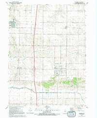
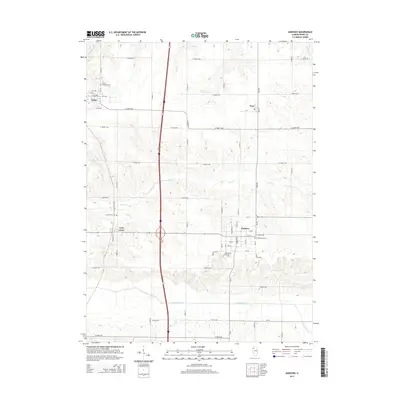
 1991 Orion1992 Print · USGSThe intersection of Rock Island, Henry, and Mercer counties comes to life in this early 1990s portrait of Illinois farm country. Local historians can trace the foundations of Orion and Sherrard or find family roots at Beulah Ch and Brush Hill Cem.
 - 1991 Map of Andover, 1992 Print
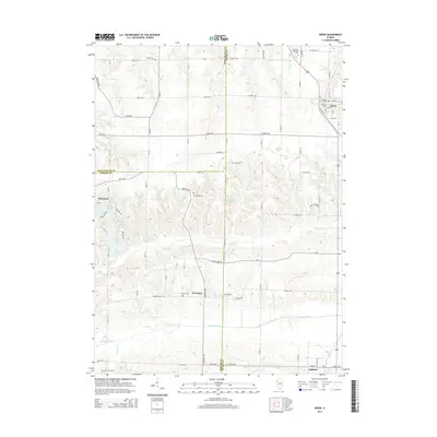
 1991 Andover1992 Print · USGSHenry County's agricultural heartland is documented here in the early nineties, centered on the historic village of Andover. Researchers can trace the path of the Old Railroad Grade and locate local landmarks like the Township Cem and Love Park.
 - 2012 Map of Orion, 2012 Print
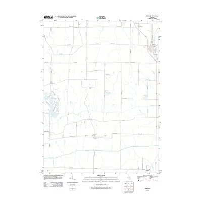 2012 Orion2012 Print · USGSCovers Orion, including Sherrard, Swedona, and other nearby areas
 - 2012 Map of Andover, 2012 Print
 2012 Andover2012 Print · USGSCovers Orion, including Andover, Osco, and other nearby areas
 - 2015 Map of Orion, 2015 Print
 2015 Orion2015 Print · USGSCovers Orion, including Sherrard, Swedona, and other nearby areas
 - 2015 Map of Andover, 2015 Print
 2015 Andover2015 Print · USGSCovers Orion, including Andover, Osco, and other nearby areas
 - 2018 Map of Orion, 2018 Print
 2018 Orion2018 Print · USGSCovers Orion, including Sherrard, Swedona, and other nearby areas
 - 2018 Map of Andover, 2018 Print
 2018 Andover2018 Print · USGSCovers Orion, including Andover, Osco, and other nearby areas
 - 2021 Map of Andover, 2021 Print
 2021 Andover2021 Print · USGSCovers Orion, including Andover, Osco, and other nearby areas
 - 2021 Map of Orion, 2021 Print
 2021 Orion2021 Print · USGSCovers Orion, including Sherrard, Swedona, and other nearby areas
 - 2024 Map of Orion, 2024 Print
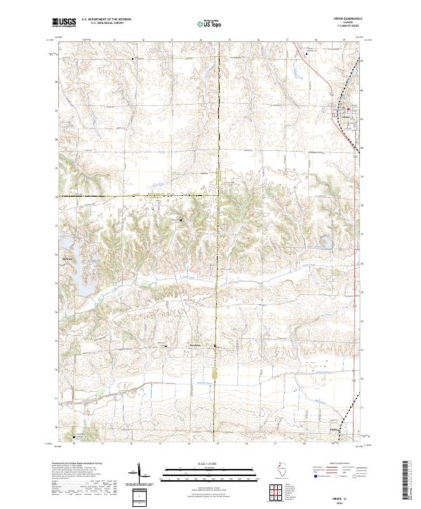 2024 Orion2024 Print · USGSThe borderlands of Henry, Rock Island, and Mercer counties come to life in this detailed survey of the Orion-Sherrard corridor. Researchers can trace ancestral locations at Swedona Cem or follow the winding path of the Edwards River past Ophiem.
 - 2024 Map of Andover, 2024 Print
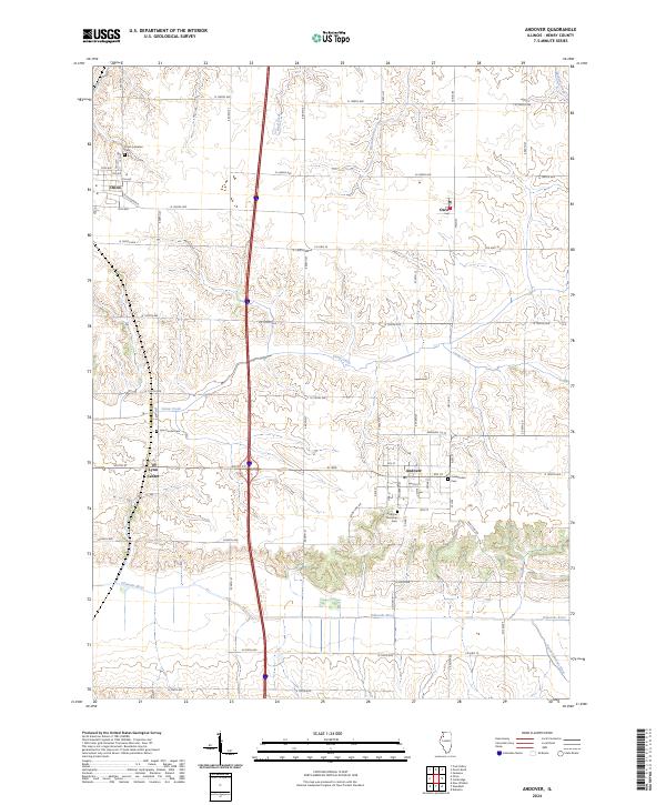 2024 Andover2024 Print · USGSHenry County’s agricultural heartland is documented here in the current era, showing the intersection of rural life and heritage sites. Researchers can locate family landmarks at Andover Township Cem, Lynn Center, and the banks of the Edwards River.
End of results
Showing maps 1-20 of 20
Top cities near Orion
- Davenport historical maps
- Moline historical maps
- Bettendorf historical maps
- Rock Island historical maps
- East Moline historical maps
- Silvis historical maps
See more
Frequently asked questions
- What are the different types of historical maps available for Orion?
- What is the oldest map of Orion?
- Where can I purchase historical maps of Orion for my home or office?
- Where can I download high-res historical maps of Orion?
- Are there historical topographic maps available for Orion?
- Is there historical aerial imagery available for Orion?
- Where are historical maps of Orion sourced from?