2020s Maps of Warren, Warren Township
Explore 7 historic maps of Warren from the 2020s. These maps offer a rare glimpse into what life looked like during the 2020s — showing old roads, neighborhoods, homes, and landmarks that have changed or disappeared over time.
Whether you're researching your family's past, planning a metal detecting trip, or studying how Warren's landscape evolved across the 2020s, these high-resolution maps are a powerful tool for exploring the history of this region.
- Focus on a specific era: All maps on this page are from the 2020s, giving you a focused view of this time period.
- See what’s changed: Compare century-old streets, trails, and buildings to today's modern landscape using overlays and satellite layers.
- Research with precision: Use these maps for genealogy, historical research, land use analysis, or educational projects.
- View, download, or print: Maps are fully viewable online in high resolution, and can be downloaded or printed for your own records.
Start exploring Warren's history through authentic maps from the 2020s. This is your window into the past.
Warren, Warren Township maps
(7)- 2021 Map of Elizabeth NE, 2021 Print
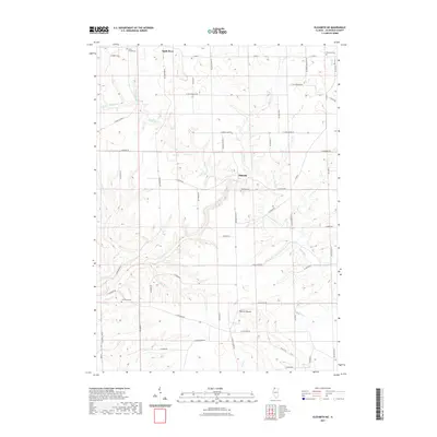 2021 Elizabeth NE2021 Print · USGSCovers Warren, including Apple River, Millville Town Site, and other nearby areas
 - 2021 Map of Warren, 2021 Print
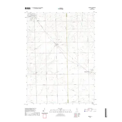 2021 Warren2021 Print · USGSCovers Warren, including Nora, Rush Township, and other nearby areas
 - 2021 Map of Apple River, 2021 Print
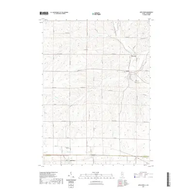 2021 Apple River2021 Print · USGSCovers Warren, including Wiota, Apple River, and other nearby areas
 - 2022 Map of South Wayne, 2022 Print
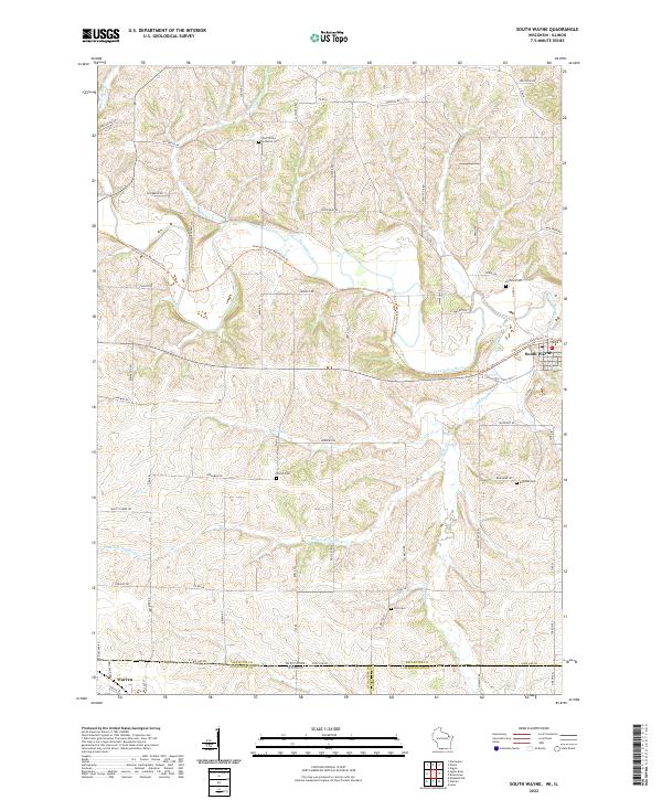 2022 South Wayne2022 Print · USGSThe Wisconsin and Illinois borderlands appear here as a patchwork of river valleys and rural homesteads. Trace family history at the West Wiota Lutheran Cem or follow the Cheese Country Recreation Trl through South Wayne.
 - 2024 Map of Elizabeth NE, 2024 Print
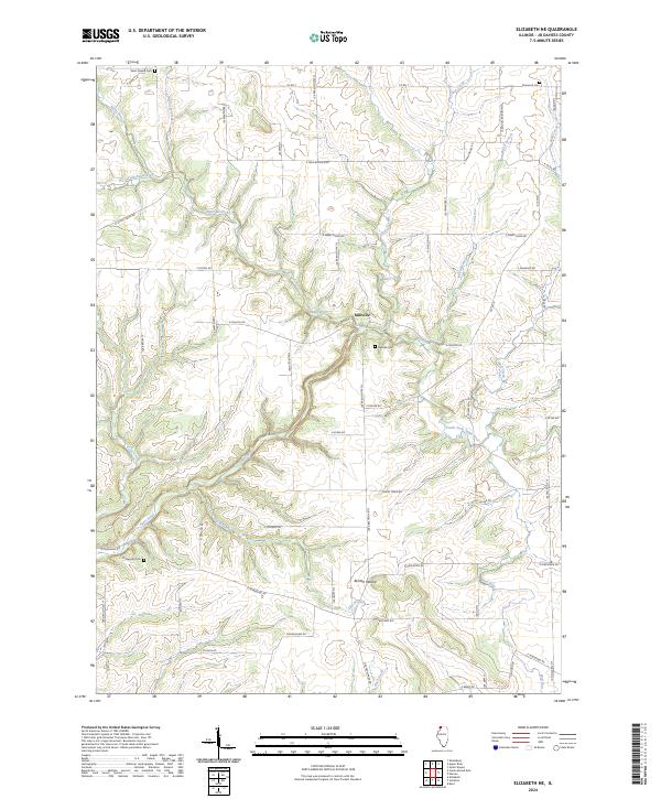 2024 Elizabeth NE2024 Print · USGSJo Daviess County's rural landscape is mapped here in the contemporary era, showing a world of winding river forks and hilltop mounds. Genealogists can trace family roots at Millville Cem or Thompson Cem and locate the historic site of Millville.
 - 2024 Map of Apple River, 2024 Print
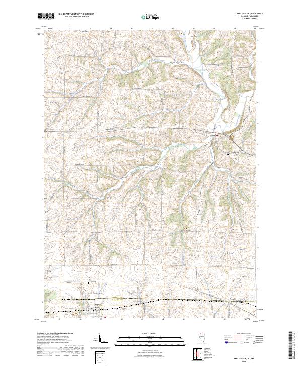 2024 Apple River2024 Print · USGSThe Illinois and Wisconsin borderlands come into focus in this recent study of the area surrounding Apple River and Gratiot. Researchers can trace local heritage through numerous landmarks like West Ella Highland Cem and the banks of the Pecatonica River.
 - 2024 Map of Warren, 2024 Print
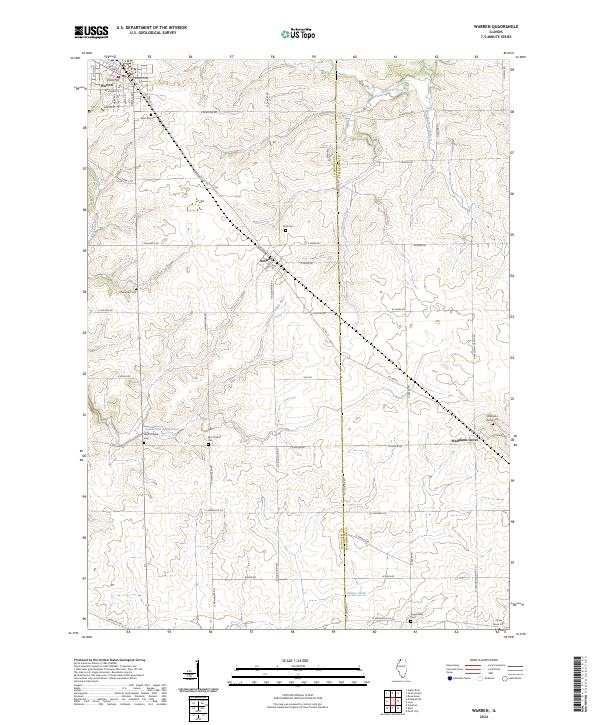 2024 Warren2024 Print · USGSNorthwest Illinois farmland meets the Jo Daviess and Stephenson county line in this contemporary landscape of rural settlements and prairie river forks. Genealogists can trace family footprints at Oakwood Cem, Waddams Grove, and Nora, where old roads like N Stagecoach Trl still navigate the terrain.
End of results
Showing maps 1-7 of 7
Top cities near Warren
- Lena historical maps
- Darlington historical maps
- Stockton historical maps
- Wiota historical maps
- Argyle historical maps
- Pearl City historical maps
See more
Frequently asked questions
- What are the different types of historical maps available for Warren?
- What is the oldest map of Warren?
- Where can I purchase historical maps of Warren for my home or office?
- Where can I download high-res historical maps of Warren?
- Are there historical topographic maps available for Warren?
- Is there historical aerial imagery available for Warren?
- Where are historical maps of Warren sourced from?