1980s Maps of Kankakee County, Illinois
Explore 6 historic maps of Kankakee County from the 1980s. These maps offer a rare glimpse into what life looked like during the 1980s — showing old roads, neighborhoods, homes, and landmarks that have changed or disappeared over time.
Whether you're researching your family's past, planning a metal detecting trip, or studying how Kankakee County's landscape evolved across the 1980s, these high-resolution maps are a powerful tool for exploring the history of this region.
- Focus on a specific era: All maps on this page are from the 1980s, giving you a focused view of this time period.
- See what’s changed: Compare century-old streets, trails, and buildings to today's modern landscape using overlays and satellite layers.
- Research with precision: Use these maps for genealogy, historical research, land use analysis, or educational projects.
- View, download, or print: Maps are fully viewable online in high resolution, and can be downloaded or printed for your own records.
Start exploring Kankakee County's history through authentic maps from the 1980s. This is your window into the past.
Kankakee County, IL maps
(6)- 1983 Map of Campus
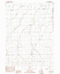 1983 Campus1983 Print · USGSLivingston County farm country is captured here in the early eighties as a network of rail lines and small prairie villages. Genealogists can locate family sites at Sacred Heart Cem or trace the development of Campus, Reddick, and the former mining center of Cardiff.
 - 1984 Map of Kankakee, 1985 Print
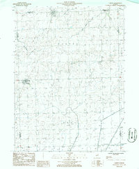
 1984 Kankakee1985 Print · USGSThe Illinois-Indiana borderlands appear here in the early eighties as a landscape of river-centered towns and vast managed wetlands. Genealogists and local historians can trace the grounds of the Kankakee State Hospital, the campus of Olivet Nazarene College, and the sprawling Beaver Lake Wildlife Refuge.
 - 1985 Map of Ottawa
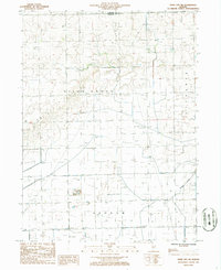
 1985 Ottawa1985 Print · USGSThe Illinois River valley in the mid-1980s shows a landscape balancing river commerce with sprawling energy and mining operations. Researchers can trace the layout of mining towns like Coal City or find family landmarks such as Oakwood Memorial Cem and Smiths Mound.
 - 1985 Map of Fairbury
 1985 Fairbury1985 Print · USGSCentral Illinois in the mid-1980s reveals a landscape shaped by the Illinois Central Gulf rail network and the Vermilion River basin. Trace the roots of local communities from Fairbury to Pontiac, and locate landmarks like the State Correctional Center and High Chapel.2 unique versions available
 - 1986 Map of Cabery
 1986 Cabery1986 Print · USGSThe prairie landscape at the junction of Ford and Kankakee counties is captured here in the mid-1980s. Researchers can trace the Illinois Central Gulf rail line near Cabery or locate local landmarks like Rogers Grove and rural cemeteries.
 - 1986 Map of Piper City NE
 1986 Piper City NE1986 Print · USGSAgricultural life in the Illinois prairie is documented during the 1980s along the border of Kankakee and Iroquois counties. Researchers can trace rural land use through features like Berns Landing Strip, the winding Langan Creek, and a local Cem.
End of results
Showing maps 1-6 of 6
Top cities of Kankakee County
- Kankakee historical maps
- Bourbonnais historical maps
- Bradley historical maps
- Manteno historical maps
- Momence historical maps
- Grant Park historical maps
See more
Frequently asked questions
- What are the different types of historical maps available for Kankakee County?
- What is the oldest map of Kankakee County?
- Where can I purchase historical maps of Kankakee County for my home or office?
- Where can I download high-res historical maps of Kankakee County?
- Are there historical topographic maps available for Kankakee County?
- Is there historical aerial imagery available for Kankakee County?
- Where are historical maps of Kankakee County sourced from?