Old Maps of Kankakee County, Illinois for Hiking & Exploration
Hike through history with 160 historic maps of Kankakee County. Explore old trails, ghost towns, and forgotten backroads — perfect for outdoor adventurers and local explorers.
- Rediscover forgotten places: Map out old mining camps, roads, and footpaths that no longer exist on modern maps.
- Layer with modern tools: Combine with LiDAR or satellite views to plan hikes through historical terrain.
- Made for exploration: Popular among hikers, overlanders, and local history lovers.
Use these maps to find adventure and explore the hidden past of Kankakee County.
Kankakee County, IL maps
(160)- 1892 Map of Wilmington
 1892 Wilmington1892 Print · USGSWill County at the end of the nineteenth century is defined by its strategic river confluences and a rapidly expanding rail network. Genealogists and local historians can trace the early footprints of Wilmington and Braidwood, or find vanished rail stops like Blodget and Drummond.3 unique versions available
 - 1918 Map of Wilmington
 1918 Wilmington1918 Print · USGSWill County in the late teens is a landscape shaped by the convergence of major rivers and several historic rail lines. Genealogists and historians can trace numerous rural schoolhouses like Red Brick School and Schweizer School alongside river towns such as Wilmington and Channahon.5 unique versions available
 - 1922 Map of Momence, 1958 Print
 1922 Momence1958 Print · USGSThe Kankakee River valley in the early twenties is a landscape of river islands and busy rail junctions. Genealogists and historians can locate dozens of country schools like Frogtown School and Searls School or trace the Illinois-Indiana border at Illinoi.
 - 1922 Map of Kankakee, 1959 Print
 1922 Kankakee1959 Print · USGSThe Kankakee valley thrived in the early 1920s as a major crossroads of electric interurbans and transcontinental railroads. Researchers can trace the footprints of numerous rural schoolhouses, the East Illinois Hospital grounds, and historic routes like the Egyptian Trail.2 unique versions available
 - 1923 Map of Herscher, 1959 Print
 1923 Herscher1959 Print · USGSKankakee and Will Counties in the early twenties show a landscape defined by busy rail junctions and a dense network of rural school districts. Genealogists and researchers can locate family-named landmarks and infrastructure like the Lehigh Stone Co Quarry, Appel Siding, and Essex Center School.2 unique versions available
 - 1924 Map of Momence
 1924 Momence1924 Print · USGSEastern Illinois and the Indiana borderlands are captured here during the 1920s, showing a landscape defined by the Kankakee River and a web of rail lines. Researchers can trace dozens of legacy district schools like Frogtown School and locate family landmarks in Momence, St Anne, and Grant Park.2 unique versions available
 - 1924 Map of Kankakee
 1924 Kankakee1924 Print · USGSThe Kankakee riverfront and its surrounding townships thrived in the early 1920s as a major hub for both industry and electric transit. Researchers can trace dozens of rural schoolhouses and vanished rail stops, from Altdorf School to the Illinois Electric Interurban station at Tucker.2 unique versions available
 - 1925 Map of Herscher
 1925 Herscher1925 Print · USGSKankakee and Grundy counties appear here during the 1920s as a thriving corridor of railroads and rural schools. Genealogists can trace family names through landmarks like Yates School, Clarke City, and the Lehigh Stone Co Quarry.2 unique versions available
 - 1944 Map of Piper City
 1944 Piper City1944 Print · USGSEast-central Illinois was a landscape of thriving rural school districts and critical rail junctions during the 1940s. Genealogists can locate dozens of family-named landmarks and schools such as Graham Sch and Taylor Sch alongside the Illinois Central tracks.2 unique versions available
 - 1947 Map of Piper City
 1947 Piper City1947 Print · USGSFord County and the surrounding prairie are captured here in the mid-1940s, showing a landscape defined by rail transport and township schools. Genealogists can locate family landmarks like Milks Grove Ch, the Town Hall, and dozens of named country schools.
 - 1948 Map of Dwight, 1965 Print
 1948 Dwight1965 Print · USGSLivingston and Grundy counties appear here just after the war, showing a region of dense rural settlements and early coal mining activity. Genealogists can locate family names via numerous country schools like Goodfarm Sch and landmarks such as the State Reformatory for Women.
 - 1949 Map of Peotone
 1949 Peotone1949 Print · USGSWill County’s rural townships are captured in the late 1940s, a period of transition for its railroad hubs and farming communities. Genealogists can locate family-named landmarks and country schools like Fivemile Grove Sch, Pfundstein Sch, and the St Peter Cem.2 unique versions available
 - 1949 Map of Crete
 1949 Crete1949 Print · USGSWill County and the surrounding borderlands are captured here in the late 1940s as a busy intersection of rail and road. Genealogists can locate dozens of country schools and churches like Beebe Grove Sch, St Annes Ch, and Crete Cem.
 - 1950 Map of Dwight
 1950 Dwight1950 Print · USGSNortheastern Illinois at mid-century shows a landscape shaped by coal mining and a dense network of rural school districts. Genealogists can trace family footprints through dozens of local landmarks like Round Grove Cemetery, Goodfarm School, and the State Reformatory for Women.2 unique versions available
 - 1953 Map of Beecher West, 1955 Print
 1953 Beecher West1955 Print · USGSThe eastern Illinois prairie near the Kankakee border comes to life in this mid-century survey of the rural landscape. Genealogists and historians can trace the foundations of local life through the St Pauls Ch, Heusing Cem, and several schoolhouses like Sumner Sch.2 unique versions available
 - 1953 Map of Beecher East, 1955 Print
 1953 Beecher East1955 Print · USGSThe Illinois and Indiana borderlands are captured here in the early fifties, showing a rural landscape defined by rail and farm. Genealogists can locate family landmarks like Deeke Sch, St Johns Ch, and the settlements of Klaasville and Beecher.3 unique versions available
 - 1953 Map of Peotone, 1955 Print
 1953 Peotone1955 Print · USGSNorthern Illinois prairie life in the early fifties is defined by the rail crossing at Peotone and the nearby Manteno. Trace family history at Elmwood Cem or follow the path of the Illinois Central through the heart of Will County.3 unique versions available
 - 1953 Map of Wilton Center, 1955 Print
 1953 Wilton Center1955 Print · USGSWilton Center and the surrounding townships of Will and Kankakee Counties are shown here during the early fifties, before the expansion of the modern highway system. Genealogists and local historians can locate family plots at Wilton Cem or West Peotone Cem and trace the rail path of the C M St P & P near Andres.2 unique versions available
 - 1953 Map of Symerton, 1955 Print
 1953 Symerton1955 Print · USGSWill County’s rural townships meet the massive industrial presence of the Joliet Arsenal in the early fifties. Local historians can trace the Old Indian Boundary and find lost landmarks like Oak Grove Sch and Ritchie Sta.2 unique versions available
 - 1953 Map of Chicago, 1964 Print
 1953 Chicago1964 Print · USGSThe southern Lake Michigan shoreline was rapidly modernizing in the mid-fifties, balancing heavy industry with its famous academic centers. Researchers can trace the footprints of Notre Dame University or locate vanished sites like the Kingsbury Ordnance Plant and Meigs Field.5 unique versions available
 - 1954 Map of Wilmington, 1960 Print
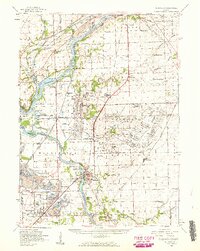 1954 Wilmington1960 Print · USGSWill and Grundy counties in the mid-fifties show a landscape of industrial convergence where major railroads meet the state's storied canal systems. Researchers can trace the Old Indian Boundary or locate family sites like the Soldiers Widows Home and Willard Grove Cem.3 unique versions available
 - 1957 Map of Chicago
 1957 Chicago1957 Print · USGSThe industrial heartland and southern Great Lakes shoreline are captured here during the peak of mid-century growth. Researchers can trace the massive Gary Steel Works, the grounds of the University of Notre Dame, and the early paths of the Tri-State Tollway.
 - 1958 Map of Aurora, 1969 Print
 1958 Aurora1969 Print · USGSNorthern Illinois in the late fifties shows a landscape of powerful river industry and expanding transport corridors. Genealogists and historians can trace the development of Aurora and Joliet or locate sites like the Elwood Ordnance Plant and Starved Rock.3 unique versions available
 - 1958 Map of Peoria, 1969 Print
 1958 Peoria1969 Print · USGSCentral Illinois thrived as a hub of education and transport during the late sixties, as the new interstate system began to reshape the prairie. Genealogists and historians can trace local landmarks like Springdale Cem, Bradley University, and the sprawling grounds of Chanute AFB.4 unique versions available
 - 1959 Map of Momence NE, 1960 Print
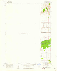 1959 Momence NE1960 Print · USGSThe Illinois-Indiana borderlands appear in the late fifties as a landscape defined by industrial rail and massive drainage projects. Genealogists and historians can trace the New York Central line and search for family roots at West Creek Cem near the banks of West Creek.
Showing maps 1-25 of 160
Top cities of Kankakee County
- Kankakee historical maps
- Bourbonnais historical maps
- Bradley historical maps
- Manteno historical maps
- Momence historical maps
- Grant Park historical maps
See more
Frequently asked questions
- What are the different types of historical maps available for Kankakee County?
- What is the oldest map of Kankakee County?
- Where can I purchase historical maps of Kankakee County for my home or office?
- Where can I download high-res historical maps of Kankakee County?
- Are there historical topographic maps available for Kankakee County?
- Is there historical aerial imagery available for Kankakee County?
- Where are historical maps of Kankakee County sourced from?