1990s Maps of Kankakee County, Illinois
Explore 11 historic maps of Kankakee County from the 1990s. These maps offer a rare glimpse into what life looked like during the 1990s — showing old roads, neighborhoods, homes, and landmarks that have changed or disappeared over time.
Whether you're researching your family's past, planning a metal detecting trip, or studying how Kankakee County's landscape evolved across the 1990s, these high-resolution maps are a powerful tool for exploring the history of this region.
- Focus on a specific era: All maps on this page are from the 1990s, giving you a focused view of this time period.
- See what’s changed: Compare century-old streets, trails, and buildings to today's modern landscape using overlays and satellite layers.
- Research with precision: Use these maps for genealogy, historical research, land use analysis, or educational projects.
- View, download, or print: Maps are fully viewable online in high resolution, and can be downloaded or printed for your own records.
Start exploring Kankakee County's history through authentic maps from the 1990s. This is your window into the past.
Kankakee County, IL maps
(11)- 1990 Map of Peoria
 1990 Peoria1990 Print · USGSCentral Illinois at the start of the nineties reveals a landscape of industrial river towns and sprawling university campuses. Researchers can trace the legacy of major institutions like Chanute Air Force Base and the University of Illinois alongside regional landmarks such as Sand Ridge State Forest.
 - 1990 Map of Peotone, 1991 Print
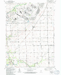
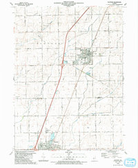 1990 Peotone1991 Print · USGSThe eastern Illinois prairie near the Will and Kankakee county line is captured here as the towns of Peotone and Manteno expanded in the late twentieth century. Trace local genealogy and civic history through St Paul Ch, Peotone Cem, and the Illinois Central Gulf rail corridor.
 - 1990 Map of Beecher West, 1991 Print
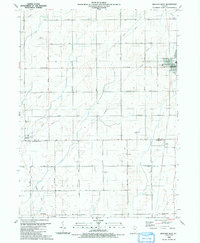 1990 Beecher West1991 Print · USGSEastern Will County and northern Kankakee County are shown here as the nineteenth-century farm grid met late-century infrastructure. Genealogists can locate family sites near Heusing Cem, St Pauls Ch, or the small rail-side community of Sollitt.
 - 1990 Map of Beecher East, 1991 Print
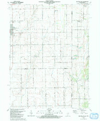 1990 Beecher East1991 Print · USGSThe Illinois-Indiana borderlands are captured here in the late twentieth century, showing a landscape of small farming communities and country roads. Genealogists and researchers can locate St Pauls Ch, trace the Old Railroad Grade, and find quiet cemeteries like Brunswick Cem.
 - 1990 Map of Wilton Center, 1991 Print
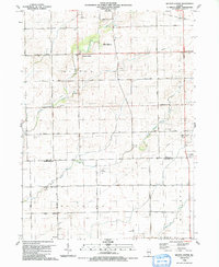 1990 Wilton Center1991 Print · USGSWilton Center and the surrounding townships of Peotone and Rockville are captured here in the late twentieth century. Genealogists can locate family sites at the Wilton Center Cem and West Peotone Cem or trace the Old Railroad Grade near Andres.
 - 1991 Map of Ottawa
 1991 Ottawa1991 Print · USGSNorth-central Illinois in the early nineties remains a vital corridor of river commerce and heavy rail. Genealogists and historians can trace the legacy of industrial mining near Morris or explore the river-bluff geography of Starved Rock State Park and Buffalo Rock.
 - 1991 Map of Kankakee
 1991 Kankakee1991 Print · USGSThe Illinois-Indiana borderlands come into focus during the early nineties, centered on the growing Kankakee valley and its sprawling drainage systems. Trace the rail-and-river economy through landmarks like the Wilton Railroad Grade, the Manteno State Hospital, and the historic Old Pioneer Cem.
 - 1993 Map of Symerton, 1994 Print
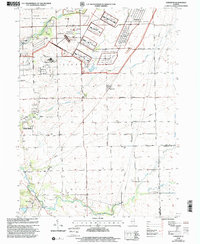
 1993 Symerton1994 Print · USGSWill County agriculture meets military history in the early nineties as the vast Joliet Ammunitions Plant borders rural township life. Trace family roots and vanished rail lines near Symerton, Ritchie, and the Star Grove Cem.
 - 1998 Map of Piper City NE, 2003 Print
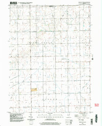 1998 Piper City NE2003 Print · USGSIroquois County at the close of the nineties reveals a landscape of precision drainage and prairie townships. Local researchers can locate rural family markers like the Cem and QUARRY, alongside the private Porter Landing Strip and Langan Creek.
 - 1998 Map of Cabery, 2003 Print
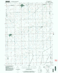 1998 Cabery2003 Print · USGSCabery and Kempton anchor this Illinois prairie landscape at the end of the twentieth century, showing a region deeply shaped by agricultural drainage and local townships. Genealogists can trace family burial grounds at Mount Hope Cem and Floridale Cem or explore the unique layout of Stelle.
 - 1999 Map of Symerton, 2002 Print
 1999 Symerton2002 Print · USGSSymerton and the surrounding prairie lands of Will County are captured at the end of the century during a significant shift from military to conservation use. Genealogists can locate family sites at Chicago Road Cem or trace the old rail lines through Ritchie Sta and Symerton.
End of results
Showing maps 1-11 of 11
Top cities of Kankakee County
- Kankakee historical maps
- Bourbonnais historical maps
- Bradley historical maps
- Manteno historical maps
- Momence historical maps
- Grant Park historical maps
See more
Frequently asked questions
- What are the different types of historical maps available for Kankakee County?
- What is the oldest map of Kankakee County?
- Where can I purchase historical maps of Kankakee County for my home or office?
- Where can I download high-res historical maps of Kankakee County?
- Are there historical topographic maps available for Kankakee County?
- Is there historical aerial imagery available for Kankakee County?
- Where are historical maps of Kankakee County sourced from?