1940s Maps of Livingston County, Illinois
Explore 9 historic maps of Livingston County from the 1940s. These maps offer a rare glimpse into what life looked like during the 1940s — showing old roads, neighborhoods, homes, and landmarks that have changed or disappeared over time.
Whether you're researching your family's past, planning a metal detecting trip, or studying how Livingston County's landscape evolved across the 1940s, these high-resolution maps are a powerful tool for exploring the history of this region.
- Focus on a specific era: All maps on this page are from the 1940s, giving you a focused view of this time period.
- See what’s changed: Compare century-old streets, trails, and buildings to today's modern landscape using overlays and satellite layers.
- Research with precision: Use these maps for genealogy, historical research, land use analysis, or educational projects.
- View, download, or print: Maps are fully viewable online in high resolution, and can be downloaded or printed for your own records.
Start exploring Livingston County's history through authentic maps from the 1940s. This is your window into the past.
Livingston County, IL maps
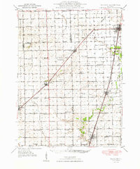
(9)- 1944 Map of Piper City
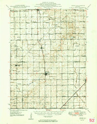
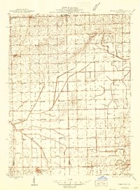 1944 Piper City1944 Print · USGSEast-central Illinois was a landscape of thriving rural school districts and critical rail junctions during the 1940s. Genealogists can locate dozens of family-named landmarks and schools such as Graham Sch and Taylor Sch alongside the Illinois Central tracks.2 unique versions available
 - 1947 Map of Piper City
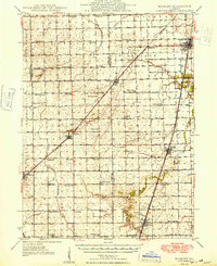
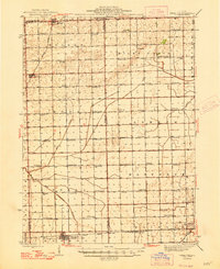 1947 Piper City1947 Print · USGSFord County and the surrounding prairie are captured here in the mid-1940s, showing a landscape defined by rail transport and township schools. Genealogists can locate family landmarks like Milks Grove Ch, the Town Hall, and dozens of named country schools.
 - 1947 Map of Sibley, 1965 Print
 1947 Sibley1965 Print · USGSCentral Illinois prairie life is captured here in the late 1940s, showing a landscape defined by rail junctions and rural schoolhouses. Trace the Wabash RR through Sibley or find family landmarks like Mt Hope Cem and Happy Home Sch.2 unique versions available
 - 1947 Map of Cullom, 1977 Print
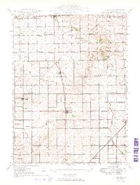
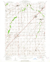
 1947 Cullom1977 Print · USGSIn the mid-twentieth century, Livingston County was a thriving agricultural hub defined by its dense rail network and rural school districts. Researchers can trace family roots at St Marys Cem or locate many local landmarks like Peppard Sch and the Vieley Br Gaging Sta.
 - 1948 Map of Buckley
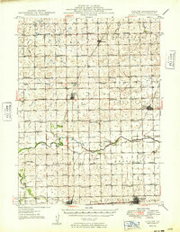
 1948 Buckley1948 Print · USGSThe Illinois prairie of the late 1940s reveals a rural landscape still revolving around the village schoolhouse and the Illinois Central rail line. Trace family roots and vanished landmarks across Piper City, Thawville, and dozens of rural schools like Shute Sch or Zahn Sch.
 - 1948 Map of Dwight, 1965 Print
 1948 Dwight1965 Print · USGSLivingston and Grundy counties appear here just after the war, showing a region of dense rural settlements and early coal mining activity. Genealogists can locate family names via numerous country schools like Goodfarm Sch and landmarks such as the State Reformatory for Women.
 - 1949 Map of Buckley
 1949 Buckley1949 Print · USGSEast-central Illinois farm country thrived alongside the Illinois Central railroad just after the war, when small towns and family farms defined the prairie. Researchers can locate dozens of country schoolhouses like Willow Grove Sch and Larkin Sch, or trace the path of the North Fork Vermilion River near Thawville.2 unique versions available
 - 1949 Map of Cullom
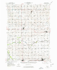
 1949 Cullom1949 Print · USGSLivingston County's agricultural heartland is captured here in the late 1940s, a landscape defined by the crossing of the Illinois Central and Wabash railroads. Genealogists can trace family footprints across dozens of local school sites like Eggenberger Sch and Bell Top Sch.
 - 1949 Map of Sibley
 1949 Sibley1949 Print · USGSThe Illinois prairie of Ford and McLean counties is captured here in the late 1940s, a time when rail lines and country schoolhouses still anchored the rural community. Genealogists can locate family names at Mt Hope Cem and trace vanished landmarks like Cropsey Sch or Allen Sch.2 unique versions available
End of results
Showing maps 1-9 of 9
Top cities of Livingston County
- Dwight historical maps
- Fairbury historical maps
- Chatsworth historical maps
- Forrest historical maps
- Flanagan historical maps
- Odell historical maps
See more
Frequently asked questions
- What are the different types of historical maps available for Livingston County?
- What is the oldest map of Livingston County?
- Where can I purchase historical maps of Livingston County for my home or office?
- Where can I download high-res historical maps of Livingston County?
- Are there historical topographic maps available for Livingston County?
- Is there historical aerial imagery available for Livingston County?
- Where are historical maps of Livingston County sourced from?