1980s Maps of Fogarty, Illinois
Explore 3 historic maps of Fogarty from the 1980s. These maps offer a rare glimpse into what life looked like during the 1980s — showing old roads, neighborhoods, homes, and landmarks that have changed or disappeared over time.
Whether you're researching your family's past, planning a metal detecting trip, or studying how Fogarty's landscape evolved across the 1980s, these high-resolution maps are a powerful tool for exploring the history of this region.
- Focus on a specific era: All maps on this page are from the 1980s, giving you a focused view of this time period.
- See what’s changed: Compare century-old streets, trails, and buildings to today's modern landscape using overlays and satellite layers.
- Research with precision: Use these maps for genealogy, historical research, land use analysis, or educational projects.
- View, download, or print: Maps are fully viewable online in high resolution, and can be downloaded or printed for your own records.
Start exploring Fogarty's history through authentic maps from the 1980s. This is your window into the past.
Fogarty, IL maps
(3)- 1980 Map of Broadwell, 1981 Print
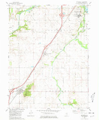 1980 Broadwell1981 Print · USGSLogan County in the early eighties shows a landscape of deep-rooted settlements and evolving infrastructure. Genealogists and local historians can locate numerous burial sites like Warrick Cem and Lucas Chapel Cem, or trace the rail lines through Broadwell.
 - 1985 Map of Lincoln
 1985 Lincoln1985 Print · USGSMid-century Illinois comes to life in this survey of Logan and Mason counties as the interstate era reshapes the prairie. Genealogists and historians can trace rail-town development from San Jose to Kenney or locate landmarks like Rose Hill Cem and Funks Grove.
 - 1989 Map of Lincoln
 1989 Lincoln1989 Print · USGSCentral Illinois in the late eighties remains a landscape of productive prairie and vital river arteries. Genealogists and local historians can trace rural family landmarks like Rose Hill Cem, identify early aviation at Logan County Airport, or follow the Illinois Central Gulf Railroad through towns like Atlanta and Lincoln.
End of results
Showing maps 1-3 of 3
Top cities near Fogarty
- Springfield historical maps
- Lincoln historical maps
- Sherman historical maps
- Atlanta historical maps
- Mount Pulaski historical maps
- Williamsville historical maps
See more
Frequently asked questions
- What are the different types of historical maps available for Fogarty?
- What is the oldest map of Fogarty?
- Where can I purchase historical maps of Fogarty for my home or office?
- Where can I download high-res historical maps of Fogarty?
- Are there historical topographic maps available for Fogarty?
- Is there historical aerial imagery available for Fogarty?
- Where are historical maps of Fogarty sourced from?