1990s Maps of Hartsburg, Illinois
Explore 3 historic maps of Hartsburg from the 1990s. These maps offer a rare glimpse into what life looked like during the 1990s — showing old roads, neighborhoods, homes, and landmarks that have changed or disappeared over time.
Whether you're researching your family's past, planning a metal detecting trip, or studying how Hartsburg's landscape evolved across the 1990s, these high-resolution maps are a powerful tool for exploring the history of this region.
- Focus on a specific era: All maps on this page are from the 1990s, giving you a focused view of this time period.
- See what’s changed: Compare century-old streets, trails, and buildings to today's modern landscape using overlays and satellite layers.
- Research with precision: Use these maps for genealogy, historical research, land use analysis, or educational projects.
- View, download, or print: Maps are fully viewable online in high resolution, and can be downloaded or printed for your own records.
Start exploring Hartsburg's history through authentic maps from the 1990s. This is your window into the past.
Hartsburg, IL maps
(3)- 1990 Map of Peoria
 1990 Peoria1990 Print · USGSCentral Illinois at the start of the nineties reveals a landscape of industrial river towns and sprawling university campuses. Researchers can trace the legacy of major institutions like Chanute Air Force Base and the University of Illinois alongside regional landmarks such as Sand Ridge State Forest.
 - 1996 Map of Emden, 1997 Print
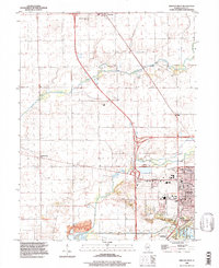
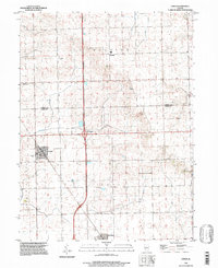 1996 Emden1997 Print · USGSEmden and Hartsburg are shown here in the mid-1990s as classic rail-aligned agricultural communities on the Logan County line. Trace family sites and local history through the Illinois Central Railroad corridor, Patterson Cem, and the rural Landing Strip.
 - 1996 Map of Lincoln West, 1997 Print
 1996 Lincoln West1997 Print · USGSCentral Illinois in the late twentieth century reveals a landscape of historic courthouses and rural townships. Trace family roots at Schrader Cem or visit the Postville Court House State Historic Site near Lincoln Lakes.
End of results
Showing maps 1-3 of 3
Top cities near Hartsburg
- Lincoln historical maps
- Delavan historical maps
- Atlanta historical maps
- Minier historical maps
- Hopedale historical maps
- Green Valley historical maps
See more
Frequently asked questions
- What are the different types of historical maps available for Hartsburg?
- What is the oldest map of Hartsburg?
- Where can I purchase historical maps of Hartsburg for my home or office?
- Where can I download high-res historical maps of Hartsburg?
- Are there historical topographic maps available for Hartsburg?
- Is there historical aerial imagery available for Hartsburg?
- Where are historical maps of Hartsburg sourced from?