1900s (20th Century) Maps of Godfrey, Illinois
Explore 26 historic maps of Godfrey from the 1900s (20th Century). These maps offer a rare glimpse into what life looked like during the 1900s — showing old roads, neighborhoods, homes, and landmarks that have changed or disappeared over time.
Whether you're researching your family's past, planning a metal detecting trip, or studying how Godfrey's landscape evolved across the 1900s, these high-resolution maps are a powerful tool for exploring the history of this region.
- Focus on a specific era: All maps on this page are from the 1900s, giving you a focused view of this time period.
- See what’s changed: Compare century-old streets, trails, and buildings to today's modern landscape using overlays and satellite layers.
- Research with precision: Use these maps for genealogy, historical research, land use analysis, or educational projects.
- View, download, or print: Maps are fully viewable online in high resolution, and can be downloaded or printed for your own records.
Start exploring Godfrey's history through authentic maps from the 1900s. This is your window into the past.
Godfrey, IL maps
(26)- 1925 Map of Brighton, 1958 Print
 1925 Brighton1958 Print · USGSSouthwestern Illinois was a bustling rail-and-farm corridor in the mid-1920s, characterized by numerous small settlements and village schoolhouses. Researchers can trace the vanished rural infrastructure of Medora, Piasa, and Woodburn, alongside over twenty named country schools like Brush College School.2 unique versions available
 - 1927 Map of Alton
 1927 Alton1927 Print · USGSThe industrial and riverfront corridor of the Mississippi and Missouri confluence is captured here during a period of heavy rail and ferry traffic. Researchers can trace historic family locations through dozens of rural landmarks like Monticello Seminary, Greenwood Cem, and the City of St Louis Farms.
 - 1927 Map of St. Charles, 1955 Print
 1927 St. Charles1955 Print · USGSThe Missouri and Mississippi rivers meet in this mid-century survey, showcasing a landscape of fertile bottomlands and early aviation hubs. Genealogists can trace family footprints through dozens of rural landmarks like St Stanislaus Seminary, Orchard Farm, and Cul de Sac Sch.2 unique versions available
 - 1928 Map of Brighton
 1928 Brighton1928 Print · USGSSouthwestern Illinois was a bustling network of rail-side towns and country school districts in the mid-1920s. Researchers can locate nearly thirty local schools including Brush College School and Washington School, or trace the tracks of the Chicago and Alton through Shipman and Brighton.2 unique versions available
 - 1930 Map of Jerseyville, 1965 Print
 1930 Jerseyville1965 Print · USGSJersey and Greene Counties are captured here between the world wars, showing a landscape defined by steam rail and one-room schoolhouses. Genealogists can trace the exact locations of Old Kane, the County Farm, and numerous local landmarks like St Marys Sch.2 unique versions available
 - 1933 Map of Jerseyville
 1933 Jerseyville1933 Print · USGSJersey County is captured in the early thirties as a hub of rail activity and rural education. Genealogists can trace family roots through numerous local landmarks like Bethany Ch, Otterville, and the remote Shakerag Sch.2 unique versions available
 - 1933 Map of Saint Charles
 1933 Saint Charles1933 Print · USGSThe confluence of the Missouri and Mississippi rivers in the early thirties reveals a landscape of fertile river bottoms and emerging suburban rail towns. Genealogists and researchers can trace old school districts like Cul de Sac Sch and historic sites such as St Stanislaus Seminary.3 unique versions available
 - 1934 Map of Alton
 1934 Alton1934 Print · USGSThe confluence of the Mississippi and Missouri rivers in the early 1930s shows a dense industrial and rail corridor centered on Alton. Genealogists and researchers can trace dozens of rural schools and landmarks like Monticello Seminary, Mt Olive Church, and the City of St Louis Farms.2 unique versions available
 - 1948 Map of Quincy
 1948 Quincy1948 Print · USGSThe Mississippi and Illinois River valleys are captured at a post-war crossroads as rail and river travel met the expanding highway system. Genealogists can trace family settlements from Quincy to Hannibal and smaller towns like Vandalia and Jerseyville.2 unique versions available
 - 1948 Map of Alton, 1954 Print
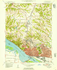 1948 Alton1954 Print · USGSAlton and the Mississippi River bluffs are captured here in the late Forties, showing a region defined by its heavy rail industry and prominent educational institutions. Genealogists and historians can locate Shurtleff College, the Confederate Cem, and the tracks of the Chicago and Alton railroad.
 - 1949 Map of Saint Louis
 1949 Saint Louis1949 Print · USGSGreater St. Louis and its surrounding river valleys are captured here just after the war, showing the metropolitan core and the rural Ozark fringe. Researchers can trace the sprawling rail network of the Wabash RR or locate landmarks like Meramec Caverns Airport and Scott Air Force Base.2 unique versions available
 - 1950 Map of Alton
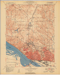 1950 Alton1950 Print · USGSAlton was a bustling river and rail hub at the mid-century, defined by its educational institutions and heavy river infrastructure. Trace the old campus of Western Military Academy, the riverfront at Lock and Dam No 26, and cemeteries like Confederate Cem.2 unique versions available
 - 1954 Map of Elsah, 1959 Print
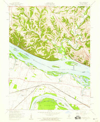 1954 Elsah1959 Print · USGSThe river bluffs of Jersey and Madison counties are captured here in the mid-fifties as river life and rail commerce intersected. Researchers can trace the grounds of Principia College, the streets of Portage Des Sioux, and defunct rural sites like Mertz Sch.3 unique versions available
 - 1954 Map of Alton, 1959 Print
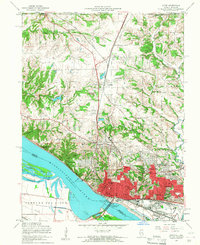 1954 Alton1959 Print · USGSMid-century Alton and Godfrey thrive as centers of education and industry along the Mississippi. Researchers can trace the grounds of Monticello College, locate the Confederate Cem, and follow the Gulf Mobile and Ohio rail lines.4 unique versions available
 - 1954 Map of St. Charles, 1960 Print
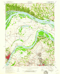 1954 St. Charles1960 Print · USGSThe river confluence near St. Louis during the mid-fifties reveals a landscape balancing traditional river life with rapid suburban and aviation growth. Genealogists and historians can trace family roots through sites like St Stanislaus Seminary Cem, Portage Des Sioux, and the campus of Principia College.2 unique versions available
 - 1955 Map of Alton, 1960 Print
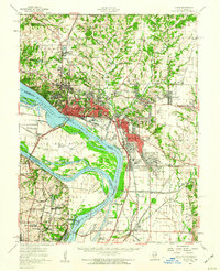 1955 Alton1960 Print · USGSThe industrial riverfronts and expanding rail corridors of the Metro East are captured here in the mid-fifties. Researchers can trace the development of Alton State Hospital, the grounds of Monticello College, and historic sites like Fort Bellefontaine.2 unique versions available
 - 1956 Map of Quincy, 1967 Print
 1956 Quincy1967 Print · USGSThe river and rail corridors of the Illinois-Missouri border are documented here during the mid-1950s. Researchers can trace historic river landings and regional transit hubs from Quincy and Hannibal to smaller settlements like Meredosia and Roodhouse.3 unique versions available
 - 1962 Map of St. Louis
 1962 St. Louis1962 Print · USGSThe mid-century gateway to the west shows the metropolitan expansion of St Louis alongside its critical river confluences. Genealogists and historians can trace the rail corridors of the Missouri Pacific RR and settlements from Fulton to De Soto.
 - 1963 Map of St. Louis, 1970 Print
 1963 St. Louis1970 Print · USGSSt. Louis and its surrounding river valleys are captured here during the peak of mid-century suburban expansion and industrial activity. Trace the historic rail routes of the Norfolk and Western Ry or locate the St Louis Ordnance Plant and early stretches of US Highway 66.4 unique versions available
 - 1966 Map of St. Louis
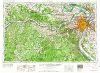 1966 St. Louis1966 Print · USGSThe St. Louis metropolitan area and its surrounding river valleys are captured here during the mid-sixties era of suburban growth and industrial strength. Genealogists and historians can trace the foundations of local communities through sites like Old Pioneer Cem, Parks College, and the Jefferson Barracks Military Reservation.
 - 1983 Map of Jerseyville South, 1984 Print
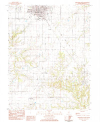 1983 Jerseyville South1984 Print · USGSJersey and Mississippi townships in the early eighties show a landscape of traditional farming and evolving transport. Genealogists can locate family names at Lurton Cem or Van Horn Cem and trace the paths of McClusky and New Delhi.
 - 1983 Map of Brighton, 1984 Print
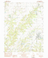 1983 Brighton1984 Print · USGSBrighton and the surrounding Illinois prairie are captured in the early 1980s as the regional landscape balanced its agricultural roots with suburban growth. Genealogists can locate several family burial sites like Tribble Cem and Asbury Cem, or trace the street-level details of Brighton near Betsy Ann Park.
 - 1985 Map of St Louis
 1985 St Louis1985 Print · USGSThe St. Louis metropolitan area and its river confluences are captured here during a period of significant suburban expansion in the 1980s. Genealogists and historians can trace the development of older neighborhoods and landmarks like Jefferson Barracks, Cahokia Mounds State Park, and Washington University.3 unique versions available
 - 1985 Map of Jerseyville
 1985 Jerseyville1985 Print · USGSThe confluence of the Illinois and Mississippi rivers defines this 1980s landscape of fertile bottomlands and rail-hub towns. Genealogists and historians can trace the foundations of communities like Jerseyville and White Hall alongside the Oak Grove Cem and St Mary Church.2 unique versions available
 - 1991 Map of Elsah, 1995 Print
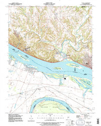 1991 Elsah1995 Print · USGSThe Mississippi and Missouri rivers meet here in the early nineties, revealing a landscape of protective levees and riverfront villages. Genealogists can locate family names at St Francis Cem and Elsah Cem or trace the early river footprints of Portage Des Sioux and Machens.
Showing maps 1-25 of 26
Top cities near Godfrey
- Florissant historical maps
- Maryland Heights historical maps
- Granite City historical maps
- Edwardsville historical maps
- Alton historical maps
- Hazelwood historical maps
See more
Top neighborhoods of Godfrey
- Belmont Village historical maps
- North Alton historical maps
- Quatoga Bluff historical maps
- Piasa Hills historical maps
- Riehl historical maps
- Alandale historical maps
See more
Frequently asked questions
- What are the different types of historical maps available for Godfrey?
- What is the oldest map of Godfrey?
- Where can I purchase historical maps of Godfrey for my home or office?
- Where can I download high-res historical maps of Godfrey?
- Are there historical topographic maps available for Godfrey?
- Is there historical aerial imagery available for Godfrey?
- Where are historical maps of Godfrey sourced from?