1900s (20th Century) Maps of Kinmundy, Illinois
Explore 7 historic maps of Kinmundy from the 1900s (20th Century). These maps offer a rare glimpse into what life looked like during the 1900s — showing old roads, neighborhoods, homes, and landmarks that have changed or disappeared over time.
Whether you're researching your family's past, planning a metal detecting trip, or studying how Kinmundy's landscape evolved across the 1900s, these high-resolution maps are a powerful tool for exploring the history of this region.
- Focus on a specific era: All maps on this page are from the 1900s, giving you a focused view of this time period.
- See what’s changed: Compare century-old streets, trails, and buildings to today's modern landscape using overlays and satellite layers.
- Research with precision: Use these maps for genealogy, historical research, land use analysis, or educational projects.
- View, download, or print: Maps are fully viewable online in high resolution, and can be downloaded or printed for your own records.
Start exploring Kinmundy's history through authentic maps from the 1900s. This is your window into the past.
Kinmundy, IL maps
(7)- 1945 Map of Kinmundy, 1965 Print
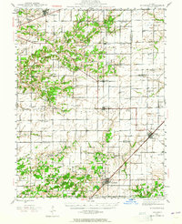 1945 Kinmundy1965 Print · USGSThe rural borderlands of Fayette and Marion Counties are shown at the end of the war, when small farming communities still thrived around rail junctions. You can trace family roots at St Johns Ch or locate forgotten sites like Old Loogootee Sch and Gray Cem.2 unique versions available
 - 1947 Map of Kinmundy
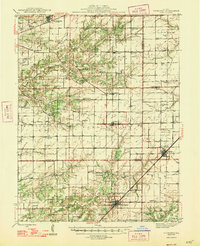 1947 Kinmundy1947 Print · USGSMarion and Fayette counties are captured here just after the war, showing a rural landscape anchored by a dense network of farm-to-market railroads. Genealogists can trace family footprints through numerous small schools and cemeteries, from Farina and St Peter to Shanghai Sch and Cumberland Cem.2 unique versions available
 - 1958 Map of Belleville, 1973 Print
 1958 Belleville1973 Print · USGSSouthern Illinois during the mid-twentieth century reveals a landscape of industrial growth and massive new reservoirs. Genealogists and historians can trace the paths of the Illinois Central RR through towns like Centralia or locate landmarks such as Emerald Mound and the Looking Glass Prairie.3 unique versions available
 - 1962 Map of Belleville
 1962 Belleville1962 Print · USGSSouthern Illinois in the late fifties reveals a landscape of industrial growth and ancient landmarks before the full expansion of the interstate system. Genealogists can trace family names and rural post offices near Centralia, Salem, and the historic Monks Mound.
 - 1985 Map of Kinmundy
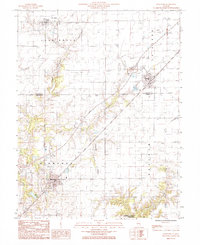 1985 Kinmundy1985 Print · USGSIn the mid-eighties, the border of Fayette and Marion Counties centered on the rail hub of Kinmundy and the surrounding prairie. You can trace the Illinois Central Gulf line through Farina or locate old burial sites near Lone Grove Branch.
 - 1985 Map of St. Paul
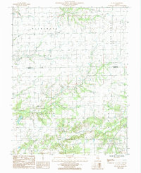 1985 St. Paul1985 Print · USGSMarion and Fayette counties are shown here in the mid-1980s, revealing a landscape shaped by the East Fork Kaskaskia River and its many branches. Researchers can locate the small community of St Paul, identify local cemeteries, and trace the elevation changes at Lowe Mound.
 - 1986 Map of Olney
 1986 Olney1986 Print · USGSSouth-central Illinois in the mid-eighties shows a landscape of small agricultural towns linked by historic rail lines and prairie preserves. Trace family roots and vanished rail stops near Kinmundy, the Prairie Chicken Sanctuary, and Salem.2 unique versions available
End of results
Showing maps 1-7 of 7
Top cities near Kinmundy
- Centralia historical maps
- Salem historical maps
- Odin historical maps
- Tonti historical maps
- La Clede historical maps
- Brownstown historical maps
See more
Frequently asked questions
- What are the different types of historical maps available for Kinmundy?
- What is the oldest map of Kinmundy?
- Where can I purchase historical maps of Kinmundy for my home or office?
- Where can I download high-res historical maps of Kinmundy?
- Are there historical topographic maps available for Kinmundy?
- Is there historical aerial imagery available for Kinmundy?
- Where are historical maps of Kinmundy sourced from?