1990s Maps of Toluca, Illinois
Explore 3 historic maps of Toluca from the 1990s. These maps offer a rare glimpse into what life looked like during the 1990s — showing old roads, neighborhoods, homes, and landmarks that have changed or disappeared over time.
Whether you're researching your family's past, planning a metal detecting trip, or studying how Toluca's landscape evolved across the 1990s, these high-resolution maps are a powerful tool for exploring the history of this region.
- Focus on a specific era: All maps on this page are from the 1990s, giving you a focused view of this time period.
- See what’s changed: Compare century-old streets, trails, and buildings to today's modern landscape using overlays and satellite layers.
- Research with precision: Use these maps for genealogy, historical research, land use analysis, or educational projects.
- View, download, or print: Maps are fully viewable online in high resolution, and can be downloaded or printed for your own records.
Start exploring Toluca's history through authentic maps from the 1990s. This is your window into the past.
Toluca, IL maps
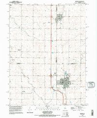
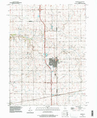
(3)- 1990 Map of Peoria
 1990 Peoria1990 Print · USGSCentral Illinois at the start of the nineties reveals a landscape of industrial river towns and sprawling university campuses. Researchers can trace the legacy of major institutions like Chanute Air Force Base and the University of Illinois alongside regional landmarks such as Sand Ridge State Forest.
 - 1995 Map of Minonk, 1996 Print
 1995 Minonk1996 Print · USGSAgricultural and industrial history meet in this mid-1990s record of Woodford and Marshall counties. Genealogists can locate several family burial grounds like St Patricks Cem and Rutland Cem, while tracing remnants of the mining era at the Mine Dump near Rutland.
 - 1996 Map of Wenona, 1997 Print
 1996 Wenona1997 Print · USGSWenona and its surrounding prairie townships are captured here in the mid-nineties as the region balanced its agricultural roots with modern transit. Genealogists can locate several local burial sites including Wenona Cem, Cherry Point Cem, and Bethany Cem alongside landmarks like the Entwistle Landing Strip.
End of results
Showing maps 1-3 of 3
Top cities near Toluca
- Metamora historical maps
- Henry historical maps
- Minonk historical maps
- Roanoke historical maps
- Cazenovia historical maps
- Evans historical maps
See more
Frequently asked questions
- What are the different types of historical maps available for Toluca?
- What is the oldest map of Toluca?
- Where can I purchase historical maps of Toluca for my home or office?
- Where can I download high-res historical maps of Toluca?
- Are there historical topographic maps available for Toluca?
- Is there historical aerial imagery available for Toluca?
- Where are historical maps of Toluca sourced from?