Old Maps of Toluca, Illinois for Genealogy
Trace your family roots with 39 historic maps of Toluca. These high-res maps reveal old neighborhoods, homesites, landmarks, and streets — helping you uncover where your ancestors lived and how the area evolved over time.
- Explore historic neighborhoods: Identify where your relatives may have lived in the 1800s or 1900s.
- Compare maps over time: Trace the changes in streets, buildings, and landmarks for multi-generational research.
- Perfect for genealogy & ancestry research: Used by family historians and researchers to map out lineage and migration.
These maps are an incredible resource for exploring your personal connection to Toluca's past.
Toluca, IL maps
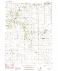
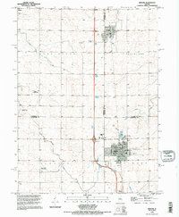
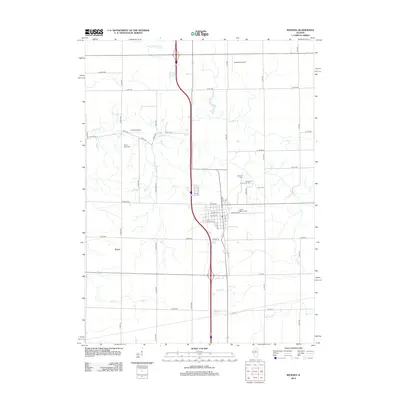
(39)- 1934 Map of Wenona
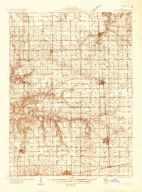 1934 Wenona1934 Print · USGSThe crossroads of Marshall, Putnam, and La Salle counties are captured here in the mid-1930s, revealing a landscape defined by railroad junctions and rural school districts. Genealogists can locate family-named landmarks like Hullinger Sch and Beckwith Sch, or trace the tracks of the Illinois Central through Wenona.2 unique versions available
 - 1939 Map of Wenona
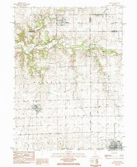
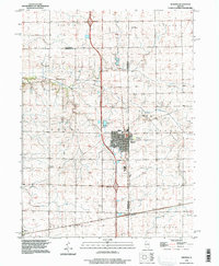
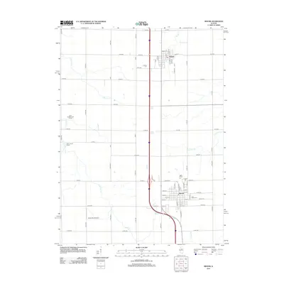
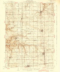 1939 Wenona1939 Print · USGSNorth-central Illinois agricultural and rail hubs are captured here in the late 1930s as steam-era infrastructure reached its peak. Researchers can locate dozens of country schools and trace the tracks of the Illinois Central through Wenona and Tonica.2 unique versions available
 - 1955 Map of Minonk, 1956 Print
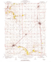 1955 Minonk1956 Print · USGSWoodford and Marshall counties at mid-century reveal a thriving rail-and-coal economy across the Illinois prairie. Family researchers and historians can trace lineage at Mennonite Ch, find old Mine Dumps, or locate vanished landmarks like Spring Hill Sch.
 - 1958 Map of Aurora, 1969 Print
 1958 Aurora1969 Print · USGSNorthern Illinois in the late fifties shows a landscape of powerful river industry and expanding transport corridors. Genealogists and historians can trace the development of Aurora and Joliet or locate sites like the Elwood Ordnance Plant and Starved Rock.3 unique versions available
 - 1958 Map of Peoria, 1969 Print
 1958 Peoria1969 Print · USGSCentral Illinois thrived as a hub of education and transport during the late sixties, as the new interstate system began to reshape the prairie. Genealogists and historians can trace local landmarks like Springdale Cem, Bradley University, and the sprawling grounds of Chanute AFB.4 unique versions available
 - 1961 Map of Aurora
 1961 Aurora1961 Print · USGSNorthern Illinois at the height of the post-war era reveals a landscape of massive industrial works and thriving river towns. Genealogists and historians can trace the paths of the Lincoln Highway or locate long-standing landmarks like the Green River Ordnance Plant and Starved Rock State Park.
 - 1961 Map of Peoria
 1961 Peoria1961 Print · USGSCentral Illinois thrived at the intersection of river trade and rail power during the late fifties. Genealogists and local historians can trace the rail networks of the Illinois Central and Wabash, alongside landmarks like Chanute AFB and Weldon Springs State Park.
 - 1963 Map of Peoria
 1963 Peoria1963 Print · USGSCentral Illinois thrived as a rail and highway crossroads during the early sixties, centered on the bustling Illinois River valley. Genealogists and historians can trace the mid-century layout of Peoria, locate the grounds of Chanute Air Force Base, and follow historic lines like the Toledo Peoria and Western Railway.
 - 1982 Map of Wenona, 1983 Print
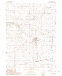 1982 Wenona1983 Print · USGSWenona and the surrounding Marshall County prairies are shown here in the early eighties as a network of rail lines and rural townships. Genealogists can locate family sites like Cherry Point Cem, St Marys Cem, and the industrial Mine Dump.
 - 1983 Map of La Rose, 1984 Print
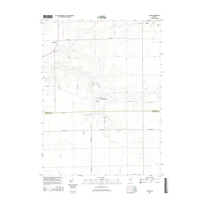
 1983 La Rose1984 Print · USGSCentral Illinois farmland meets the winding Crow Creek drainage during the early eighties. Genealogists can locate family burial grounds like Hallenback Cem or trace the Atchison Topeka and Santa Fe line through La Rose.
 - 1983 Map of Varna, 1984 Print
 1983 Varna1984 Print · USGSThe northern Illinois prairie towns of Varna and Magnolia are captured here in the early eighties as the regional rail network gave way to new transport. Genealogists can trace family footprints across Statler Cem, Antioch Cem, and the Old Railroad Grade.
 - 1983 Map of Minonk, 1984 Print
 1983 Minonk1984 Print · USGSCentral Illinois prairie and rail crossroads come alive in the early 1980s. Genealogists and historians can trace the foundations of Minonk and Rutland, including local sites like St Patricks Sch and the regional mine dump.
 - 1984 Map of Wenona, 1985 Print
 1984 Wenona1985 Print · USGSWenona served as a busy rail crossroads in the mid-1980s, where two major lines intersected amidst the fields of Marshall and La Salle counties. Genealogists can locate several family landmarks including Cherry Point Cem, Riely Cem, and the notable Mine Dump near the town center.
 - 1985 Map of Kewanee
 1985 Kewanee1985 Print · USGSNorth-central Illinois in the mid-eighties shows a landscape of river-valley industry and prairie transit. Researchers can trace family roots through Evergreen Memory Garden or follow the historic Hennepin Canal past Tiskilwa and Wyanet.2 unique versions available
 - 1985 Map of Peoria
 1985 Peoria1985 Print · USGSThe Illinois River valley and the Tri-County area are captured here in the mid-1980s as industry and infrastructure reshaped the heart of the state. Researchers can trace the grounds of Jubilee College, locate the Stark Mine near Elmwood, or follow the busy tracks of the Norfolk and Western Railroad.
 - 1989 Map of Peoria
 1989 Peoria1989 Print · USGSThe Illinois River valley thrived as a regional center of industry, education, and transport during the late eighties. Researchers can trace the extensive rail networks of the Peoria and Pekin Union Railway or locate landmarks like Bradley University and the Peoria Air National Guard Base.
 - 1990 Map of Peoria
 1990 Peoria1990 Print · USGSCentral Illinois at the start of the nineties reveals a landscape of industrial river towns and sprawling university campuses. Researchers can trace the legacy of major institutions like Chanute Air Force Base and the University of Illinois alongside regional landmarks such as Sand Ridge State Forest.
 - 1995 Map of Minonk, 1996 Print
 1995 Minonk1996 Print · USGSAgricultural and industrial history meet in this mid-1990s record of Woodford and Marshall counties. Genealogists can locate several family burial grounds like St Patricks Cem and Rutland Cem, while tracing remnants of the mining era at the Mine Dump near Rutland.
 - 1996 Map of Wenona, 1997 Print
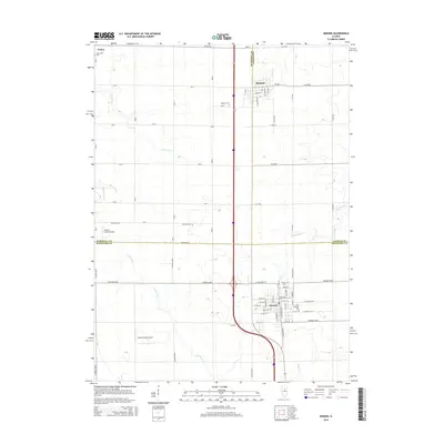
 1996 Wenona1997 Print · USGSWenona and its surrounding prairie townships are captured here in the mid-nineties as the region balanced its agricultural roots with modern transit. Genealogists can locate several local burial sites including Wenona Cem, Cherry Point Cem, and Bethany Cem alongside landmarks like the Entwistle Landing Strip.
 - 2012 Map of La Rose, 2012 Print
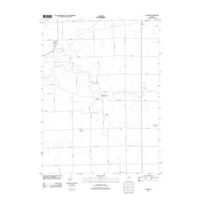 2012 La Rose2012 Print · USGSCovers Toluca, including La Rose, Pattonsburg, and other nearby areas
 - 2012 Map of Varna, 2012 Print
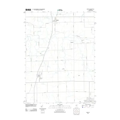 2012 Varna2012 Print · USGSCovers Toluca, including Varna, Magnolia, and other nearby areas
 - 2012 Map of Wenona, 2012 Print
 2012 Wenona2012 Print · USGSCovers Toluca, including Evans, Lostant, and other nearby areas
 - 2012 Map of Minonk, 2012 Print
 2012 Minonk2012 Print · USGSCovers Toluca, including Minonk, Rutland, and other nearby areas
 - 2015 Map of La Rose, 2015 Print
 2015 La Rose2015 Print · USGSCovers Toluca, including La Rose, Pattonsburg, and other nearby areas
 - 2015 Map of Minonk, 2015 Print
 2015 Minonk2015 Print · USGSCovers Toluca, including Minonk, Rutland, and other nearby areas
Showing maps 1-25 of 39
Top cities near Toluca
- Metamora historical maps
- Henry historical maps
- Minonk historical maps
- Roanoke historical maps
- Cazenovia historical maps
- Evans historical maps
See more
Frequently asked questions
- What are the different types of historical maps available for Toluca?
- What is the oldest map of Toluca?
- Where can I purchase historical maps of Toluca for my home or office?
- Where can I download high-res historical maps of Toluca?
- Are there historical topographic maps available for Toluca?
- Is there historical aerial imagery available for Toluca?
- Where are historical maps of Toluca sourced from?