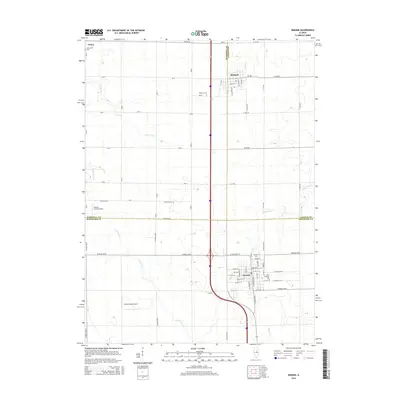
2015 Map of Minonk
USGS Topo · Published 2015About this map
Minonk sits at the intersection of three central Illinois counties, serving as a hub for the surrounding agricultural landscape where Marshall, LaSalle, and Woodford counties meet. The settlement pattern follows a rigid cardinal grid of rural roads, including Co Road 2200 N and Toluca Rd, which connect the primary towns of Rutland and Toluca. The local topography is subtly defined by the drainage networks of S Br Crow Cr and Panther Cr, which cut through the level prairie land. Genealogy researchers will find several significant burial sites documented, such as Saint Patricks Cem and the Minonk Cem. Small-scale aviation landmarks, including the Hattan Farms Airport and Oltman-Shuck Airport, point to the area's modern utility and the continued importance of private transport in this rural corridor.
Find a feature on this map
47 named features on this map. Tap any name to fly to it.
Don’t see what you’re looking for? This feature index may not catch every label — zoom into the map to look around manually.
Map Details
Editions of this 2015 Minonk Map
This is the sole edition of this map. No revisions or reprints were ever made.
Other maps of this area

1925 · Streator
USGS Topo · 1:62,500

1927 · Streator
USGS Topo · 1:62,500

1934 · Wenona
USGS Topo · 1:48,000

1939 · Wenona
USGS Topo · 1:62,500

1955 · Minonk
USGS Topo · 1:62,500

1958 · Flanagan
USGS Topo · 1:62,500

1958 · Aurora
USGS Topo · 1:250,000

1958 · Peoria
USGS Topo · 1:250,000

1961 · Aurora
USGS Topo · 1:250,000

1961 · Peoria
USGS Topo · 1:250,000