1940s Maps of Mercer County, Illinois
Explore 6 historic maps of Mercer County from the 1940s. These maps offer a rare glimpse into what life looked like during the 1940s — showing old roads, neighborhoods, homes, and landmarks that have changed or disappeared over time.
Whether you're researching your family's past, planning a metal detecting trip, or studying how Mercer County's landscape evolved across the 1940s, these high-resolution maps are a powerful tool for exploring the history of this region.
- Focus on a specific era: All maps on this page are from the 1940s, giving you a focused view of this time period.
- See what’s changed: Compare century-old streets, trails, and buildings to today's modern landscape using overlays and satellite layers.
- Research with precision: Use these maps for genealogy, historical research, land use analysis, or educational projects.
- View, download, or print: Maps are fully viewable online in high resolution, and can be downloaded or printed for your own records.
Start exploring Mercer County's history through authentic maps from the 1940s. This is your window into the past.
Mercer County, IL maps
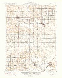
(6)- 1941 Map of Keithsburg
 1941 Keithsburg1941 Print · USGSThe Mississippi River front in Mercer County thrived during the early 1940s as a hub of rail and river commerce. Genealogists can trace family footprints through dozens of rural landmarks, from Peniel Ch to schoolhouses like Prouty Sch and Lee Sch.2 unique versions available
 - 1944 Map of Milan, 1958 Print
 1944 Milan1958 Print · USGSThe Illinois-Iowa border comes alive in the 1940s, highlighting the industrial riverfronts and the rural interior of Rock Island and Mercer Counties. Trace family roots and local industry at the Coal Valley Mine, the US Arsenal, or the vanished schoolhouses like Doxie School.
 - 1946 Map of Wapello, 1954 Print
 1946 Wapello1954 Print · USGSThe riverfront town of New Boston and the surrounding islands are captured in the mid-1940s as the Mississippi River meets the Iowa River. Researchers can trace the era's local rural life at Swan Lake Sch, Pin Oak Sch, and the engineering at Lock and Dam No 17.2 unique versions available
 - 1947 Map of Woodhull
 1947 Woodhull1947 Print · USGSThe Illinois prairie at mid-century reveals a dense network of family farms and rural institutions near the Henry and Knox county lines. Genealogists can trace ancestral sites through dozens of named schools and cemeteries like Prairie Flower Sch and Oxford Cem.2 unique versions available
 - 1948 Map of Muscatine
 1948 Muscatine1948 Print · USGSThe Mississippi River bottomlands along the Iowa-Illinois border are captured here in the late 1940s, showing a transition from river commerce to intensive drainage agriculture. Researchers can trace rural school districts like Lillibridge Sch and local landmarks such as the Muscatine Bridge and Glancey Lake.2 unique versions available
 - 1949 Map of Wapello
 1949 Wapello1949 Print · USGSThe riverfront of Mercer County and the Mississippi border appear here in the late 1940s, just after the war. Local historians can trace the river's path through Lock and Dam No 17, find rural schoolhouses like Bay View Sch, or locate the Ferry at the mouth of the Iowa River.2 unique versions available
End of results
Showing maps 1-6 of 6
Top cities of Mercer County
- Aledo historical maps
- Preemption historical maps
- Viola historical maps
- Matherville historical maps
- Millersburg historical maps
- Keithsburg historical maps
See more
Frequently asked questions
- What are the different types of historical maps available for Mercer County?
- What is the oldest map of Mercer County?
- Where can I purchase historical maps of Mercer County for my home or office?
- Where can I download high-res historical maps of Mercer County?
- Are there historical topographic maps available for Mercer County?
- Is there historical aerial imagery available for Mercer County?
- Where are historical maps of Mercer County sourced from?