Old Maps of Mercer County, Illinois for Genealogy
Trace your family roots with 139 historic maps of Mercer County. These high-res maps reveal old neighborhoods, homesites, landmarks, and streets — helping you uncover where your ancestors lived and how the area evolved over time.
- Explore historic neighborhoods: Identify where your relatives may have lived in the 1800s or 1900s.
- Compare maps over time: Trace the changes in streets, buildings, and landmarks for multi-generational research.
- Perfect for genealogy & ancestry research: Used by family historians and researchers to map out lineage and migration.
These maps are an incredible resource for exploring your personal connection to Mercer County's past.
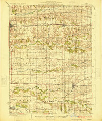
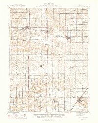
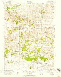
Mercer County, IL maps
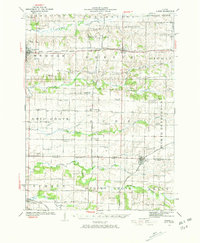
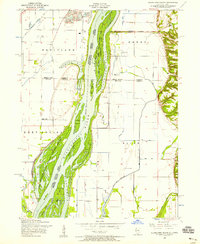
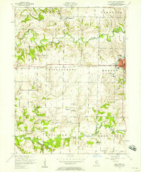
(139)- 1912 Map of Milan
 1912 Milan1912 Print · USGSThe river confluence and burgeoning rail networks of Rock Island County are captured here just before the First World War. Researchers can trace the legacy of early industry and education through sites like the Coal Valley Mine, Blackhawk Watchtower, and Excelsior School.7 unique versions available
 - 1916 Map of Edgington
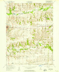
 1916 Edgington1916 Print · USGSThe river-and-rail corridor along the Mississippi border emerges in high detail during the early twentieth century. Genealogists and local historians can trace the rural landscape through a dense network of country schools like Whiteoak School and New Era, alongside river features like Geneva Island.3 unique versions available
 - 1923 Map of Alexis
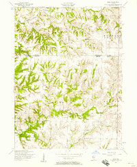
 1923 Alexis1923 Print · USGSNorthwestern Illinois at the height of the steam-rail era shows a countryside dotted with local schools and coal-hauling branch lines. Genealogists and historians can trace family ties to Ohio Grove Church, Mann Cemetery, or vanished stops like Shale City.2 unique versions available
 - 1925 Map of Alexis
 1925 Alexis1925 Print · USGSThe Illinois prairie of the 1920s is preserved here through a remarkably detailed network of rural schoolhouses and railroad stops. Trace the paths of the Rock Island Southern through Shale City or locate family roots at Ohio Grove Church and Mann Cemetery.
 - 1935 Map of Keithsburg
 1935 Keithsburg1935 Print · USGSMercer County during the mid-thirties reveals a landscape of river towns and railroad junctions along the Mississippi. Genealogists and local historians can trace rural roots at Peniel Ch, Brick Cem, and numerous schoolhouses like Hazel Dell Sch.4 unique versions available
 - 1937 Map of Orion
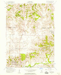
 1937 Orion1937 Print · USGSHenry County and Mercer County are captured here in the late 1930s, showing a landscape of small agricultural hubs connected by a dense rail network. Genealogists can trace family footprints through dozens of rural schools like Washington Sch and landmarks like the Valhalla Cemetery.2 unique versions available
 - 1938 Map of Edgington, 1955 Print
 1938 Edgington1955 Print · USGSThe Mississippi River corridor in the late thirties shows a landscape of active rail lines and riverfront industry. Genealogists can trace rural family roots through numerous local landmarks like Jimtown, White Eagle School, and Buffalo Center School.
 - 1941 Map of Keithsburg
 1941 Keithsburg1941 Print · USGSThe Mississippi River front in Mercer County thrived during the early 1940s as a hub of rail and river commerce. Genealogists can trace family footprints through dozens of rural landmarks, from Peniel Ch to schoolhouses like Prouty Sch and Lee Sch.2 unique versions available
 - 1944 Map of Milan, 1958 Print
 1944 Milan1958 Print · USGSThe Illinois-Iowa border comes alive in the 1940s, highlighting the industrial riverfronts and the rural interior of Rock Island and Mercer Counties. Trace family roots and local industry at the Coal Valley Mine, the US Arsenal, or the vanished schoolhouses like Doxie School.
 - 1946 Map of Wapello, 1954 Print
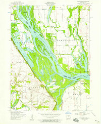
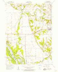
 1946 Wapello1954 Print · USGSThe riverfront town of New Boston and the surrounding islands are captured in the mid-1940s as the Mississippi River meets the Iowa River. Researchers can trace the era's local rural life at Swan Lake Sch, Pin Oak Sch, and the engineering at Lock and Dam No 17.2 unique versions available
 - 1947 Map of Woodhull
 1947 Woodhull1947 Print · USGSThe Illinois prairie at mid-century reveals a dense network of family farms and rural institutions near the Henry and Knox county lines. Genealogists can trace ancestral sites through dozens of named schools and cemeteries like Prairie Flower Sch and Oxford Cem.2 unique versions available
 - 1948 Map of Muscatine
 1948 Muscatine1948 Print · USGSThe Mississippi River bottomlands along the Iowa-Illinois border are captured here in the late 1940s, showing a transition from river commerce to intensive drainage agriculture. Researchers can trace rural school districts like Lillibridge Sch and local landmarks such as the Muscatine Bridge and Glancey Lake.2 unique versions available
 - 1949 Map of Wapello
 1949 Wapello1949 Print · USGSThe riverfront of Mercer County and the Mississippi border appear here in the late 1940s, just after the war. Local historians can trace the river's path through Lock and Dam No 17, find rural schoolhouses like Bay View Sch, or locate the Ferry at the mouth of the Iowa River.2 unique versions available
 - 1953 Map of Viola, 1957 Print
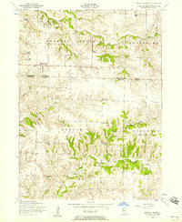
 1953 Viola1957 Print · USGSMercer County farmland and rail-side villages appear in the early fifties during the height of the rural school era. Trace local family history through Viola Cemetery, Green Summit School, and the defunct rail stops at Gilchrist or Wanlock.2 unique versions available
 - 1953 Map of Matherville, 1957 Print
 1953 Matherville1957 Print · USGSThe border of Rock Island and Mercer Counties is shown in the early 1950s as the local coal mining era was fading. Researchers can trace historic industrial sites like the Gilhrist Mine and several rural burial grounds including Farlows Grove Cemetery and Soderberg Cemetery.2 unique versions available
 - 1953 Map of New Windsor, 1957 Print
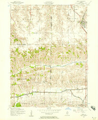
 1953 New Windsor1957 Print · USGSNorthwestern Illinois farm country in the early fifties shows a transition from local rail reliance to industrial coal extraction. Genealogists can locate family burial plots at Oxford Cemetery or trace the rural school system through sites like Oakridge School and Hopewell School.2 unique versions available
 - 1953 Map of Orion, 1957 Print
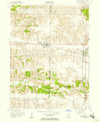
 1953 Orion1957 Print · USGSThe tri-county border of Henry, Rock Island, and Mercer counties appears in the early fifties as a landscape of rural schools and coal works. Researchers can trace family sites at Beulah Church, the Long View Mine, and the Rural Town Hall School.3 unique versions available
 - 1953 Map of Toolesboro, 1958 Print
 1953 Toolesboro1958 Print · USGSThe Mississippi River valley along the Iowa-Illinois border comes alive in the 1950s, showcasing a landscape of shifting sloughs and river commerce. Genealogists and historians can trace family roots through Mallory Cemetery or locate the site of the New Boston Ferry and local landmarks like Pin Oak School.2 unique versions available
 - 1953 Map of Blanchard Island, 1958 Print
 1953 Blanchard Island1958 Print · USGSThe Mississippi River bottomlands between Illinois and Iowa are captured here in the early fifties, showing a landscape of complex chutes and islands. Genealogists can locate rural landmarks like Island Church, Reynolds Cemetery, and several local schools such as Excelsior School.2 unique versions available
 - 1953 Map of Buffalo Prairie, 1958 Print
 1953 Buffalo Prairie1958 Print · USGSIllinois prairie life in the early fifties comes into focus along the Rock Island and Mercer County line. Researchers can trace the heritage of rural communities through several country schoolhouses and church sites like Buffalo Prairie Church and the Duncan Town Hall.2 unique versions available
 - 1953 Map of Aledo East, 1958 Print
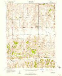
 1953 Aledo East1958 Print · USGSMercer County's rural townships are captured here in the early 1950s, showing a landscape defined by small rail towns and country crossroads. Genealogists can trace family names through sites like Motherred Cemetery, Shale City, and the Mercer County Nursing Home.2 unique versions available
 - 1953 Map of Eliza, 1958 Print
 1953 Eliza1958 Print · USGSWestern Illinois farm country in the early fifties is mapped here in detail, spanning the boundary of Rock Island and Mercer Counties. Researchers can locate local landmarks like the White Eagle School, Miller Cemetery, and the rural community center of Eliza.2 unique versions available
 - 1953 Map of Reynolds, 1958 Print
 1953 Reynolds1958 Print · USGSThe borderlands of Rock Island and Mercer counties are captured here in the early 1950s, showing a landscape shaped by small farmsteads and rural schools. Researchers can trace family sites at Hamlet Cemetery, locate vanished schoolhouses like McAfee School, and follow the path of a dismantled railroad.2 unique versions available
 - 1953 Map of Joy, 1958 Print
 1953 Joy1958 Print · USGSMercer County, Illinois, is captured in the early 1950s as the rail and river landscape of New Boston and Joy continued to evolve. Researchers can locate rural landmarks like Lone Star School, Shields Cemetery, and the path of the dismantled railroad.2 unique versions available
 - 1953 Map of Aledo West, 1958 Print
 1953 Aledo West1958 Print · USGSMercer County farmland in the early fifties shows a landscape of busy rural townships and established schools. Researchers can locate the Roosevelt Military Academy in Aledo or trace family sites like Griffith Cemetery and Peniel Church.2 unique versions available
Showing maps 1-25 of 139
Top cities of Mercer County
- Aledo historical maps
- Preemption historical maps
- Viola historical maps
- Matherville historical maps
- Millersburg historical maps
- Keithsburg historical maps
See more
Frequently asked questions
- What are the different types of historical maps available for Mercer County?
- What is the oldest map of Mercer County?
- Where can I purchase historical maps of Mercer County for my home or office?
- Where can I download high-res historical maps of Mercer County?
- Are there historical topographic maps available for Mercer County?
- Is there historical aerial imagery available for Mercer County?
- Where are historical maps of Mercer County sourced from?