Old Maps of Monroe County, Illinois for Genealogy
Trace your family roots with 144 historic maps of Monroe County. These high-res maps reveal old neighborhoods, homesites, landmarks, and streets — helping you uncover where your ancestors lived and how the area evolved over time.
- Explore historic neighborhoods: Identify where your relatives may have lived in the 1800s or 1900s.
- Compare maps over time: Trace the changes in streets, buildings, and landmarks for multi-generational research.
- Perfect for genealogy & ancestry research: Used by family historians and researchers to map out lineage and migration.
These maps are an incredible resource for exploring your personal connection to Monroe County's past.
Monroe County, IL maps
(144)- 1888 Map of St. Louis
 1888 St. Louis1888 Print · USGSThe Illinois bottomlands across from St. Louis come alive in the late nineteenth century as a massive railroad hub emerging from the river wetlands. Researchers can trace early rail junctions and settlements like French Village, the ancient Monks Mound, and the industrial waterfronts of Brooklyn and East St Louis.
 - 1910 Map of Waterloo, 1956 Print
 1910 Waterloo1956 Print · USGSMonroe and St. Clair counties are shown in detail during the early twentieth century, highlighting a landscape of rail-dependent prairie towns. Family historians can trace rural schools and churches like Oakdale School or Zion Church, and locate early stops on the Mobile and Ohio RR.
 - 1912 Map of New Athens
 1912 New Athens1912 Print · USGSThe St. Clair County prairies in the early nineteen-hundreds were a bustling corridor of river commerce and rail expansion. Genealogists and historians can locate vanished landmarks like Lementon, dozens of country schools, and the Kaskaskia River oxbows.2 unique versions available
 - 1912 Map of Kimmswick
 1912 Kimmswick1912 Print · USGSThe Illinois bottomlands along the Mississippi River are shown here in the early twentieth century, just as the railroad was solidifying the region's economy. Genealogists and local researchers can trace the locations of Harrisonville, the Blue Church, and historic schools like Miles Prairie School.2 unique versions available
 - 1912 Map of Baldwin, 1967 Print
 1912 Baldwin1967 Print · USGSRandolph and St. Clair counties come alive in this early twentieth-century survey of the Kaskaskia River valley. Genealogists can trace family footprints across dozens of local school sites, including Charter Oak School, Stringtown School, and the rural community of Schuline.
 - 1913 Map of Waterloo
 1913 Waterloo1913 Print · USGSMonroe and St. Clair counties are shown just after the first decade of the twentieth century as the region’s rural economy matured. Genealogists can trace family footprints through dozens of rural landmarks like Diamond Joe Mine, Palmer Cem, and the Mobile and Ohio RR.3 unique versions available
 - 1914 Map of Baldwin
 1914 Baldwin1914 Print · USGSSouthern Illinois farm country and the meandering Kaskaskia River define this 1910s landscape. Genealogists can locate nearly thirty named schoolhouses, including Hiawassie School and Risdon School, alongside the early routes of the Illinois Southern railroad.2 unique versions available
 - 1915 Map of Renault
 1915 Renault1915 Print · USGSThe Illinois river bluffs and the American Bottom appear here in the early twentieth century as a landscape of thriving rail-side villages and rural schools. You can trace early family sites like Stuptown Church, the historic Ruma Convent, and landings at Prairie du Rocher.4 unique versions available
 - 1915 Map of Crystal City
 1915 Crystal City1915 Print · USGSThe Missouri-Illinois riverfront comes alive in this early 1900s survey of the industrial corridor between Crystal City and VALLES MINES. Researchers can trace the path of the St Louis and San Francisco railroad and locate old community centers like Rush Tower or the Telegraph School.4 unique versions available
 - 1916 Map of Kimmswick
 1916 Kimmswick1916 Print · USGSThe Mississippi River valley comes alive in this early twentieth-century survey of the Missouri-Illinois borderlands. Genealogists and historians can trace defunct schoolhouses like Fawn Ridge School, river landings such as Harrisonville Landing, and the path of the St Louis Iron Mountain and Southern RR.6 unique versions available
 - 1933 Map of Jefferson Barracks
 1933 Jefferson Barracks1933 Print · USGSSouth St. Louis County and the riverfront during the mid-thirties reveal a landscape of expanding suburbs and deep military roots. Genealogists and historians can trace family plots in National Cem or locate the early centers of Luxemburg and Affton PO Grevois Sta.
 - 1933 Map of Cahokia
 1933 Cahokia1933 Print · USGSThe riverfront neighborhoods of south St. Louis are captured in detail during the early 1930s, showing a bustling landscape of schools and industry. Genealogists can trace family locations near Carondelet, St Anthony Ch, or the Mo Pac Hospital.
 - 1934 Map of Cahokia
 1934 Cahokia1934 Print · USGSThe industrial corridor and riverfront of St. Clair County are captured here in the mid-1930s as heavy rail and river commerce defined the landscape. Genealogists and historians can trace family-named schools and early settlements like Dupo, Lark Cem, and Falling Spring.2 unique versions available
 - 1940 Map of Cahokia
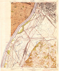 1940 Cahokia1940 Print · USGSThe industrial riverfront south of St Louis thrived in the early twentieth century as a massive rail and shipping hub. Trace the development of Cahokia and Dupo or locate landmarks like the U S Marine Hospital and the Lark Cem.3 unique versions available
 - 1940 Map of Renault, 1955 Print
 1940 Renault1955 Print · USGSThe Illinois-Missouri borderlands come to life in the 1940s, highlighting the river-driven economy and rural community structure of the Mississippi valley. Genealogists can trace family footprints through dozens of local landmarks, from the Ruma Convent to historic schoolhouses like Yankeetown School and Foster School.2 unique versions available
 - 1941 Map of Jefferson Barracks
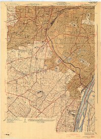 1941 Jefferson Barracks1941 Print · USGSThe suburbs south of St. Louis were maturing into a dense network of rail-side towns and institutions just before the mid-century. Genealogists and historians can trace family roots through numerous sites like Grants Farm, National Cemetery, and Webster College.3 unique versions available
 - 1942 Map of Baldwin, 1960 Print
 1942 Baldwin1960 Print · USGSMid-century southwestern Illinois reveals a landscape of river-bend settlements and extensive rail networks. Genealogists can locate many local landmarks like Jordan Grove School, the Mobile and Ohio rail line, and the village of Evansville along the Kaskaskia River.
 - 1948 Map of Kimmswick, 1955 Print
 1948 Kimmswick1955 Print · USGSThe Mississippi River corridor south of St. Louis appears here at a mid-century peak of rail and river industry. Researchers can trace historic river landings and rural schools like Harrisonville Landing, Blue Church, and the sprawling grounds of Jefferson Barracks.
 - 1949 Map of Saint Louis
 1949 Saint Louis1949 Print · USGSGreater St. Louis and its surrounding river valleys are captured here just after the war, showing the metropolitan core and the rural Ozark fringe. Researchers can trace the sprawling rail network of the Wabash RR or locate landmarks like Meramec Caverns Airport and Scott Air Force Base.2 unique versions available
 - 1949 Map of Cahokia, 1954 Print
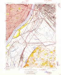 1949 Cahokia1954 Print · USGSMid-century development and heavy industry define this riverfront region as St. Louis expands toward the Illinois rail yards. Researchers can trace the heritage of Dupo and Cahokia, locate St Josephs Cem, or find industrial landmarks like Monsanto.2 unique versions available
 - 1949 Map of Crystal City, 1959 Print
 1949 Crystal City1959 Print · USGSThe Mississippi River valley comes alive in the late 1940s, showing the industrial pulse of Festus and the rural reaches of Jefferson County. Genealogists can locate numerous vanished landmarks like the Telegraph School, Valle Mines, and the Rush Tower river landing.2 unique versions available
 - 1951 Map of Columbia
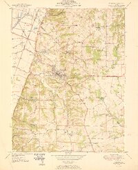 1951 Columbia1951 Print · USGSMonroe and St. Clair counties appear here in the early fifties as the region balanced its agricultural roots with growing rail and oil interests. Researchers can find numerous family landmarks and rural institutions, from Shoemaker Cem and Lark Cem to the New Hanover Station.
 - 1954 Map of New Athens West, 1959 Print
 1954 New Athens West1959 Print · USGSThe Kaskaskia River and its intricate backwaters define this corner of St. Clair and Monroe counties in the mid-1950s. Genealogists and historians can trace the foundations of local life through the many country schools and cemeteries, such as McQuillan Sch, Brick Cem, and the village of Hecker.4 unique versions available
 - 1954 Map of Oakville, 1959 Print
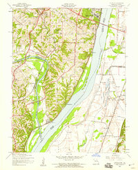 1954 Oakville1959 Print · USGSThe confluence of the Meramec and Mississippi rivers comes into focus during the mid-fifties, showing the growth of St. Louis County and the Illinois bottomlands. Researchers can trace the grounds of Jefferson Barracks, locate family plots at St Pauls Cem, or find long-standing community landmarks like Nazareth Convent.4 unique versions available
 - 1954 Map of Webster Groves, 1959 Print
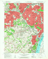 1954 Webster Groves1959 Print · USGSMid-century St. Louis and Webster Groves appear here during a period of rapid suburban maturation and institutional development. Genealogists can trace family sites near Jefferson Barracks, Resurrection Cemetery, and Luxemburg.5 unique versions available
Showing maps 1-25 of 144
Top cities of Monroe County
- Columbia historical maps
- Waterloo historical maps
- Valmeyer historical maps
- Maeystown historical maps
- Fults historical maps
Frequently asked questions
- What are the different types of historical maps available for Monroe County?
- What is the oldest map of Monroe County?
- Where can I purchase historical maps of Monroe County for my home or office?
- Where can I download high-res historical maps of Monroe County?
- Are there historical topographic maps available for Monroe County?
- Is there historical aerial imagery available for Monroe County?
- Where are historical maps of Monroe County sourced from?