1970s Maps of Ogle County, Illinois
Explore 7 historic maps of Ogle County from the 1970s. These maps offer a rare glimpse into what life looked like during the 1970s — showing old roads, neighborhoods, homes, and landmarks that have changed or disappeared over time.
Whether you're researching your family's past, planning a metal detecting trip, or studying how Ogle County's landscape evolved across the 1970s, these high-resolution maps are a powerful tool for exploring the history of this region.
- Focus on a specific era: All maps on this page are from the 1970s, giving you a focused view of this time period.
- See what’s changed: Compare century-old streets, trails, and buildings to today's modern landscape using overlays and satellite layers.
- Research with precision: Use these maps for genealogy, historical research, land use analysis, or educational projects.
- View, download, or print: Maps are fully viewable online in high resolution, and can be downloaded or printed for your own records.
Start exploring Ogle County's history through authentic maps from the 1970s. This is your window into the past.
Ogle County, IL maps
(7)- 1971 Map of Stillman Valley, 1973 Print
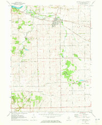 1971 Stillman Valley1973 Print · USGSNorthern Illinois farmland and rail corridors define the landscape around the early seventies. Genealogists can trace family roots through Beach Cem and Stimponian Cem, or locate old junctions at Stillman Valley and Holcomb.2 unique versions available
 - 1971 Map of Creston, 1973 Print
 1971 Creston1973 Print · USGSCreston and its neighboring townships are captured in the early seventies during a period of established agricultural growth and institutional expansion. Trace local family history and property lines near Woodlawn Cem, Kishwaukee College, or along the Chicago and North Western rail line.2 unique versions available
 - 1971 Map of Kishwaukee, 1973 Print
 1971 Kishwaukee1973 Print · USGSWinnebago and Ogle Counties are captured here in the early seventies as the river valleys supported both industry and recreation. Genealogists and local historians can locate Winnebago Cemetery, rural schools like Oak Grove, and the Alworth settlement.
 - 1971 Map of Kings, 1973 Print
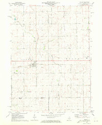
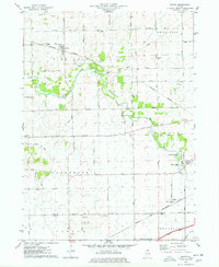
 1971 Kings1973 Print · USGSOgle County was a thriving rail and agricultural corridor in the early 1970s, centered on the busy junction at Davis Junction. You can trace the historic paths of the Chicago and North Western railroad or locate family plots at Killbuck Cem and Lindenwood Cem.2 unique versions available
 - 1971 Map of Rockford South, 1973 Print
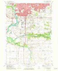 1971 Rockford South1973 Print · USGSSouthern Rockford and the surrounding Winnebago County countryside appear here in the early seventies as suburban growth began to reach toward the Ogle County line. Researchers can trace local landmarks like Starkey Cem, the Grange Hall, and small communities such as New Milford and Morristown.2 unique versions available
 - 1975 Map of Rochelle, 1978 Print
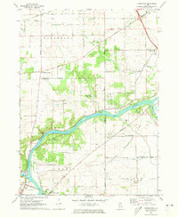
 1975 Rochelle1978 Print · USGSRochelle thrived as a vital Illinois rail hub during the mid-seventies, situated where two major western railroads met. Genealogists and local historians can trace the town's growth through its neighborhood schools like May Sch, the Lawnridge Cem, and the early layout of the Rochelle Municipal Airport.
 - 1975 Map of Chana, 1978 Print
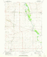
 1975 Chana1978 Print · USGSOgle County's rural landscape is captured here in the mid-1970s, showcasing the intersection of the Kite River and several major rail lines. Researchers can trace historic cemeteries like Chapel Hill Cem and local landmarks such as Ashton Ch or the settlement of Chana.
End of results
Showing maps 1-7 of 7
Top cities of Ogle County
Frequently asked questions
- What are the different types of historical maps available for Ogle County?
- What is the oldest map of Ogle County?
- Where can I purchase historical maps of Ogle County for my home or office?
- Where can I download high-res historical maps of Ogle County?
- Are there historical topographic maps available for Ogle County?
- Is there historical aerial imagery available for Ogle County?
- Where are historical maps of Ogle County sourced from?