1990s Maps of Ogle County, Illinois
Explore 3 historic maps of Ogle County from the 1990s. These maps offer a rare glimpse into what life looked like during the 1990s — showing old roads, neighborhoods, homes, and landmarks that have changed or disappeared over time.
Whether you're researching your family's past, planning a metal detecting trip, or studying how Ogle County's landscape evolved across the 1990s, these high-resolution maps are a powerful tool for exploring the history of this region.
- Focus on a specific era: All maps on this page are from the 1990s, giving you a focused view of this time period.
- See what’s changed: Compare century-old streets, trails, and buildings to today's modern landscape using overlays and satellite layers.
- Research with precision: Use these maps for genealogy, historical research, land use analysis, or educational projects.
- View, download, or print: Maps are fully viewable online in high resolution, and can be downloaded or printed for your own records.
Start exploring Ogle County's history through authentic maps from the 1990s. This is your window into the past.
Ogle County, IL maps
(3)- 1993 Map of Rochelle
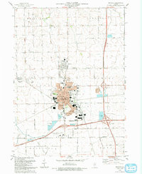 1993 Rochelle1993 Print · USGSRochelle and Hillcrest are shown at the height of their late-century growth where the tollways meet the Illinois prairie. Researchers can trace family sites at Lawnridge Cem, locate the St Patricks Sch, or explore the Kyte River valley.
 - 1993 Map of Kings
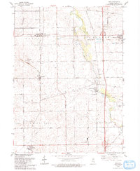 1993 Kings1993 Print · USGSOgle County and the eastern Illinois prairies are shown here in the early nineties, revealing a landscape of historic rail corridors and quiet hamlets. Researchers can trace the Old Railroad Grade and locate ancestral sites at Kilbuck Cem or Big Mound Cem.
 - 1993 Map of Rockford South
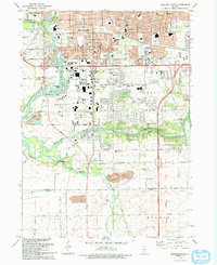 1993 Rockford South1993 Print · USGSThe Rockford suburbs and the Kishwaukee riverfront are captured here in the early nineties, showing a mix of industrial expansion and preserved forest land. Researchers can trace local institutions like Starkey Cem and New Milford alongside the Chicago and North Western rail lines.
End of results
Showing maps 1-3 of 3
Top cities of Ogle County
Frequently asked questions
- What are the different types of historical maps available for Ogle County?
- What is the oldest map of Ogle County?
- Where can I purchase historical maps of Ogle County for my home or office?
- Where can I download high-res historical maps of Ogle County?
- Are there historical topographic maps available for Ogle County?
- Is there historical aerial imagery available for Ogle County?
- Where are historical maps of Ogle County sourced from?