Old Maps of Pine Creek Township, Illinois for Metal Detecting
Plan your next treasure hunt with 41 historic maps of Pine Creek Township. Find old homesites, ghost towns, trails, and gathering spots that may be lost to time — perfect for identifying promising metal detecting locations.
- Locate forgotten sites: Uncover places like long-lost settlements, abandoned rail lines, or gathering spots.
- Plan better hunts: Use map overlays combined with LiDAR or satellite views to narrow in on historically rich areas.
- Made for detectorists: Thousands of hobbyists use these maps to discover relics, coins, and hidden history.
Use these historic maps to boost your research and find new opportunities beneath the surface of Pine Creek Township.
Pine Creek Township, IL maps
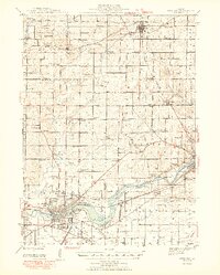
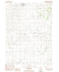
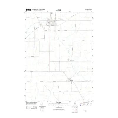
(41)- 1918 Map of Dixon
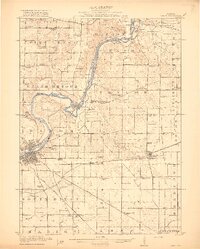 1918 Dixon1918 Print · USGSLee and Ogle Counties are captured at a pivotal moment during the First World War when the rural schoolhouse system was at its peak. Genealogists can trace family footprints across townships to landmarks like Grand Detour, Pennsylvania Corners, and the White Temple School.3 unique versions available
 - 1922 Map of Oregon, 1967 Print
 1922 Oregon1967 Print · USGSNorthern Illinois at the start of the twenties reveals a landscape of thriving rail towns and numerous one-room schoolhouses. Genealogists can trace family footprints at Wessels School, Ebenezer Church, and early village sites like Adeline and Egan.
 - 1924 Map of Oregon
 1924 Oregon1924 Print · USGSOgle County's rural landscape is captured here in the early twenties, showing a network of river-valley settlements and busy rail lines. Researchers can trace family history through numerous landmarks like the German Valley PO and station, St Thomas Church, and Mount Morris.3 unique versions available
 - 1930 Map of Woodsung
 1930 Woodsung1930 Print · USGSNorthern Illinois at the dawn of the 1930s shows a landscape of tight-knit farming townships linked by the Lincoln Highway. Genealogists and local historians can trace schoolhouse locations like Stone Sch and Gap Grove Sch, or locate family sites near the Prairieville Cem.
 - 1942 Map of Forreston, 1965 Print
 1942 Forreston1965 Print · USGSForreston and the surrounding Ogle County prairie are shown during a height of rail activity in the 1940s. Genealogists can trace family roots through numerous country schools like White Oak Sch and rural landmarks such as Prairie Dell Ch and Shelly Cem.2 unique versions available
 - 1945 Map of Forreston
 1945 Forreston1945 Print · USGSIn the mid-1940s, the rural landscapes of Ogle and Stephenson counties were defined by a sprawling network of one-room schoolhouses and busy rail lines. Genealogists and historians can trace family roots at West Grove Ch, Maryland, and schools like Wall Sch or Good Sch.2 unique versions available
 - 1946 Map of Sterling, 1969 Print
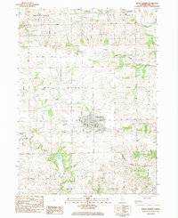
 1946 Sterling1969 Print · USGSThe Rock River corridor in the mid-1940s is captured here, showing the industrial heart of the region alongside its deep agricultural roots. Researchers can find dozens of country schools and cemeteries, including Buffalo Grove Sch, Zion Cem, and Oak Knoll Mem Park Cem.
 - 1948 Map of Sterling
 1948 Sterling1948 Print · USGSMid-century Sterling and Rock Falls are captured here during a time of robust rail and river activity. Genealogists can trace family roots through dozens of rural landmarks, including the Prairieville settlement, West Science Ridge Ch, and Hitt Cem.2 unique versions available
 - 1950 Map of Dixon, 1964 Print
 1950 Dixon1964 Print · USGSThe Rock River valley in the mid-twentieth century shows a landscape of busy river towns and dense rural school districts. Genealogists can locate family-named landmarks like Tealls Corners School, Emmert School, and the White Temple church.2 unique versions available
 - 1954 Map of Rockford
 1954 Rockford1954 Print · USGSThe Rock River valley and the Illinois-Wisconsin borderlands are captured here in the mid-1950s during a period of robust industrial and agricultural activity. Genealogists and historians can trace rail-era corridors like the Illinois Central RR and locate landmarks from Big Foot Prairie to Lake Geneva.
 - 1955 Map of Rockford
 1955 Rockford1955 Print · USGSThe Rock River valley and southern Wisconsin dairy country are shown here in the mid-fifties as the region's manufacturing centers grew. Genealogists and historians can trace the paths of the Chicago and North Western RR and Illinois Central RR through hubs like Rockford and Beloit.
 - 1958 Map of Aurora, 1969 Print
 1958 Aurora1969 Print · USGSNorthern Illinois in the late fifties shows a landscape of powerful river industry and expanding transport corridors. Genealogists and historians can trace the development of Aurora and Joliet or locate sites like the Elwood Ordnance Plant and Starved Rock.3 unique versions available
 - 1958 Map of Rockford, 1974 Print
 1958 Rockford1974 Print · USGSNorthern Illinois and southern Wisconsin are shown here in the mid-twentieth century as rail-dependent industrial towns began to interface with growing lakefront communities. Genealogists can trace family roots through settlements like Saylesville and Tess Corners or locate historical landmarks like the Rockford Ordnance Depot.4 unique versions available
 - 1961 Map of Aurora
 1961 Aurora1961 Print · USGSNorthern Illinois at the height of the post-war era reveals a landscape of massive industrial works and thriving river towns. Genealogists and historians can trace the paths of the Lincoln Highway or locate long-standing landmarks like the Green River Ordnance Plant and Starved Rock State Park.
 - 1963 Map of Rockford
 1963 Rockford1963 Print · USGSThe mid-century industrial corridor along the Rock River is shown here during a period of rapid post-war growth. Researchers can trace the extensive rail lines of the Chicago and North Western or locate local landmarks like the Rockford Ordnance Depot and Holy Hill.
 - 1981 Map of Rockford
 1981 Rockford1981 Print · USGSNorthern Illinois during the early eighties shows a landscape shaped by river valleys and a maturing rail network. Genealogists can trace family roots through settlements like Morseville and Buckhorn Corners while exploring the Rock River valley.2 unique versions available
 - 1983 Map of Polo, 1984 Print
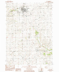 1983 Polo1984 Print · USGSDuring the early 1980s, the rural townships of Ogle and Lee Counties maintained a steady landscape of family farms and small-town centers like Polo. Researchers can locate several burial grounds including Fairmont Cem and trace old country schools like Congress Sch.
 - 1983 Map of Grand Detour, 1984 Print
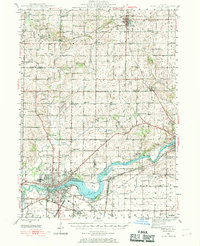
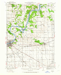
 1983 Grand Detour1984 Print · USGSOgle and Lee County are captured in the early eighties as the Rock River winds through the historic horseshoe bend at Grand Detour. Genealogists and local historians can trace rural sites like Kingdom, the Pine Creek Cemetery, and the Townhall north of the river.
 - 1983 Map of Forreston South, 1984 Print
 1983 Forreston South1984 Print · USGSOgle County's agricultural heartland is documented here in the early 1980s as rural life centered on crossroads like Haldane and the Illinois Central Gulf rail corridor. Researchers can locate local landmarks including the Church of the Brethren, West Branch Cem, and Goose Hollow.
 - 1983 Map of Mount Morris, 1984 Print
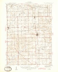
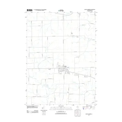
 1983 Mount Morris1984 Print · USGSMount Morris and the surrounding Ogle County townships are captured here in the early 1980s as the regional agricultural and rail networks remained firmly established. Researchers can trace historic burial sites like Oak Wood Cem and Cedar Hill Cem or locate regional landmarks such as Nick Lung Airport.
 - 1985 Map of Dixon
 1985 Dixon1985 Print · USGSNorth-central Illinois in the mid-eighties was a land of river cities and expansive prairies defined by rail lines and private airfields. Researchers can locate family landmarks like Oakwood Cem, the Sword Landing Strip, and Sauk Valley College while tracing the C & N W railroad.2 unique versions available
 - 2012 Map of Forreston South, 2012 Print
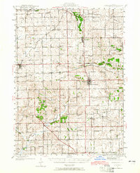
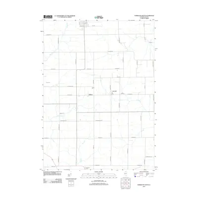 2012 Forreston South2012 Print · USGSCovers Pine Creek Township, including Forreston, Maryland, and other nearby areas
 - 2012 Map of Grand Detour, 2012 Print
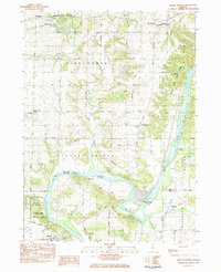
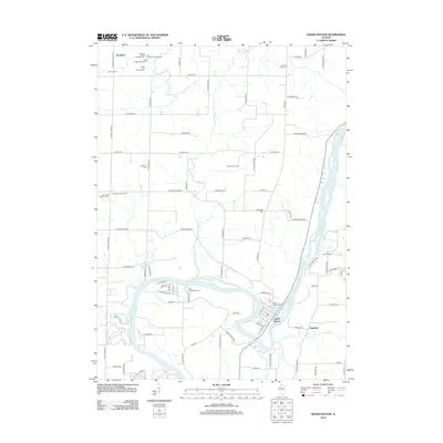 2012 Grand Detour2012 Print · USGSCovers Pine Creek Township, including Dixon, Grand Detour, and other nearby areas
 - 2012 Map of Polo, 2012 Print
 2012 Polo2012 Print · USGSCovers Pine Creek Township, including Polo, Woosung, and other nearby areas
 - 2012 Map of Mount Morris, 2012 Print
 2012 Mount Morris2012 Print · USGSCovers Pine Creek Township, including Mount Morris, Leaf River, and other nearby areas
Showing maps 1-25 of 41
Top cities near Pine Creek Township
- Dixon historical maps
- Sterling historical maps
- Rock Falls historical maps
- Oregon historical maps
- Byron historical maps
- Mount Morris historical maps
See more
Top neighborhoods of Pine Creek Township
Frequently asked questions
- What are the different types of historical maps available for Pine Creek Township?
- What is the oldest map of Pine Creek Township?
- Where can I purchase historical maps of Pine Creek Township for my home or office?
- Where can I download high-res historical maps of Pine Creek Township?
- Are there historical topographic maps available for Pine Creek Township?
- Is there historical aerial imagery available for Pine Creek Township?
- Where are historical maps of Pine Creek Township sourced from?