1980s Maps of Pine Creek Township, Illinois
Explore 6 historic maps of Pine Creek Township from the 1980s. These maps offer a rare glimpse into what life looked like during the 1980s — showing old roads, neighborhoods, homes, and landmarks that have changed or disappeared over time.
Whether you're researching your family's past, planning a metal detecting trip, or studying how Pine Creek Township's landscape evolved across the 1980s, these high-resolution maps are a powerful tool for exploring the history of this region.
- Focus on a specific era: All maps on this page are from the 1980s, giving you a focused view of this time period.
- See what’s changed: Compare century-old streets, trails, and buildings to today's modern landscape using overlays and satellite layers.
- Research with precision: Use these maps for genealogy, historical research, land use analysis, or educational projects.
- View, download, or print: Maps are fully viewable online in high resolution, and can be downloaded or printed for your own records.
Start exploring Pine Creek Township's history through authentic maps from the 1980s. This is your window into the past.
Pine Creek Township, IL maps
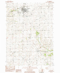
(6)- 1981 Map of Rockford
 1981 Rockford1981 Print · USGSNorthern Illinois during the early eighties shows a landscape shaped by river valleys and a maturing rail network. Genealogists can trace family roots through settlements like Morseville and Buckhorn Corners while exploring the Rock River valley.2 unique versions available
 - 1983 Map of Polo, 1984 Print
 1983 Polo1984 Print · USGSDuring the early 1980s, the rural townships of Ogle and Lee Counties maintained a steady landscape of family farms and small-town centers like Polo. Researchers can locate several burial grounds including Fairmont Cem and trace old country schools like Congress Sch.
 - 1983 Map of Grand Detour, 1984 Print
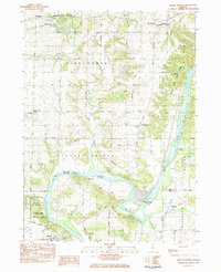 1983 Grand Detour1984 Print · USGSOgle and Lee County are captured in the early eighties as the Rock River winds through the historic horseshoe bend at Grand Detour. Genealogists and local historians can trace rural sites like Kingdom, the Pine Creek Cemetery, and the Townhall north of the river.
 - 1983 Map of Forreston South, 1984 Print
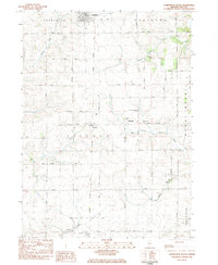 1983 Forreston South1984 Print · USGSOgle County's agricultural heartland is documented here in the early 1980s as rural life centered on crossroads like Haldane and the Illinois Central Gulf rail corridor. Researchers can locate local landmarks including the Church of the Brethren, West Branch Cem, and Goose Hollow.
 - 1983 Map of Mount Morris, 1984 Print
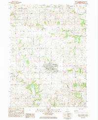 1983 Mount Morris1984 Print · USGSMount Morris and the surrounding Ogle County townships are captured here in the early 1980s as the regional agricultural and rail networks remained firmly established. Researchers can trace historic burial sites like Oak Wood Cem and Cedar Hill Cem or locate regional landmarks such as Nick Lung Airport.
 - 1985 Map of Dixon
 1985 Dixon1985 Print · USGSNorth-central Illinois in the mid-eighties was a land of river cities and expansive prairies defined by rail lines and private airfields. Researchers can locate family landmarks like Oakwood Cem, the Sword Landing Strip, and Sauk Valley College while tracing the C & N W railroad.2 unique versions available
End of results
Showing maps 1-6 of 6
Top cities near Pine Creek Township
- Dixon historical maps
- Sterling historical maps
- Rock Falls historical maps
- Oregon historical maps
- Byron historical maps
- Mount Morris historical maps
See more
Top neighborhoods of Pine Creek Township
Frequently asked questions
- What are the different types of historical maps available for Pine Creek Township?
- What is the oldest map of Pine Creek Township?
- Where can I purchase historical maps of Pine Creek Township for my home or office?
- Where can I download high-res historical maps of Pine Creek Township?
- Are there historical topographic maps available for Pine Creek Township?
- Is there historical aerial imagery available for Pine Creek Township?
- Where are historical maps of Pine Creek Township sourced from?