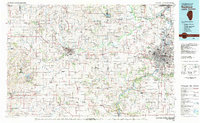
1981 Map of Rockford
USGS Topo · Published 1981About this map
The Rock River corridor anchors this 1981 snapshot of northern Illinois, where the industrial and transport hub of Rockford meets the rolling agricultural lands of Stephenson and Jo Daviess counties. The region is defined by a dense network of watercourses, including the Pecatonica River and Kishwaukee River, which supported the early development of towns like Freeport and Beloit. The map captures the transition from old river-town economies to modern infrastructure, highlighted by the prominence of the Greater Rockford Airport and the campus of Highland Community College.
Find a feature on this map
133 named features on this map. Tap any name to fly to it.
Don’t see what you’re looking for? This feature index may not catch every label — zoom into the map to look around manually.
Map Details
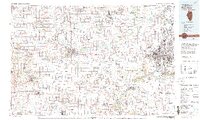
Editions of this 1981 Rockford Map
2 editions found
Other maps of this area

1891 · Clinton
USGS Topo · 1:62,500

1891 · Janesville
USGS Topo · 1:62,500

1892 · Savanna
USGS Topo · 1:62,500

1893 · Janesville
USGS Topo · 1:62,500

1893 · Brodhead
USGS Topo · 1:62,500

1893 · Shopiere
USGS Topo · 1:62,500

1894 · Clinton
USGS Topo · 1:62,500

1899 · Clinton
USGS Topo · 1:125,000

1902 · Mineral Point
USGS Topo · 1:125,000

1911 · Elizabeth
USGS Topo · 1:62,500