1990s Maps of Peoria County, Illinois
Explore 12 historic maps of Peoria County from the 1990s. These maps offer a rare glimpse into what life looked like during the 1990s — showing old roads, neighborhoods, homes, and landmarks that have changed or disappeared over time.
Whether you're researching your family's past, planning a metal detecting trip, or studying how Peoria County's landscape evolved across the 1990s, these high-resolution maps are a powerful tool for exploring the history of this region.
- Focus on a specific era: All maps on this page are from the 1990s, giving you a focused view of this time period.
- See what’s changed: Compare century-old streets, trails, and buildings to today's modern landscape using overlays and satellite layers.
- Research with precision: Use these maps for genealogy, historical research, land use analysis, or educational projects.
- View, download, or print: Maps are fully viewable online in high resolution, and can be downloaded or printed for your own records.
Start exploring Peoria County's history through authentic maps from the 1990s. This is your window into the past.
Peoria County, IL maps
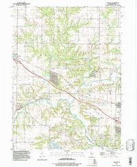
(12)- 1990 Map of Peoria
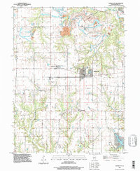
 1990 Peoria1990 Print · USGSCentral Illinois at the start of the nineties reveals a landscape of industrial river towns and sprawling university campuses. Researchers can trace the legacy of major institutions like Chanute Air Force Base and the University of Illinois alongside regional landmarks such as Sand Ridge State Forest.
 - 1995 Map of Germantown Hills, 1996 Print
 1995 Germantown Hills1996 Print · USGSWoodford County in the mid-nineties shows the distinct meeting point of expanding residential life and the river bluff terrain. Genealogists and local historians can trace family-named sites like Winkler Cem and Hickory Point Cem or the industrial footprint of the Old Grade Railroad.
 - 1996 Map of Glasford, 1997 Print
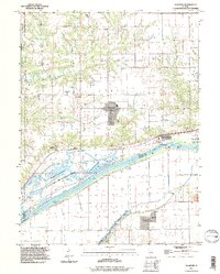 1996 Glasford1997 Print · USGSThe Peoria County bluffs and Illinois River bottomlands are captured here in the late nineties, showing a landscape of river industry and conservation. Trace local family roots at St Peters Ch, Union Cem, and the settlement of Lancaster.
 - 1996 Map of Spring Bay, 1997 Print
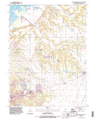
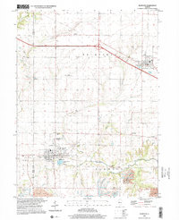
 1996 Spring Bay1997 Print · USGSThe Illinois River valley north of Peoria comes into focus in the mid-1990s, showing a mix of industrial riverfront and wooded bluffs. Researchers can trace local landmarks like Mt Hawley Auxiliary Airport, Robinson Cem, and the community of Mossville.
 - 1996 Map of Peoria East, 1997 Print
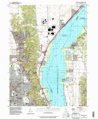
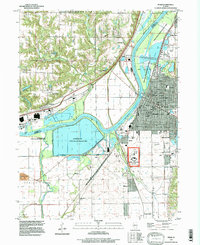
 1996 Peoria East1997 Print · USGSThe Illinois River valley in the late twentieth century reveals a bustling metropolitan hub where industry and education meet on the water. Researchers can trace family roots through Bradley University, find old burials at Mooberry Cem, or locate landmarks like Fort Creve Coeur State Park.
 - 1996 Map of Hanna City, 1997 Print
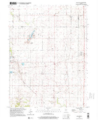
 1996 Hanna City1997 Print · USGSPeoria County's rural landscape is captured here in the mid-1990s as longstanding farming communities began to interface with newer residential developments. Local historians can trace established landmarks like Texas Ch, Logan Sch, and the community of Smithville.
 - 1996 Map of Pekin, 1997 Print
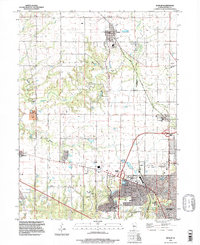
 1996 Pekin1997 Print · USGSThe industrial and riverfront corridor of Tazewell County is captured here in the late twentieth century. Genealogists and local historians can locate many community anchors, including Sacred Heart Cem, Orchard Mines, and the Federal Correction Center.
 - 1996 Map of Peoria West, 1997 Print
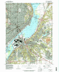
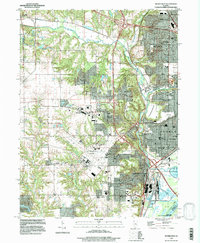 1996 Peoria West1997 Print · USGSGreater Peoria in the mid-1990s reveals a complex network of industrial rail, suburban expansion, and river infrastructure. Genealogists and local historians can trace family-named sites like Cameron Cem, schools such as Oak Grove West Sch, and the layout of Pottstown.
 - 1996 Map of Dunlap, 1997 Print
 1996 Dunlap1997 Print · USGSCentral Illinois farmland meets suburban growth in the late twentieth century near Peoria. Researchers can trace local history through family-named landmarks like Dickson Cem and the route of the Rock Island Trail State Park.
 - 1997 Map of Oak Hill
 1997 Oak Hill1997 Print · USGSPeoria County's rural character is captured here in the late 1990s, centered on the landmark Jubilee College State Historic Site. Researchers can trace local lineage through several burial grounds like St Pauls Cem and Oak Hill Cem or locate forgotten stops like Kramm and Olin.
 - 1998 Map of Elmwood, 2001 Print
 1998 Elmwood2001 Print · USGSPeoria County's agricultural and mining history is documented here in the late twentieth century. Researchers can trace family roots at St Marys Cemetery or locate the sprawling STRIP MINE operations and the quiet residential streets of Elmwood.
 - 1998 Map of Edelstein, 2001 Print
 1998 Edelstein2001 Print · USGSPeoria and Stark counties at the turn of the millennium show a landscape evolving from rail-based industry to modern trails. Genealogists can trace family names through several rural burial grounds like Streitmatter Cem and Lawn Ridge Cem, while the Old Rock Island State Trail marks the area's changing transportation legacy.
End of results
Showing maps 1-12 of 12
Top cities of Peoria County
- Peoria historical maps
- Bartonville historical maps
- Chillicothe historical maps
- West Peoria historical maps
- Kickapoo historical maps
- Elmwood historical maps
See more
Frequently asked questions
- What are the different types of historical maps available for Peoria County?
- What is the oldest map of Peoria County?
- Where can I purchase historical maps of Peoria County for my home or office?
- Where can I download high-res historical maps of Peoria County?
- Are there historical topographic maps available for Peoria County?
- Is there historical aerial imagery available for Peoria County?
- Where are historical maps of Peoria County sourced from?