2020s Maps of Peoria, Illinois
Explore 8 historic maps of Peoria from the 2020s. These maps offer a rare glimpse into what life looked like during the 2020s — showing old roads, neighborhoods, homes, and landmarks that have changed or disappeared over time.
Whether you're researching your family's past, planning a metal detecting trip, or studying how Peoria's landscape evolved across the 2020s, these high-resolution maps are a powerful tool for exploring the history of this region.
- Focus on a specific era: All maps on this page are from the 2020s, giving you a focused view of this time period.
- See what’s changed: Compare century-old streets, trails, and buildings to today's modern landscape using overlays and satellite layers.
- Research with precision: Use these maps for genealogy, historical research, land use analysis, or educational projects.
- View, download, or print: Maps are fully viewable online in high resolution, and can be downloaded or printed for your own records.
Start exploring Peoria's history through authentic maps from the 2020s. This is your window into the past.
Peoria, IL maps
(8)- 2021 Map of Peoria West, 2021 Print
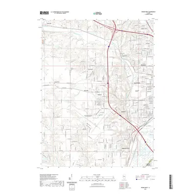 2021 Peoria West2021 Print · USGSCovers Peoria, including Bartonville, Creve Coeur, and other nearby areas
 - 2021 Map of Peoria East, 2021 Print
 2021 Peoria East2021 Print · USGSCovers Peoria, including East Peoria, Morton, and other nearby areas
 - 2021 Map of Dunlap, 2021 Print
 2021 Dunlap2021 Print · USGSCovers Peoria, including Dunlap, Alta, and other nearby areas
 - 2021 Map of Spring Bay, 2021 Print
 2021 Spring Bay2021 Print · USGSCovers Peoria, including Spring Bay, Long Shore Park, and other nearby areas
 - 2024 Map of Spring Bay, 2024 Print
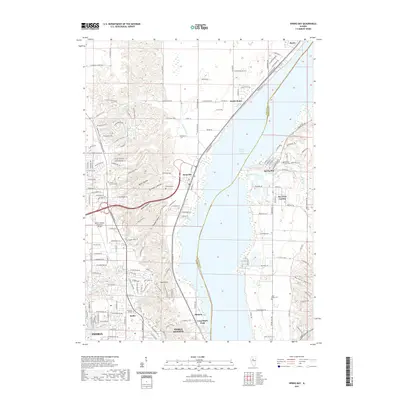
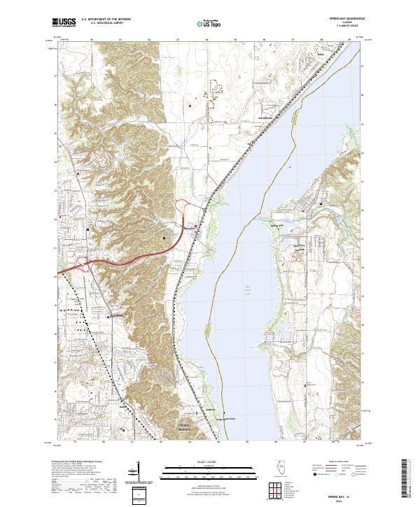 2024 Spring Bay2024 Print · USGSPeoria and its northern suburbs are captured in this recent survey as they line the banks of the Illinois River. Researchers can locate several burial grounds like Sand Ridge Cem and explore the residential growth around Mossville and South Rome.
 - 2024 Map of Peoria East, 2024 Print
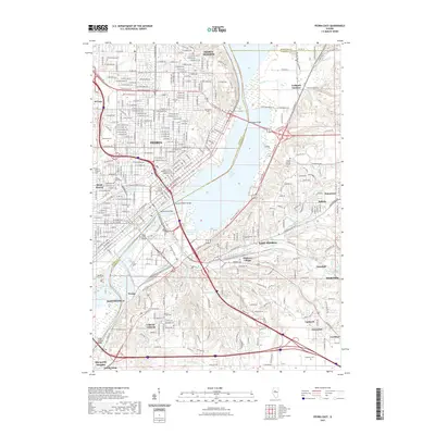
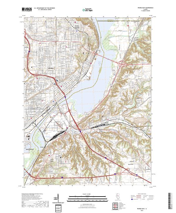 2024 Peoria East2024 Print · USGSGreater Peoria and the Illinois River valley are shown here in recent detail, tracing the modern industrial and residential landscape. You can locate family history at Springdale Cem, explore the campus of Bradley University, or trace the TP&W Railway through East Peoria.
 - 2024 Map of Peoria West, 2024 Print
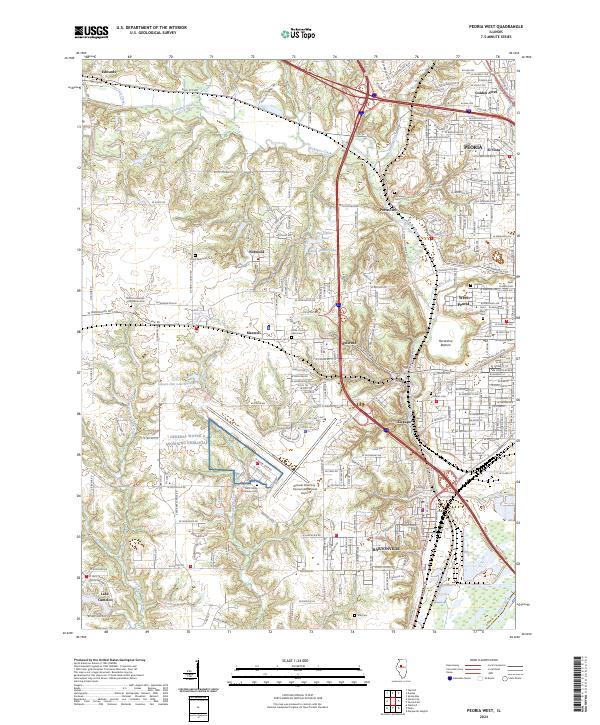 2024 Peoria West2024 Print · USGSPeoria and its western neighbors are mapped here at a time of significant suburban development and aviation activity. Local historians can trace numerous legacy burial grounds including Peoria County Farm Cem and Saint Johns Lutheran Cem, alongside landmarks like Lake Camelot.
 - 2024 Map of Dunlap, 2024 Print
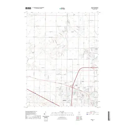
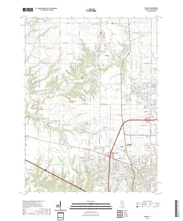 2024 Dunlap2024 Print · USGSPeoria County in the modern era shows a landscape where suburban growth meets traditional rural roads and wooded creek valleys. Genealogists and local historians can trace several local burial sites, including Saint Clements Cem and Koerner Cem, alongside the development of Alta and Orange Prairie.
End of results
Showing maps 1-8 of 8
Top cities near Peoria
- Pekin historical maps
- East Peoria historical maps
- Groveland historical maps
- Morton historical maps
- Washington historical maps
- Bartonville historical maps
See more
Top neighborhoods of Peoria
- Sankoty historical maps
- El Vista historical maps
- Keller historical maps
- Arbor District historical maps
- Roanoke-Randolph Street Historic District historical maps
- Armstrong-Ellis historical maps
See more
Frequently asked questions
- What are the different types of historical maps available for Peoria?
- What is the oldest map of Peoria?
- Where can I purchase historical maps of Peoria for my home or office?
- Where can I download high-res historical maps of Peoria?
- Are there historical topographic maps available for Peoria?
- Is there historical aerial imagery available for Peoria?
- Where are historical maps of Peoria sourced from?