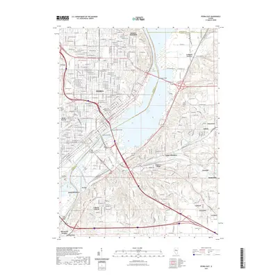
2021 Map of Peoria East
USGS Topo · Published 2021About this map
Upper Peoria Lake and the Illinois River bisect this detailed landscape, illustrating the industrial and urban density of central Illinois in the early 21st century. The complex riverfront infrastructure is anchored by the Cedar Street Bridge, Lohman Bridge, and the Murray M Baker Bridge, connecting the metropolitan centers of Peoria and East Peoria. This era shows a heavily modified environment, particularly evident in the Farm Creek Diversion Channel and the sprawling rail networks of the Burlington Northern Santa Fe RR and Norfolk Southern RR that navigate the river's edge.
Find a feature on this map
212 named features on this map. Tap any name to fly to it.
Don’t see what you’re looking for? This feature index may not catch every label — zoom into the map to look around manually.
Map Details
Editions of this 2021 Peoria East Map
This is the sole edition of this map. No revisions or reprints were ever made.
Other maps of this area

1893 · Metamora
USGS Topo · 1:62,500

1893 · Dunlap
USGS Topo · 1:62,500

1898 · Dunlap
USGS Topo · 1:62,500

1905 · Peoria
USGS Topo · 1:62,500

1927 · Peoria
USGS Topo · 1:62,500

1928 · Mackinaw
USGS Topo · 1:62,500

1932 · Mackinaw
USGS Topo · 1:62,500

1932 · Dunlap
USGS Topo · 1:62,500

1933 · Dunlap
USGS Topo · 1:62,500

1937 · Metamora
USGS Topo · 1:62,500