Old Maps of Richland County, Illinois
Explore 88 old maps of Richland County, spanning from 1910 to today. These high-resolution historic maps reveal how streets, neighborhoods, landmarks, and natural features evolved over time — perfect for genealogy, metal detecting, research, and local history exploration.
What you can do with these maps:
- See how Richland County changed over time: Compare historical maps to modern-day views to trace roads, homesites, rail lines & more.
- View detailed metadata: Each map includes creators, publishers, year, scale, and archive source.
- Overlay maps with satellite & LiDAR: Visualize the past alongside modern tools to explore terrain & human change.
- Trusted historical sources: Maps sourced from the USGS, Library of Congress, and other archives.
- Access maps your way: View online, download high-res files, or order prints for personal or research use.
Start exploring old maps of Richland County to uncover forgotten places, hidden landmarks, and the deep history beneath your feet.
Richland County, IL maps
(88)- 1910 Map of Hardinville
 1910 Hardinville1910 Print · USGSSoutheastern Illinois at the start of the century reveals a landscape defined by the Embarrass River and early oil exploration. Genealogists can trace family roots through numerous local landmarks like Oil Center, Lucky Ford Ferry, and the Mann School.2 unique versions available
 - 1911 Map of Sumner, 1954 Print
 1911 Sumner1954 Print · USGSSoutheast Illinois at the dawn of the twentieth century was a landscape of bustling rail towns and ubiquitous country schools. Genealogists can locate family-named landmarks and long-lost rural centers like Berryville, the Oil Tanks of Bridgeport, and Frogeye School.
 - 1913 Map of Sumner
 1913 Sumner1913 Print · USGSThe rural landscape of Lawrence and Richland counties is captured here just before the First World War, centered on the BALTIMORE AND OHIO SOUTHWESTERN rail line. Genealogists can locate numerous rural schools like Frogeye School and Buckhorn School or trace the early Oil Tanks near Bridgeport.2 unique versions available
 - 1941 Map of Newton, 1972 Print
 1941 Newton1972 Print · USGSJasper and Richland counties appear here during the early 1940s, showing a landscape of river-valley farms and small rail towns. Genealogists can trace family footprints through dozens of rural landmarks like Onion Prairie Sch, Bethel Cem, and Willow Hill.
 - 1943 Map of Newton
 1943 Newton1943 Print · USGSJasper and Richland counties are captured here in the early 1940s, showing a landscape defined by the Embarrass River and the Illinois Central railroad. Genealogists can locate dozens of country schools and churches, from Brush College Sch to Shiloh Ch.2 unique versions available
 - 1948 Map of Flora, 1963 Print
 1948 Flora1963 Print · USGSClay and Wayne counties are shown at their mid-century peak of rural development, centered on the BALTIMORE AND OHIO RR corridor. Local historians can trace dozens of vanished schoolhouses and country churches, from West Seminary Sch to the South Freedom Ch.
 - 1949 Map of Olney
 1949 Olney1949 Print · USGSSoutheastern Illinois in the late 1940s is a landscape of thriving rail hubs and scattered oil wells. Genealogists can locate family names and rural landmarks like Sodom Sch, Shields Cem, and the Baltimore and Ohio RR corridor.2 unique versions available
 - 1949 Map of Flora
 1949 Flora1949 Print · USGSSouthern Illinois during the late 1940s was a landscape defined by the winding Little Wabash River and the busy Baltimore and Ohio RR. Researchers can trace the cultural roots of the region through dozens of local landmarks like Lathrop Chapel, Long Prairie Sch, and Oil Wells near Cisne.2 unique versions available
 - 1953 Map of Sailor Springs, 1955 Print
 1953 Sailor Springs1955 Print · USGSSoutheast Illinois farmland at the start of the fifties reveals a landscape of tight-knit rural precincts and family homesteads. Genealogists can trace family names through dozens of landmarks like Shouse Chapel, Bethsaida Cem, and the Little Grove Sch.2 unique versions available
 - 1956 Map of Vincennes, 1967 Print
 1956 Vincennes1967 Print · USGSSouthern Indiana and the Illinois borderlands are captured here in the mid-fifties, showing the region's dense network of river towns and rail lines. Researchers can trace historic river crossings along the Wabash River or locate landmarks like Wyandotte Cave and Lincoln State Park.4 unique versions available
 - 1957 Map of Vincennes
 1957 Vincennes1957 Print · USGSSouthwest Indiana and the Illinois borderlands come alive in the late 1950s, a period of heavy rail traffic and expanding state forests. Genealogists and historians can trace the riverfronts and rail lines of Vincennes, New Harmony, and the vast Crane Naval Ammunition Depot.
 - 1958 Map of Vincennes
 1958 Vincennes1958 Print · USGSSouthern Indiana and the Illinois borderlands are captured during a mid-century period of heavy rail traffic and military activity. Researchers can trace the sprawling bounds of the Crane Naval Ammunition Depot or locate historic settlements like New Harmony and French Lick.2 unique versions available
 - 1958 Map of Belleville, 1973 Print
 1958 Belleville1973 Print · USGSSouthern Illinois during the mid-twentieth century reveals a landscape of industrial growth and massive new reservoirs. Genealogists and historians can trace the paths of the Illinois Central RR through towns like Centralia or locate landmarks such as Emerald Mound and the Looking Glass Prairie.3 unique versions available
 - 1962 Map of Belleville
 1962 Belleville1962 Print · USGSSouthern Illinois in the late fifties reveals a landscape of industrial growth and ancient landmarks before the full expansion of the interstate system. Genealogists can trace family names and rural post offices near Centralia, Salem, and the historic Monks Mound.
 - 1968 Map of Berryville, 1969 Print
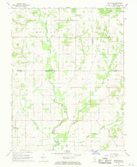 1968 Berryville1969 Print · USGSSoutheast Illinois at the end of the sixties reveals a rural landscape where county lines meet along the Old Indian Treaty Boundary. Genealogists can locate several family landmarks and burial sites like Welser Cem, Pinhook Cem, and Pleasant Grove Ch.
 - 1968 Map of Landes, 1970 Print
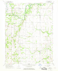 1968 Landes1970 Print · USGSRichland and Jasper counties in the late sixties remain a patchwork of small townships and rural parishes. Family historians can trace local roots through numerous country landmarks like South Bend Cem, St Joseph Sch, and the Amity settlement.
 - 1968 Map of Claremont, 1970 Print
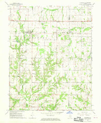 1968 Claremont1970 Print · USGSRichland and Lawrence counties appear here in the late sixties, centered on the railroad town of Claremont. Researchers can trace old family burial sites like Dutch Flat Cem and Brian Cem or locate rural landmarks like Otterbein Ch.
 - 1970 Map of Clay City, 1971 Print
 1970 Clay City1971 Print · USGSClay County at the dawn of the seventies is defined here by the intersection of river transport and petroleum industry. Genealogists can trace family landmarks like Hanna Cem and South Freedom Ch alongside the busy Baltimore and Ohio rail line.2 unique versions available
 - 1970 Map of Enterprise, 1971 Print
 1970 Enterprise1971 Print · USGSWayne and Clay counties are shown here in the 1970s, a period when the local economy was shaped by the Clay City Oil Field and river bottom farming. Researchers can locate numerous family burial sites and rural landmarks like Enterprise, Laird Cem, and Patterson Ch.
 - 1971 Map of Mount Erie, 1973 Print
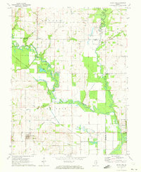 1971 Mount Erie1973 Print · USGSWayne County settlement centers on the high ground near Mount Erie in the early 1970s, while the Little Wabash River meanders through the bottomlands. Researchers can trace rural lineages through numerous local sites like Wynoose Cem, Forest Ridge Ch, and the crossroads at Bennington.2 unique versions available
 - 1971 Map of West Salem, 1973 Print
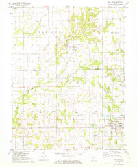 1971 West Salem1973 Print · USGSSoutheastern Illinois reveals its rural character and energy history in the early seventies as the Edwards and Richland County line meets. Genealogists and historians can trace numerous family burial sites and country churches, including Bethel Cemetery, Marion Church, and the Moravian Cemetery.
 - 1971 Map of Olney, 1973 Print
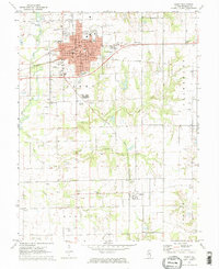 1971 Olney1973 Print · USGSRichland County at the start of the 1970s reveals a landscape shaped by the rail junction at Olney and active petroleum extraction. Genealogists and historians can trace family plots at Haven Hill Cem, locate the Richland Sch, or follow the Illinois Central line to Calhoun.2 unique versions available
 - 1971 Map of Noble, 1973 Print
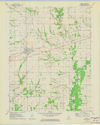 1971 Noble1973 Print · USGSRichland County at the start of the 1970s is a landscape of rural crossroads and active energy extraction. Genealogists and historians can trace family locations near Noble using landmarks like Decker Cem, Antioch Ch, and the Noble Oil Field.2 unique versions available
 - 1985 Map of Sailor Springs
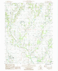 1985 Sailor Springs1985 Print · USGSThe rural borderlands of Clay and Jasper counties are captured here in the mid-1980s, centered on the village of Sailor Springs. Genealogists and local historians can trace the creek-side settlements of Ingraham and Wendelin or locate family plots near Big Muddy Creek.
 - 1985 Map of Dundas
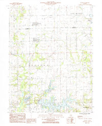 1985 Dundas1985 Print · USGSThe borderlands of Jasper and Richland counties in the mid-1980s show a landscape of quiet rural settlements and expanding reservoirs. Researchers can trace family sites near West Liberty, Dundas, and Rafetown, or locate old burials at several Cem locations near Olney Lake.
Showing maps 1-25 of 88
Top cities of Richland County
- Olney historical maps
- Noble historical maps
- Parkersburg historical maps
- Calhoun historical maps
- Claremont historical maps
Frequently asked questions
- What are the different types of historical maps available for Richland County?
- What is the oldest map of Richland County?
- Where can I purchase historical maps of Richland County for my home or office?
- Where can I download high-res historical maps of Richland County?
- Are there historical topographic maps available for Richland County?
- Is there historical aerial imagery available for Richland County?
- Where are historical maps of Richland County sourced from?