1980s Maps of Sangamon County, Illinois
Explore 12 historic maps of Sangamon County from the 1980s. These maps offer a rare glimpse into what life looked like during the 1980s — showing old roads, neighborhoods, homes, and landmarks that have changed or disappeared over time.
Whether you're researching your family's past, planning a metal detecting trip, or studying how Sangamon County's landscape evolved across the 1980s, these high-resolution maps are a powerful tool for exploring the history of this region.
- Focus on a specific era: All maps on this page are from the 1980s, giving you a focused view of this time period.
- See what’s changed: Compare century-old streets, trails, and buildings to today's modern landscape using overlays and satellite layers.
- Research with precision: Use these maps for genealogy, historical research, land use analysis, or educational projects.
- View, download, or print: Maps are fully viewable online in high resolution, and can be downloaded or printed for your own records.
Start exploring Sangamon County's history through authentic maps from the 1980s. This is your window into the past.
Sangamon County, IL maps
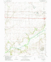
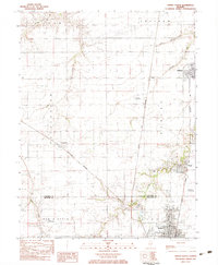
(12)- 1981 Map of Loami, 1982 Print
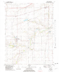 1981 Loami1982 Print · USGSSangamon County’s rural townships are documented here in the early eighties as a network of rail-side hamlets and family cemeteries. Trace the historical footprints of Loami and Curran, or locate heritage sites like Sulphur Springs Cem and Shelton Cem.
 - 1982 Map of Mechanicsburg, 1983 Print
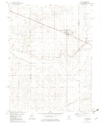
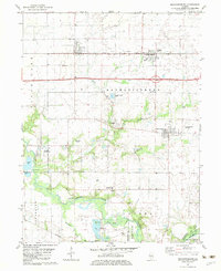 1982 Mechanicsburg1983 Print · USGSMechanicsburg and the surrounding Sangamon County prairie are shown in the early 1980s as a landscape of productive farms and active oil extraction. Genealogists and local historians can locate Mechanicsburg Cem, the ILLINOIS TERMINAL AND WESTERN rail line, and the Mechanicsburg Oil Field.
 - 1982 Map of Lake Fork, 1983 Print
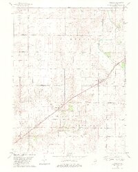
 1982 Lake Fork1983 Print · USGSAgricultural Logan County is captured here in the early eighties, defined by the drainage of the namesake Lake Fork and the rail line. Genealogists can locate family sites at Steenbergen Cem, Bell Cem, and the rural Copeland Ch.
 - 1982 Map of Niantic, 1983 Print
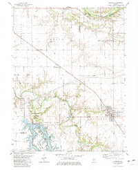
 1982 Niantic1983 Print · USGSNiantic and Illiopolis sit at the heart of this early 1980s landscape, where the Sangamon River valley meets a bustling rail corridor. Researchers can locate generational sites like Hunter Cem, Long Point Ch, and the rural outpost of Osbernville.
 - 1982 Map of Mount Auburn, 1983 Print
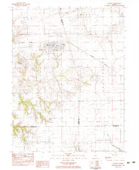
 1982 Mount Auburn1983 Print · USGSAgricultural and industrial life meet along the Sangamon River during the early eighties. Genealogists and local historians can trace family plots at Riverside Cem or study the rail operations of the Norfolk and Western and Baltimore and Ohio.
 - 1982 Map of Latham, 1983 Print
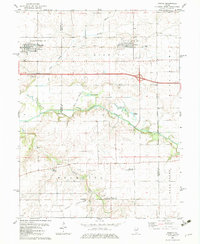
 1982 Latham1983 Print · USGSThe village of Latham and the rail corridors of Central Illinois are captured here in the early eighties. Genealogists can locate family sites at Lake Bank Cem and Twomile Grove Cem or trace the path of the Illinois Central Gulf railroad.
 - 1982 Map of Cornland, 1983 Print
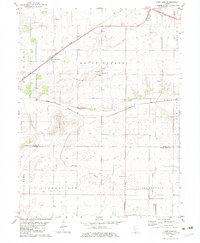
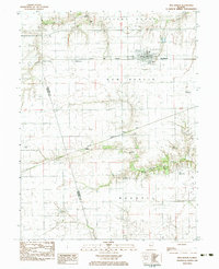
 1982 Cornland1983 Print · USGSThe Logan and Sangamon county line comes alive in the early eighties as a hub of prairie agriculture and rail transit. Genealogists and local historians can locate several family burial sites like Turley Cem and Cass Cem, or trace the tracks of the Illinois Central Gulf through Cornland.2 unique versions available
 - 1982 Map of Edinburg, 1983 Print
 1982 Edinburg1983 Print · USGSChristian and Sangamon counties in the early eighties show a landscape where recreation at Sangchris Lake State Park meets active energy production. Researchers can trace family history through sites like Oak Hill Cem and the diagonal route of the Baltimore and Ohio railroad.
 - 1983 Map of Virden North
 1983 Virden North1983 Print · USGSMidwestern prairie life is captured here in the early eighties as the rail lines through Auburn and Virden shaped local commerce. Genealogists and historians can trace family plots at Virden Cem or locate industrial sites like the Mine Shaft near Thayer.
 - 1983 Map of New Berlin
 1983 New Berlin1983 Print · USGSThe Illinois prairie around New Berlin is captured here in the early eighties, showing a landscape defined by grain transport and rural townships. Genealogists can locate family sites at St Marys Cem and Luken Cem or trace the old rail stops at Prouty and Huffaker.
 - 1983 Map of Waverly
 1983 Waverly1983 Print · USGSWaverly and its surrounding townships are captured in the early 1980s as the rail-line economy of the Burlington Northern met growing utility infrastructure. Genealogists can locate several family and parish burial sites, such as St Sebastians Cem, Rogers Cem, and Conlee Cem.
 - 1985 Map of Springfield
 1985 Springfield1985 Print · USGSCentral Illinois during the mid-eighties shows a landscape of growing state capital influence and deep historical roots. Genealogists and historians can trace family sites near Oak Ridge Cem or follow the path of the Sangamon River past Williamsville and Riverton.2 unique versions available
End of results
Showing maps 1-12 of 12
Top cities of Sangamon County
- Springfield historical maps
- Woodside historical maps
- Chatham historical maps
- Auburn historical maps
- Sherman historical maps
- Riverton historical maps
See more
Frequently asked questions
- What are the different types of historical maps available for Sangamon County?
- What is the oldest map of Sangamon County?
- Where can I purchase historical maps of Sangamon County for my home or office?
- Where can I download high-res historical maps of Sangamon County?
- Are there historical topographic maps available for Sangamon County?
- Is there historical aerial imagery available for Sangamon County?
- Where are historical maps of Sangamon County sourced from?