1900s (20th Century) Maps of Sangamon County, Illinois
Explore 48 historic maps of Sangamon County from the 1900s (20th Century). These maps offer a rare glimpse into what life looked like during the 1900s — showing old roads, neighborhoods, homes, and landmarks that have changed or disappeared over time.
Whether you're researching your family's past, planning a metal detecting trip, or studying how Sangamon County's landscape evolved across the 1900s, these high-resolution maps are a powerful tool for exploring the history of this region.
- Focus on a specific era: All maps on this page are from the 1900s, giving you a focused view of this time period.
- See what’s changed: Compare century-old streets, trails, and buildings to today's modern landscape using overlays and satellite layers.
- Research with precision: Use these maps for genealogy, historical research, land use analysis, or educational projects.
- View, download, or print: Maps are fully viewable online in high resolution, and can be downloaded or printed for your own records.
Start exploring Sangamon County's history through authentic maps from the 1900s. This is your window into the past.
Sangamon County, IL maps
(48)- 1907 Map of Springfield
 1907 Springfield1907 Print · USGSSpringfield and the Sangamon River valley are captured here in the early twentieth century as the region thrived on coal, rail, and state government. Researchers can locate ancestral sites at Camp Lincoln, Calvary Cemetery, and the State Fair Grounds.2 unique versions available
 - 1909 Map of Tallula
 1909 Tallula1909 Print · USGSCentral Illinois at the turn of the century shows a landscape defined by the Sangamon River and a dense rail network. Researchers can trace the early footprints of Pleasant Plains, Tallula, and Berlin, as well as several smaller stops along the Chicago and Alton RR.3 unique versions available
 - 1922 Map of Divernon, 1957 Print
 1922 Divernon1957 Print · USGSThe Sangamon County prairie in the early twenties was a landscape of bustling rail towns and one-room schoolhouses. Genealogists can trace family roots through dozens of local landmarks like Cotton Hill Academy, Stout Church, and the Illinois Traction System.
 - 1923 Map of Taylorville, 1961 Print
 1923 Taylorville1961 Print · USGSChristian County's rail-and-river landscape comes alive in the early twenties, showing the region's dense network of rural school districts and coal-country towns. Trace family roots at Brush College, Good Hope Church, or the mining-related tracks of the Chicago and Illinois Midland.2 unique versions available
 - 1924 Map of Divernon
 1924 Divernon1924 Print · USGSSangamon County at the height of its rail-and-river era shows a landscape where agriculture and industry met along the South Fork Sangamon River. Researchers can trace the roots of vanished rural life through dozens of local landmarks like the Cotton Hill Academy, Zenobia, and Irwins Park.2 unique versions available
 - 1924 Map of Waverly
 1924 Waverly1924 Print · USGSCentral Illinois at the height of the rail era shows a landscape dotted with country schoolhouses and bustling farming hubs. Trace the path of the Illinois Traction and locate family sites near Mound Seminary School or McClain Church.2 unique versions available
 - 1925 Map of Taylorville
 1925 Taylorville1925 Print · USGSTaylorville and its surrounding coal-and-corn country are captured here in the mid-twenties. Genealogists can trace family roots through dozens of rural landmarks like Brush College, the rail stop at Humphrey Sta, and the mining communities of Jeisyville and Bulpitt.2 unique versions available
 - 1926 Map of Waverly
 1926 Waverly1926 Print · USGSIn the mid-1920s, this portion of central Illinois was a bustling intersection of steam railroads and electric interurbans. Genealogists can trace the rural communities of Waverly, New Berlin, and Loami, alongside dozens of local landmarks like Rohrer Church and the Highwater Mark School.2 unique versions available
 - 1930 Map of Springfield
 1930 Springfield1930 Print · USGSSpringfield and its surrounding farming townships are seen here in the late twenties, captured as a vital crossroads of rail and road. Genealogists can locate family-named landmarks like Derry Farm and over two dozen country schools, including Crankneck Sch and American Hill Sch.3 unique versions available
 - 1940 Map of Tallula, 1956 Print
 1940 Tallula1956 Print · USGSCentral Illinois during the late thirties and early forties reveals a landscape of river-bluff history and active rail towns. Genealogists can trace family connections in Tallula, Salisbury, and Berlin, or locate the historic New Salem State Park.2 unique versions available
 - 1940 Map of Springfield, 1959 Print
 1940 Springfield1959 Print · USGSSpringfield and its surrounding townships appear here as a bustling pre-war rail and aviation center. Researchers can trace family roots through numerous rural schools like Locate Lane Sch or historical sites like Lindbergh Air Mail Field and Camp Butler Cem.2 unique versions available
 - 1950 Map of Springfield West
 1950 Springfield West1950 Print · USGSPost-war Springfield exhibits a complex network of railroads and civic institutions at the midpoint of the century. Trace family roots at Oak Ridge Cem or locate historic landmarks like the Lincoln Tomb and State Capitol.
 - 1950 Map of Springfield East
 1950 Springfield East1950 Print · USGSEast of the Illinois capital in the mid-twentieth century, a complex rail and river network shaped the landscape. Genealogists can trace family names through rural landmarks like St James Sch, Taylor Cem, and the U S Naval Training Sta.
 - 1954 Map of Niantic, 1955 Print
 1954 Niantic1955 Print · USGSMid-century Macon County is defined here by its bustling rail corridors and the winding Sangamon River. Researchers can trace old family names at Lake Bank Cem or locate forgotten stops like Wyckles Corners and Bulldog Crossing.3 unique versions available
 - 1954 Map of Mechanicsburg, 1955 Print
 1954 Mechanicsburg1955 Print · USGSSangamon and Logan counties are shown here during the mid-fifties as the railroad era began to give way to modern highways. Genealogists can trace family names at Pickrell Cem and Steenbergen Cem or locate the North Side Sch (Abandoned).2 unique versions available
 - 1958 Map of Decatur, 1971 Print
 1958 Decatur1971 Print · USGSCentral Illinois in the mid-twentieth century shows a landscape defined by industrial rail hubs and the creation of large reservoirs. Researchers can trace historic corridors like the Penn Central or locate landmarks such as Lincoln Log Cabin State Park and Lake Springfield.3 unique versions available
 - 1961 Map of New City
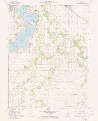 1961 New City1961 Print · USGSSangamon County at the start of the 1960s reveals a landscape balancing suburban growth near Southlawn with the rural traditions of Cotton Hill. Researchers can locate historic family sites like Brunk Cem, the village of New City, and the Baltimore and Ohio rail line.3 unique versions available
 - 1961 Map of Decatur
 1961 Decatur1961 Print · USGSCentral Illinois in the late fifties was a bustling corridor of rail lines and prairie commerce centered on the state capital. Genealogists and historians can trace the intricate connections between Springfield, Decatur, and dozens of smaller settlements like Nokomis and Arcola.2 unique versions available
 - 1961 Map of Chatham, 1962 Print
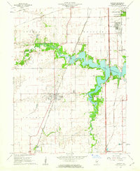 1961 Chatham1962 Print · USGSIn the early sixties, the area south of Springfield was a network of emerging suburbs and vital rail corridors centered around Chatham. Genealogists and historians can trace family landmarks like Stout Cem, local education at Glenwood Sch, and a rare Covered Bridge over Sugar Creek.3 unique versions available
 - 1964 Map of Pawnee, 1966 Print
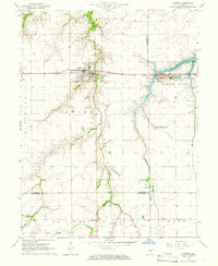 1964 Pawnee1966 Print · USGSPawnee and the surrounding Illinois prairie are captured here in the mid-1960s, showing a landscape defined by the Chicago and Illinois Midland rail line. Researchers can trace the industrial footprint of the Claypit and Mine, or locate rural landmarks like Zenobia Ch and Horse Creek Cem.4 unique versions available
 - 1965 Map of Divernon, 1966 Print
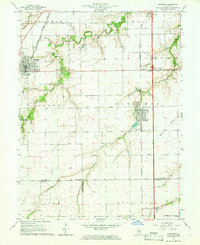 1965 Divernon1966 Print · USGSCentral Illinois prairie life and rail transport thrive in this mid-sixties survey of Sangamon County. Genealogists and historians can trace family ties at Wimmer Cem or locate the rural junctions of Cimic and Pawnee Junction along the rail lines.3 unique versions available
 - 1965 Map of Springfield West, 1966 Print
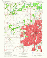 1965 Springfield West1966 Print · USGSMid-century Springfield is shown here as a bustling state capital and rail center during a period of significant suburban expansion. Researchers can pinpoint Lincolns Tomb, trace the many rail lines like the Illinois Terminal, and find dozens of local landmarks from the Illini Country Club to Oak Ridge Cemetery.3 unique versions available
 - 1965 Map of Springfield East, 1966 Print
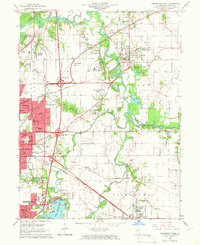 1965 Springfield East1966 Print · USGSThe eastern edges of Springfield and the Sangamon River valley are captured here in the mid-1960s during a period of infrastructure growth. Genealogists and local historians can trace family locations at Camp Butler Cem, find the rural Bissell Cem, or locate the historic St Johns Sanitarium.4 unique versions available
 - 1966 Map of Athens, 1967 Print
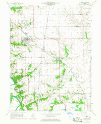 1966 Athens1967 Print · USGSNorth of Springfield in the mid-1960s, this area shows the rail junctions of Athens and Cantrall during a period of steady rural growth. Researchers can trace family history at Brittin Cem or locate the former Barr Station and the Sangamon River oxbows.3 unique versions available
 - 1966 Map of Williamsville, 1967 Print
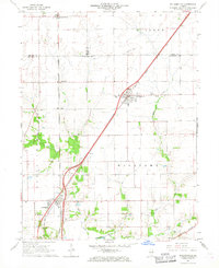 1966 Williamsville1967 Print · USGSCentral Illinois farmland in the mid-sixties shows a landscape defined by rail corridors and creek bottoms. Trace family sites near Williamsville and Sherman, including several old burial grounds like Wolf Creek Cem and Stewart Cem.3 unique versions available
Showing maps 1-25 of 48
Top cities of Sangamon County
- Springfield historical maps
- Woodside historical maps
- Chatham historical maps
- Auburn historical maps
- Sherman historical maps
- Riverton historical maps
See more
Frequently asked questions
- What are the different types of historical maps available for Sangamon County?
- What is the oldest map of Sangamon County?
- Where can I purchase historical maps of Sangamon County for my home or office?
- Where can I download high-res historical maps of Sangamon County?
- Are there historical topographic maps available for Sangamon County?
- Is there historical aerial imagery available for Sangamon County?
- Where are historical maps of Sangamon County sourced from?