1990s Maps of Sangamon County, Illinois
Explore 6 historic maps of Sangamon County from the 1990s. These maps offer a rare glimpse into what life looked like during the 1990s — showing old roads, neighborhoods, homes, and landmarks that have changed or disappeared over time.
Whether you're researching your family's past, planning a metal detecting trip, or studying how Sangamon County's landscape evolved across the 1990s, these high-resolution maps are a powerful tool for exploring the history of this region.
- Focus on a specific era: All maps on this page are from the 1990s, giving you a focused view of this time period.
- See what’s changed: Compare century-old streets, trails, and buildings to today's modern landscape using overlays and satellite layers.
- Research with precision: Use these maps for genealogy, historical research, land use analysis, or educational projects.
- View, download, or print: Maps are fully viewable online in high resolution, and can be downloaded or printed for your own records.
Start exploring Sangamon County's history through authentic maps from the 1990s. This is your window into the past.
Sangamon County, IL maps
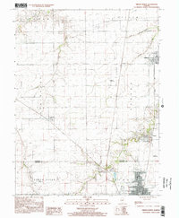
(6)- 1998 Map of Chatham, 2000 Print
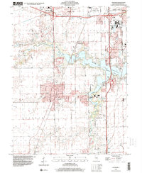 1998 Chatham2000 Print · USGSSangamon County near the end of the century shows a blend of suburban growth and lakeside recreation. Researchers can trace local landmarks like St Bernard Cem, the Covered Bridge on Sugar Creek, and the National Guard Depot.
 - 1998 Map of Springfield East, 2000 Print
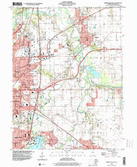 1998 Springfield East2000 Print · USGSThe eastern edges of the Illinois capital were well-established by the late nineties, balancing industry with expansive public parks. Genealogists and historians can trace the grounds of Camp Butler Cem, the St Johns Sanitarium, and the rail lines of the Illinois Central RR.
 - 1998 Map of New City, 2000 Print
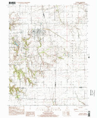
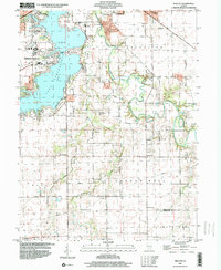 1998 New City2000 Print · USGSCentral Illinois during the late nineties shows a landscape of suburban growth and traditional farming. Genealogists can trace family names at Mottarville Cem or locate the rural crossroads of New City and Beamington near the Sangamon River.
 - 1998 Map of Springfield West, 2000 Print
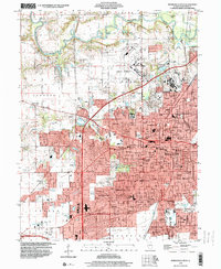 1998 Springfield West2000 Print · USGSSpringfield and its surrounding suburbs are shown in extensive detail during the late nineties as the capital city’s footprint expanded. Genealogists and historians can locate burials at Oak Ridge Cemetery, trace the Illinois Central RR, and explore the layout of Camp Lincoln.
 - 1998 Map of Virden North, 2002 Print
 1998 Virden North2002 Print · USGSThe Sangamon and Macoupin county border area is captured here in the late 1990s, showcasing the persistent layout of historic mining and farming towns. Genealogists and local historians can trace family locations near Lowder, the West Cemetery, and the coal-era Abandoned Railroad corridor.
 - 1998 Map of Waverly, 2002 Print
 1998 Waverly2002 Print · USGSWaverly and the surrounding Illinois prairie are captured here in the late nineties as a blend of agricultural tradition and modern utility infrastructure. Genealogists and local historians can pinpoint numerous rural burial sites like Conlee Cem and Pollam Cem or trace the extensive Underground Gas Storage Field.
End of results
Showing maps 1-6 of 6
Top cities of Sangamon County
- Springfield historical maps
- Woodside historical maps
- Chatham historical maps
- Auburn historical maps
- Sherman historical maps
- Riverton historical maps
See more
Frequently asked questions
- What are the different types of historical maps available for Sangamon County?
- What is the oldest map of Sangamon County?
- Where can I purchase historical maps of Sangamon County for my home or office?
- Where can I download high-res historical maps of Sangamon County?
- Are there historical topographic maps available for Sangamon County?
- Is there historical aerial imagery available for Sangamon County?
- Where are historical maps of Sangamon County sourced from?