Old Maps of Shelby County, Illinois for Genealogy
Trace your family roots with 220 historic maps of Shelby County. These high-res maps reveal old neighborhoods, homesites, landmarks, and streets — helping you uncover where your ancestors lived and how the area evolved over time.
- Explore historic neighborhoods: Identify where your relatives may have lived in the 1800s or 1900s.
- Compare maps over time: Trace the changes in streets, buildings, and landmarks for multi-generational research.
- Perfect for genealogy & ancestry research: Used by family historians and researchers to map out lineage and migration.
These maps are an incredible resource for exploring your personal connection to Shelby County's past.
Shelby County, IL maps
(220)- 1934 Map of Mattoon, 1967 Print
 1934 Mattoon1967 Print · USGSThe rail hubs and rural townships of East Central Illinois are captured here in the mid-1930s. Genealogists and local historians can trace the foundations of Mattoon and Neoga while locating family landmarks like Old Bethel Ch or the Little Brick Sch.2 unique versions available
 - 1935 Map of Sullivan
 1935 Sullivan1935 Print · USGSMid-depression Moultrie County is captured here as a thriving network of small school districts and railroad sidings. Genealogists can trace family roots through dozens of local landmarks like Stringtown Sch, the Masonic Home, and Campfield Cem.3 unique versions available
 - 1937 Map of Mattoon
 1937 Mattoon1937 Print · USGSThe rail hubs of Mattoon and Neoga are shown in the late 1930s, surrounded by a dense network of country schools and family cemeteries. Trace ancestral roots at Aetna Etna PO, Johnstown, or the many rural schoolhouses like South Loxa Sch.3 unique versions available
 - 1940 Map of Sullivan
 1940 Sullivan1940 Print · USGSCentral Illinois is seen here just before the Second World War, showing a landscape defined by small townships and an extensive rail network. Genealogists and local researchers can locate dozens of country schools like Hewitt Sch and Titus Sch, or trace family sites such as Wright Cem and the Masonic Home.2 unique versions available
 - 1941 Map of St. Elmo, 1958 Print
 1941 St. Elmo1958 Print · USGSThe Illinois counties of Fayette, Shelby, and Effingham are mapped here in the early 1940s at the height of their rail-and-refinery era. Genealogists and historians can trace numerous country schools like Martin Box Sch and churches like Crums Chapel near the Carter Refinery.2 unique versions available
 - 1942 Map of Shelbyville, 1958 Print
 1942 Shelbyville1958 Print · USGSShelby County at the start of the 1940s reveals a landscape defined by the winding Kaskaskia River and its many bridge crossings. Researchers can trace family history through dozens of rural landmarks like Williamsburg Hill, Glenwood Cem, and Sandy Hill Sch.2 unique versions available
 - 1944 Map of Ramsey, 1976 Print
 1944 Ramsey1976 Print · USGSFayette County communities like Ramsey and Bingham thrive along the intersection of the Illinois Central and other major rail lines during the 1940s. Genealogists can trace family roots through numerous rural landmarks like Bayle City P O, Halford Chapel, and Hoffman Cem.
 - 1945 Map of St. Elmo
 1945 St. Elmo1945 Print · USGSFayette and Effingham counties are seen here in the 1940s at a peak of rail and river industry. Genealogists and historians can trace family locations near Saint Elmo, locate the Carter Refinery, or find rural landmarks like Crums Chapel and Meyers Cem.2 unique versions available
 - 1946 Map of Shelbyville
 1946 Shelbyville1946 Print · USGSMid-century Shelby County centers on the rail-and-river hub of Shelbyville during an era of thriving rural townships. Genealogists can trace hundreds of family sites, from the County Poor Farm to Ragweed Sch and Gallagher Chapel Cem.2 unique versions available
 - 1946 Map of Ramsey
 1946 Ramsey1946 Print · USGSCentral Illinois rail-and-river life thrives mid-century as the Kaskaskia River winds past a dense network of country schoolhouses. Genealogists and local historians can trace family roots at Shed Cem, Bayle City P O, and the Illinois State Penal Farm.2 unique versions available
 - 1947 Map of Pana
 1947 Pana1947 Print · USGSRailroad lines from three major carriers converge at Pana in the mid-1940s, serving a productive agricultural landscape across three counties. Researchers can locate dozens of country schools and churches, including Swamp Angel School, Sacred Heart Cem, and Owaneco.
 - 1947 Map of Stewardson, 1965 Print
 1947 Stewardson1965 Print · USGSMid-century Shelby County is mapped here as a thriving agricultural landscape defined by its rural schools and rail junctions. Genealogists can locate family landmarks like Rincker Cem and East Salem School, or trace the rail lines through Stewardson.
 - 1949 Map of Stewardson
 1949 Stewardson1949 Print · USGSShelby and Moultrie counties thrive as a vital rail and farming hub at the close of the 1940s. Researchers can locate dozens of country landmarks like Jordan Chapel, Rincker Cem, and North Liberty Sch along the region's busy rail lines.2 unique versions available
 - 1949 Map of Dalton City
 1949 Dalton City1949 Print · USGSCentral Illinois agriculture and rail transit are documented here just after the war, showing the dense network of one-room schools and country churches. Genealogists can locate family landmarks like Sanner Chapel, New Hope Cem, and Penn Consolidated Sch.2 unique versions available
 - 1949 Map of Pana
 1949 Pana1949 Print · USGSCentral Illinois rail traffic peaked in the late 1940s as five major lines converged at the hub of Pana. Researchers can trace the rural school system and family burial grounds such as Durbin College Sch and Mound Cem.2 unique versions available
 - 1950 Map of Effingham, 1958 Print
 1950 Effingham1958 Print · USGSEffingham and the surrounding townships are shown at a mid-century peak of rail activity and rural development. Genealogists can trace family roots through numerous sites like Wolf Creek Cemetery, St Marys Church, and the settlement at Shumway.4 unique versions available
 - 1951 Map of Effingham
 1951 Effingham1951 Print · USGSIn the decade after the war, central Illinois thrived as a rail and agricultural crossroads. Genealogists and historians can locate dozens of country landmarks like Ewington Cem, St Pauls Ch, and the many schools of Summit and Liberty townships.2 unique versions available
 - 1952 Map of Assumption, 1953 Print
 1952 Assumption1953 Print · USGSChristian and Macon counties are seen here in the early fifties, a time when rail lines like the Wabash and Illinois Central still connected small farming towns. Researchers can locate early family burial grounds such as Adams Cem or trace the development of the Mc Coy Airport.2 unique versions available
 - 1953 Map of Teutopolis, 1955 Print
 1953 Teutopolis1955 Print · USGSMid-century Effingham County and its neighbors are documented here during a period of agricultural stability and rail-line prominence. Genealogists can locate family landmarks including Elliottstown, Lillyville, and rural schools like Plain Tree Sch.2 unique versions available
 - 1958 Map of Decatur, 1971 Print
 1958 Decatur1971 Print · USGSCentral Illinois in the mid-twentieth century shows a landscape defined by industrial rail hubs and the creation of large reservoirs. Researchers can trace historic corridors like the Penn Central or locate landmarks such as Lincoln Log Cabin State Park and Lake Springfield.3 unique versions available
 - 1961 Map of Decatur
 1961 Decatur1961 Print · USGSCentral Illinois in the late fifties was a bustling corridor of rail lines and prairie commerce centered on the state capital. Genealogists and historians can trace the intricate connections between Springfield, Decatur, and dozens of smaller settlements like Nokomis and Arcola.2 unique versions available
 - 1974 Map of Ramsey, 1977 Print
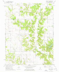 1974 Ramsey1977 Print · USGSMid-century Illinois farmland across Fayette and Montgomery counties is meticulously documented here just as modern conservation took hold. Researchers can trace numerous country burial grounds and rural parishes, including Tennessee Cem, Halford Chapel, and the lakeside Picnic Area of Ramsey Lake State Park.
 - 1980 Map of Middlesworth
 1980 Middlesworth1980 Print · USGSThe rural landscapes at the Menard and Logan County line are captured here in the late twentieth century. Researchers can trace family history at Irish Grove Cemetery and Walnut Ridge Cemetery or follow the route of the Old Grade Railroad.
 - 1981 Map of Stewardson East, 1982 Print
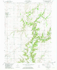 1981 Stewardson East1982 Print · USGSThe Shelby County prairie in the early eighties is defined by the rail lines and river bends between Strasburg and Stewardson. Trace family history through Rincker Cem, Gaskill Chapel, and the rural crossroads of Trowbridge.
 - 1981 Map of Fancher, 1982 Print
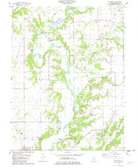 1981 Fancher1982 Print · USGSShelby County farmland and the winding Kaskaskia River valley are captured here in the early eighties. Local historians can trace rail-side settlements like Fancher and Clarksburg or locate historic sites like the Thompson Mill Covered Bridge and Gallagher Chapel Cem.
Showing maps 1-25 of 220
Top cities of Shelby County
- Shelbyville historical maps
- Windsor historical maps
- Stewardson historical maps
- Findlay historical maps
- Tower Hill historical maps
- Cowden historical maps
See more
Frequently asked questions
- What are the different types of historical maps available for Shelby County?
- What is the oldest map of Shelby County?
- Where can I purchase historical maps of Shelby County for my home or office?
- Where can I download high-res historical maps of Shelby County?
- Are there historical topographic maps available for Shelby County?
- Is there historical aerial imagery available for Shelby County?
- Where are historical maps of Shelby County sourced from?