Old Maps of Crandall, Illinois for Hiking & Exploration
Hike through history with 15 historic maps of Crandall. Explore old trails, ghost towns, and forgotten backroads — perfect for outdoor adventurers and local explorers.
- Rediscover forgotten places: Map out old mining camps, roads, and footpaths that no longer exist on modern maps.
- Layer with modern tools: Combine with LiDAR or satellite views to plan hikes through historical terrain.
- Made for exploration: Popular among hikers, overlanders, and local history lovers.
Use these maps to find adventure and explore the hidden past of Crandall.
Crandall, IL maps
(15)- 1928 Map of Mackinaw, 1954 Print
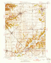 1928 Mackinaw1954 Print · USGSTazewell and Woodford Counties thrived as a major rail hub in the late twenties, balancing rich farmland with bustling rail towns. Genealogists can trace family roots through dozens of district schools like Science Hill Sch and settlements including Morton, Deer Creek, and Allentown.
 - 1932 Map of Mackinaw
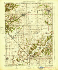 1932 Mackinaw1932 Print · USGSTazewell and Woodford counties are captured here in the early 1930s, showing a landscape tightly organized by rail lines and rural schoolhouses. Genealogists can trace family footprints across dozens of local districts like Cottonwood Sch or visit the Mennonite Ch and the Mackinaw Sanitarium.2 unique versions available
 - 1958 Map of Peoria, 1969 Print
 1958 Peoria1969 Print · USGSCentral Illinois thrived as a hub of education and transport during the late sixties, as the new interstate system began to reshape the prairie. Genealogists and historians can trace local landmarks like Springdale Cem, Bradley University, and the sprawling grounds of Chanute AFB.4 unique versions available
 - 1961 Map of Peoria
 1961 Peoria1961 Print · USGSCentral Illinois thrived at the intersection of river trade and rail power during the late fifties. Genealogists and local historians can trace the rail networks of the Illinois Central and Wabash, alongside landmarks like Chanute AFB and Weldon Springs State Park.
 - 1963 Map of Peoria
 1963 Peoria1963 Print · USGSCentral Illinois thrived as a rail and highway crossroads during the early sixties, centered on the bustling Illinois River valley. Genealogists and historians can trace the mid-century layout of Peoria, locate the grounds of Chanute Air Force Base, and follow historic lines like the Toledo Peoria and Western Railway.
 - 1970 Map of Washington, 1972 Print
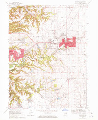 1970 Washington1972 Print · USGSTazewell County's expansion is clearly visible in the early seventies as the residential edges of WASHINGTON and MORTON begin to spread across the Illinois prairie. Researchers can trace family history through numerous rural burial sites like Guth Cem and Herstein Cem or locate local landmarks like the Smitty Landing Strip.2 unique versions available
 - 1985 Map of Peoria
 1985 Peoria1985 Print · USGSThe Illinois River valley and the Tri-County area are captured here in the mid-1980s as industry and infrastructure reshaped the heart of the state. Researchers can trace the grounds of Jubilee College, locate the Stark Mine near Elmwood, or follow the busy tracks of the Norfolk and Western Railroad.
 - 1989 Map of Peoria
 1989 Peoria1989 Print · USGSThe Illinois River valley thrived as a regional center of industry, education, and transport during the late eighties. Researchers can trace the extensive rail networks of the Peoria and Pekin Union Railway or locate landmarks like Bradley University and the Peoria Air National Guard Base.
 - 1990 Map of Peoria
 1990 Peoria1990 Print · USGSCentral Illinois at the start of the nineties reveals a landscape of industrial river towns and sprawling university campuses. Researchers can trace the legacy of major institutions like Chanute Air Force Base and the University of Illinois alongside regional landmarks such as Sand Ridge State Forest.
 - 1995 Map of Washington, 1996 Print
 1995 Washington1996 Print · USGSThe growing corridor between Washington and East Peoria is captured here in the mid-1990s, showcasing a mix of suburban sprawl and rural legacy. Local researchers can trace family landmarks like Union Cem, Grange Hall, and schools such as St Patricks Sch.
 - 2012 Map of Washington, 2012 Print
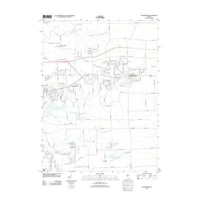 2012 Washington2012 Print · USGSCovers Crandall, including East Peoria, Morton, and other nearby areas
 - 2015 Map of Washington, 2015 Print
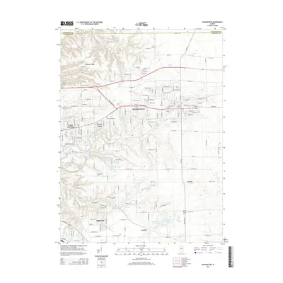 2015 Washington2015 Print · USGSCovers Crandall, including East Peoria, Morton, and other nearby areas
 - 2018 Map of Washington, 2018 Print
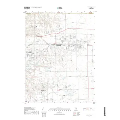 2018 Washington2018 Print · USGSCovers Crandall, including East Peoria, Morton, and other nearby areas
 - 2021 Map of Washington, 2021 Print
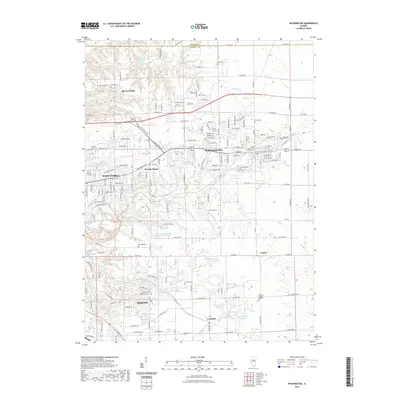 2021 Washington2021 Print · USGSCovers Crandall, including East Peoria, Morton, and other nearby areas
 - 2024 Map of Washington, 2024 Print
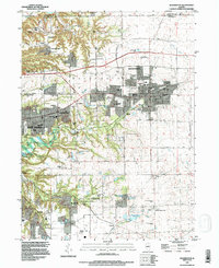
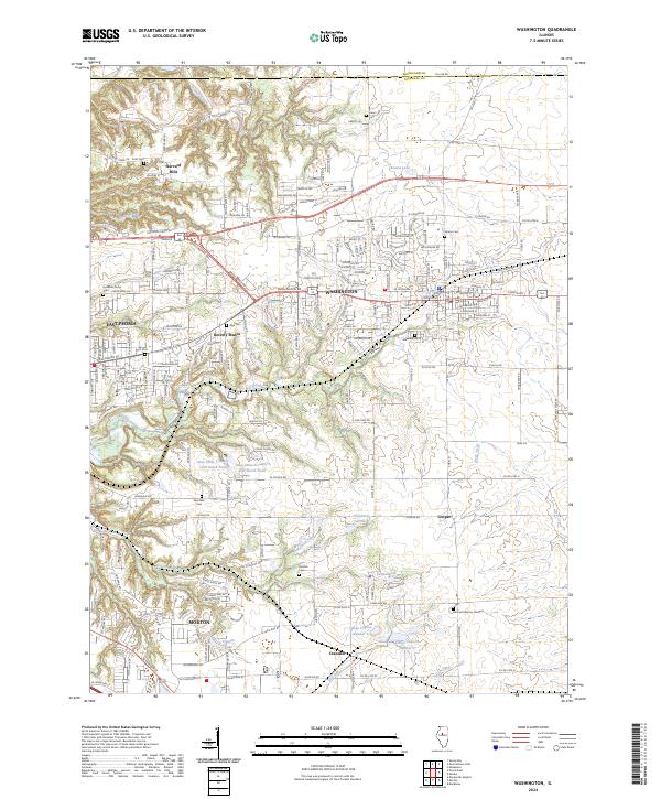 2024 Washington2024 Print · USGSTazewell County's evolving landscape shows the expansion of residential centers into historic farmland during the mid-2020s. Researchers can locate family sites near Hollands Grove Cem or trace the early paths of Crandall and Beverly Manor.
End of results
Showing maps 1-15 of 15
Top cities near Crandall
- Peoria historical maps
- Pekin historical maps
- East Peoria historical maps
- Groveland historical maps
- Morton historical maps
- Washington historical maps
See more
Frequently asked questions
- What are the different types of historical maps available for Crandall?
- What is the oldest map of Crandall?
- Where can I purchase historical maps of Crandall for my home or office?
- Where can I download high-res historical maps of Crandall?
- Are there historical topographic maps available for Crandall?
- Is there historical aerial imagery available for Crandall?
- Where are historical maps of Crandall sourced from?