Old Maps of White County, Illinois for Metal Detecting
Plan your next treasure hunt with 130 historic maps of White County. Find old homesites, ghost towns, trails, and gathering spots that may be lost to time — perfect for identifying promising metal detecting locations.
- Locate forgotten sites: Uncover places like long-lost settlements, abandoned rail lines, or gathering spots.
- Plan better hunts: Use map overlays combined with LiDAR or satellite views to narrow in on historically rich areas.
- Made for detectorists: Thousands of hobbyists use these maps to discover relics, coins, and hidden history.
Use these historic maps to boost your research and find new opportunities beneath the surface of White County.
White County, IL maps
(130)- 1903 Map of New Harmony
 1903 New Harmony1903 Print · USGSPosey County at the opening of the twentieth century was a landscape of thriving river towns and bustling rail junctions. Genealogists and historians can trace the early footprints of New Harmony and Poseyville, or locate vanished locales like Rapture and Solitude.3 unique versions available
 - 1903 Map of Patoka
 1903 Patoka1903 Print · USGSThe lower Wabash Valley at the start of the twentieth century was a vital crossroads of river trade and rail expansion. Genealogists can trace family roots through settlements like New Harmony and Parker's Settlement or locate the County Farm and Grand Rapids.2 unique versions available
 - 1904 Map of Mount Carmel
 1904 Mount Carmel1904 Print · USGSMount Carmel and the Wabash River valley are captured here at the height of the steam era. Genealogists and historians can trace defunct rail stops and riverside settlements like Schrodts Sta., Jimtown, and Rochester.3 unique versions available
 - 1905 Map of Eldorado, 1954 Print
 1905 Eldorado1954 Print · USGSSouthern Illinois rail hubs and prairie settlements thrive at the turn of the century. Genealogists can trace family roots through old stops like Texas City, Gossett, and Francis Mills, or locate early industrial sites like the Dering Mine.
 - 1905 Map of New Haven, 1966 Print
 1905 New Haven1966 Print · USGSThe tri-state border region along the Wabash and Ohio Rivers is captured here during the early twentieth century. Genealogists can trace family footprints in New Haven, Ridgway, and Herald, or locate historic crossings like Mackeys Ferry and Dogtown Ferry.
 - 1906 Map of New Haven
 1906 New Haven1906 Print · USGSThe Wabash River borderlands of Illinois and Indiana come to life in this early century survey of the river's winding oxbows and swampy bottoms. Genealogists can trace early homesteads near New Haven, Concord Emma P O, and the river landings at Dogtown Ferry.4 unique versions available
 - 1906 Map of Eldorado
 1906 Eldorado1906 Print · USGSSouthern Illinois at the turn of the century is a bustling web of competing rail lines and river-bottom settlements. Genealogists and rail historians can trace the early footprints of Eldorado, Ridgway, and the milling history at Francis Mills.2 unique versions available
 - 1938 Map of New Harmony, 1958 Print
 1938 New Harmony1958 Print · USGSIndiana's southwestern tip along the Wabash River is captured here during the late thirties. Genealogists and local historians can trace family land near the Mumford Hills or locate historic rail stops in Poseyville, Stewartsville, and Griffin.
 - 1940 Map of Carmi, 1965 Print
 1940 Carmi1965 Print · USGSThe river-and-rail hub of Carmi and the surrounding White County prairies are documented here just before the mid-century. Researchers can trace rural family roots through dozens of named sites like Miller Cem, Stokes Chapel, and Williams Sch.
 - 1941 Map of Enfield, 1968 Print
 1941 Enfield1968 Print · USGSWhite and Hamilton counties in the early 1940s were defined by a vast network of rural school districts and rail-connected hamlets. Genealogists can trace family roots through numerous local landmarks, from the Burnt Prairie P O to the McIntosh Cem and Wildcat Sch.
 - 1943 Map of Carmi
 1943 Carmi1943 Print · USGSWhite County, Illinois, is captured during the early 1940s at a critical rail and river junction. Genealogists and researchers can locate scores of rural schools and churches, from Stokes Chapel and Sylvan Glen Sch to the Baptist Orphanage near Carmi.2 unique versions available
 - 1943 Map of Albion, 1969 Print
 1943 Albion1969 Print · USGSEdwards County and its neighbors are captured here in the 1940s, showing a landscape defined by the winding Little Wabash River and the Southern rail line. Genealogists can locate numerous rural landmarks like Wanbor Cem, Samsville, and the Curtisville Sch.
 - 1944 Map of Enfield
 1944 Enfield1944 Print · USGSSoutheastern Illinois in the early 1940s is defined here by a dense grid of rural schools and the intersection of major rail lines. Researchers can trace ancestral locations through the dozens of named institutions like McIntosh Settlement, Asbury Ch, and Trousdale Sch.2 unique versions available
 - 1946 Map of Albion
 1946 Albion1946 Print · USGSEdwards and Wayne Counties are shown in the mid-1940s as a thriving network of rural school districts and small rail towns. Genealogists can trace family homesteads near Albion and Bone Gap or locate vanished landmarks like Blacks Store and Beech Bluff Sch.
 - 1948 Map of Fairfield
 1948 Fairfield1948 Print · USGSWayne County is captured in the late 1940s as a thriving network of small rail towns and rural school districts. Genealogists and historians can trace family locations near Pure Gold Sch, the Crews Cem, or the rail junction at Fairfield.2 unique versions available
 - 1949 Map of Paducah
 1949 Paducah1949 Print · USGSThe confluence of the Ohio, Mississippi, Tennessee, and Cumberland rivers at the close of the 1940s reveals a region bound by water and rail. Researchers can trace historic river landings, timberlands in the Shawnee National Forest, and the coal-mining infrastructure around West Frankfort and Herrin.2 unique versions available
 - 1949 Map of New Haven, 1958 Print
 1949 New Haven1958 Print · USGSSouthern Illinois and the Indiana borderlands are captured here in the late 1940s, highlighting the intricate river-and-rail landscape at the confluence of the Wabash and Ohio. Genealogists and historians can trace old homesteads and post offices like Concord Emma PO, Ridgway, and New Haven.
 - 1950 Map of Paducah
 1950 Paducah1950 Print · USGSThe confluence of the great midwestern rivers defines this mid-century landscape at the intersection of Illinois, Kentucky, and Missouri. Genealogists and historians can trace the rail-and-river economy through the hubs of Paducah, Cairo, and Metropolis or locate family roots near the Wildcat Hills.
 - 1954 Map of Paducah
 1954 Paducah1954 Print · USGSSouthern Illinois and Western Kentucky intersect at the great river confluences during this mid-century era of rail and river industry. Genealogists and historians can trace family roots and commerce through river towns like Cairo, Metropolis, and Golconda, or along the tracks of the Illinois Central Railroad.2 unique versions available
 - 1956 Map of Vincennes, 1967 Print
 1956 Vincennes1967 Print · USGSSouthern Indiana and the Illinois borderlands are captured here in the mid-fifties, showing the region's dense network of river towns and rail lines. Researchers can trace historic river crossings along the Wabash River or locate landmarks like Wyandotte Cave and Lincoln State Park.4 unique versions available
 - 1957 Map of Vincennes
 1957 Vincennes1957 Print · USGSSouthwest Indiana and the Illinois borderlands come alive in the late 1950s, a period of heavy rail traffic and expanding state forests. Genealogists and historians can trace the riverfronts and rail lines of Vincennes, New Harmony, and the vast Crane Naval Ammunition Depot.
 - 1958 Map of Vincennes
 1958 Vincennes1958 Print · USGSSouthern Indiana and the Illinois borderlands are captured during a mid-century period of heavy rail traffic and military activity. Researchers can trace the sprawling bounds of the Crane Naval Ammunition Depot or locate historic settlements like New Harmony and French Lick.2 unique versions available
 - 1958 Map of Emma, 1959 Print
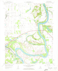 1958 Emma1959 Print · USGSThe river border between Illinois and Indiana is captured here in the late fifties, showcasing a landscape of oxbow lakes and winding channels. Genealogists can trace family roots through sites like Emma Concord Ch, Abshire Cem, and the riverfront at Rising Sun.
 - 1958 Map of Belleville, 1973 Print
 1958 Belleville1973 Print · USGSSouthern Illinois during the mid-twentieth century reveals a landscape of industrial growth and massive new reservoirs. Genealogists and historians can trace the paths of the Illinois Central RR through towns like Centralia or locate landmarks such as Emerald Mound and the Looking Glass Prairie.3 unique versions available
 - 1959 Map of Maunie, 1960 Print
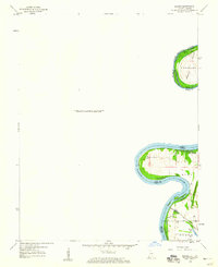 1959 Maunie1960 Print · USGSThe Illinois-Indiana border along the Wabash River is captured here in the late fifties, showcasing a shifting riverine landscape. Genealogists and researchers can trace family lands in Harmony or follow the Louisville and Nashville rail line past Weirs Lake.2 unique versions available
Showing maps 1-25 of 130
Top cities of White County
- Carmi historical maps
- Norris City historical maps
- Mill Shoals historical maps
- Crossville historical maps
- Enfield historical maps
- Emma historical maps
See more
Frequently asked questions
- What are the different types of historical maps available for White County?
- What is the oldest map of White County?
- Where can I purchase historical maps of White County for my home or office?
- Where can I download high-res historical maps of White County?
- Are there historical topographic maps available for White County?
- Is there historical aerial imagery available for White County?
- Where are historical maps of White County sourced from?