1900s (20th Century) Maps of Crawford County, Indiana
Explore 48 historic maps of Crawford County from the 1900s (20th Century). These maps offer a rare glimpse into what life looked like during the 1900s — showing old roads, neighborhoods, homes, and landmarks that have changed or disappeared over time.
Whether you're researching your family's past, planning a metal detecting trip, or studying how Crawford County's landscape evolved across the 1900s, these high-resolution maps are a powerful tool for exploring the history of this region.
- Focus on a specific era: All maps on this page are from the 1900s, giving you a focused view of this time period.
- See what’s changed: Compare century-old streets, trails, and buildings to today's modern landscape using overlays and satellite layers.
- Research with precision: Use these maps for genealogy, historical research, land use analysis, or educational projects.
- View, download, or print: Maps are fully viewable online in high resolution, and can be downloaded or printed for your own records.
Start exploring Crawford County's history through authentic maps from the 1900s. This is your window into the past.
Crawford County, IN maps
(48)- 1946 Map of Leavenworth
 1946 Leavenworth1946 Print · USGSThe Indiana-Kentucky borderlands come into focus in the mid-1940s as the river economy of the Ohio Valley transitions toward modern infrastructure. Trace family homesteads and local history through rural anchors like Blue River Chapel, Sunshine Sch, and the riverside community of Leavenworth.
 - 1946 Map of Depauw
 1946 Depauw1946 Print · USGSHarrison County communities grew along the SOUTHERN railroad during the mid-1940s, balancing river-valley life with upland farming. Genealogists can trace family footprints at Smith Cem, Mt Tabor Church, and the village of Frenchtown.2 unique versions available
 - 1947 Map of Leavenworth
 1947 Leavenworth1947 Print · USGSSouthern Indiana and northern Kentucky are captured here in the late 1940s as the Ohio River trade still defined life in these border counties. Researchers can locate vanished landmarks like Schooner Point Landing and the rural Precinct Sch or explore the early environs of Wyandotte Cave.2 unique versions available
 - 1947 Map of Hardinsburg, 1966 Print
 1947 Hardinsburg1966 Print · USGSSouthern Indiana's rural landscape is captured here in the late 1940s, showing a patchwork of small farms and family-named creek crossings. Genealogists can trace family roots at Oak Grove Ch, Walton Cem, and early schools like School No 6.
 - 1948 Map of Milltown
 1948 Milltown1948 Print · USGSCrawford and Harrison Counties appear here in the late 1940s, showing a landscape of deep river bends and rural Indiana rail towns. Genealogists can locate family landmarks like Archibald Sch, Thompson Chapel, and the cemetery at St Joseph Cem.2 unique versions available
 - 1949 Map of Hardinsburg
 1949 Hardinsburg1949 Print · USGSSouthern Indiana at the end of the 1940s reveals a patchwork of rural school districts and county-line settlements. Genealogists can trace family footprints across Hardinsburg and Marengo or find ancestral sites like Old Unity Cem and Baptist Hill Ch.2 unique versions available
 - 1950 Map of Beechwood, 1952 Print
 1950 Beechwood1952 Print · USGSThe Indiana-Kentucky borderlands along the Ohio River appear in high detail during the early fifties. Genealogists and hikers can trace remote landmarks like the Buzzard Roost Fire Tower, Old Union Ch, and the Wiseman Cem.3 unique versions available
 - 1950 Map of Valeene, 1952 Print
 1950 Valeene1952 Print · USGSSouthern Indiana's rural landscape at the edge of the Hoosier National Forest is preserved here in the mid-twentieth century. Researchers can trace the family histories of communities like Valeene and Fargo through local landmarks such as Cooks Ch and Perkiser Cem.3 unique versions available
 - 1950 Map of English, 1953 Print
 1950 English1953 Print · USGSCrawford County at mid-century reveals a landscape of deep timber and river valleys where the Southern railroad meets the winding Little Blue River. Genealogists can trace rural family life through scattered landmarks like Simpson Chapel, Dog Creek Sch, and the Sloan Cem.
 - 1950 Map of Leavenworth, 1954 Print
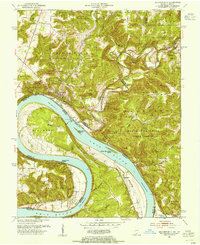 1950 Leavenworth1954 Print · USGSThe Ohio River meanders through Crawford County in the mid-century, showcasing a landscape of dramatic river bends and timbered highlands. Genealogists and local historians can trace family locations near Mt Hope Ch, Peckenpaugh Sch, or the riverside settlement of Leavenworth.3 unique versions available
 - 1950 Map of Alton, 1959 Print
 1950 Alton1959 Print · USGSThe Ohio River loops through the Indiana and Kentucky borderlands at mid-century, following the deep curves of Big Bend and Oxbow Bend. Genealogists and local historians can trace family roots through numerous rural landmarks like St Theresa Academy, Beechland Sch, and the historic town of Leavenworth.2 unique versions available
 - 1950 Map of Alton, 1962 Print
 1950 Alton1962 Print · USGSThe Ohio River borderlands between Indiana and Kentucky are captured here in the early fifties, showing a landscape defined by ferries and small river landings. Researchers can trace family roots at St Theresa Academy, the Boyer Ferry, and the remote Stephenson Cem.
 - 1951 Map of Alton
 1951 Alton1951 Print · USGSThe Indiana and Kentucky borderlands meet along the winding Ohio River in the early fifties. Genealogists can trace family names and rural institutions at St Theresa Academy, the Boyer Ferry, and Stony Point Sch.2 unique versions available
 - 1953 Map of Fredericksburg, 1954 Print
 1953 Fredericksburg1954 Print · USGSFredericksburg and the winding Blue River valley are captured here in the early fifties, showing a rural landscape defined by karst topography and river bottoms. Researchers can trace family history at the Roland Voyles Cem, visit Greene Mill, or locate the Adams Sch.2 unique versions available
 - 1956 Map of Greenbrier, 1957 Print
 1956 Greenbrier1957 Print · USGSThe Orange and Crawford County line comes to life in the mid-fifties, showing the deeply wooded hollows and rural communities of the Hoosier National Forest. Genealogists and researchers can trace family landmarks like Lowe Cem, the Spears Lookout Tower, and the remote Newton Stewart settlement.2 unique versions available
 - 1956 Map of Taswell, 1958 Print
 1956 Taswell1958 Print · USGSSouthern Indiana ridge country was still defined by its rail line and forest boundaries in the mid-1950s. Genealogists can locate family landmarks such as Highfill Chapel, Allstott Sch, and Doolittle Mills tucked among the steep hollows.2 unique versions available
 - 1956 Map of Vincennes, 1967 Print
 1956 Vincennes1967 Print · USGSSouthern Indiana and the Illinois borderlands are captured here in the mid-fifties, showing the region's dense network of river towns and rail lines. Researchers can trace historic river crossings along the Wabash River or locate landmarks like Wyandotte Cave and Lincoln State Park.4 unique versions available
 - 1957 Map of Vincennes
 1957 Vincennes1957 Print · USGSSouthwest Indiana and the Illinois borderlands come alive in the late 1950s, a period of heavy rail traffic and expanding state forests. Genealogists and historians can trace the riverfronts and rail lines of Vincennes, New Harmony, and the vast Crane Naval Ammunition Depot.
 - 1957 Map of Cuzco, 1958 Print
 1957 Cuzco1958 Print · USGSThe rural landscapes of Orange and Dubois counties are frozen in time during the late fifties, centered on the Patoka River valley. Genealogists and researchers can locate family landmarks like Cane Creek Ch, Bender Sch, and the small settlement of Newton Stewart.2 unique versions available
 - 1957 Map of Birdseye, 1959 Print
 1957 Birdseye1959 Print · USGSSouthern Indiana was a landscape of deep forests and rail-linked towns in the late fifties, where the Southern Railway connected communities across Dubois and Crawford counties. Genealogists and local historians can trace family roots through several remote burial sites and churches, including Waddle Cem, Adkins Cem, and Anderson Valley Ch.2 unique versions available
 - 1958 Map of Vincennes
 1958 Vincennes1958 Print · USGSSouthern Indiana and the Illinois borderlands are captured during a mid-century period of heavy rail traffic and military activity. Researchers can trace the sprawling bounds of the Crane Naval Ammunition Depot or locate historic settlements like New Harmony and French Lick.2 unique versions available
 - 1958 Map of Branchville, 1959 Print
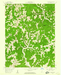 1958 Branchville1959 Print · USGSThe hills of Perry and Crawford counties come to life in this late fifties survey of the Hoosier National Forest. Genealogists can locate family landmarks like Rickenbaugh Cem, the Township High Sch, and the old settlement of Branchville.4 unique versions available
 - 1962 Map of Depauw, 1963 Print
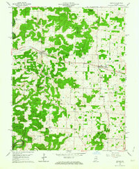 1962 Depauw1963 Print · USGSHarrison County in the early sixties maintains its character as a landscape of ridge-top farms and rail-oriented settlements. Genealogists can trace family names and rural life through landmarks like Loudens Chapel, North Central Sch, and the railway stop at Depauw.3 unique versions available
 - 1962 Map of Milltown, 1963 Print
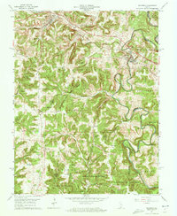 1962 Milltown1963 Print · USGSThe Blue River valley and Harrison-Crawford State Forest dominate this early 1960s landscape along the county line. Genealogists and local historians can trace rural communities through landmarks like Hogtown, St Josephs Ch, and White Cem.3 unique versions available
 - 1966 Map of Hardinsburg, 1968 Print
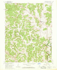 1966 Hardinsburg1968 Print · USGSSouthern Indiana's rural landscape is captured in the mid-sixties, showing the transition from agricultural tracts to protected woodlands. Genealogists can trace family sites at Baptist Hill Ch, Old Unity Ch, and the crossing at Totten Ford Bridge.2 unique versions available
Showing maps 1-25 of 48
Top cities of Crawford County
Frequently asked questions
- What are the different types of historical maps available for Crawford County?
- What is the oldest map of Crawford County?
- Where can I purchase historical maps of Crawford County for my home or office?
- Where can I download high-res historical maps of Crawford County?
- Are there historical topographic maps available for Crawford County?
- Is there historical aerial imagery available for Crawford County?
- Where are historical maps of Crawford County sourced from?