2020s Maps of Wakarusa, Indiana
Explore 2 historic maps of Wakarusa from the 2020s. These maps offer a rare glimpse into what life looked like during the 2020s — showing old roads, neighborhoods, homes, and landmarks that have changed or disappeared over time.
Whether you're researching your family's past, planning a metal detecting trip, or studying how Wakarusa's landscape evolved across the 2020s, these high-resolution maps are a powerful tool for exploring the history of this region.
- Focus on a specific era: All maps on this page are from the 2020s, giving you a focused view of this time period.
- See what’s changed: Compare century-old streets, trails, and buildings to today's modern landscape using overlays and satellite layers.
- Research with precision: Use these maps for genealogy, historical research, land use analysis, or educational projects.
- View, download, or print: Maps are fully viewable online in high resolution, and can be downloaded or printed for your own records.
Start exploring Wakarusa's history through authentic maps from the 2020s. This is your window into the past.
Wakarusa, IN maps
(2)- 2022 Map of Wakarusa, 2022 Print
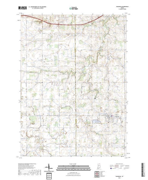 2022 Wakarusa2022 Print · USGSWakarusa and the rural border between Elkhart and St. Joseph Counties are shown here during the early 2020s. Genealogists can locate family landmarks like Pletcher Cem and Shutts Cem or trace the extensive drainage network of Baugo Creek.
 - 2022 Map of Foraker, 2022 Print
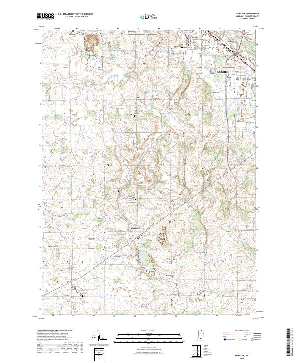 2022 Foraker2022 Print · USGSElkhart County is captured here in the early 2020s, showing the rural settlements and sophisticated drainage networks of Northern Indiana. Researchers can trace numerous family-named burial sites like Yellow Creek Brick Cemetery, Stutsman Cem, and Bull Cem.
End of results
Showing maps 1-2 of 2
Top cities near Wakarusa
- South Bend historical maps
- Elkhart historical maps
- Mishawaka historical maps
- Goshen historical maps
- Granger historical maps
- Nappanee historical maps
See more
Frequently asked questions
- What are the different types of historical maps available for Wakarusa?
- What is the oldest map of Wakarusa?
- Where can I purchase historical maps of Wakarusa for my home or office?
- Where can I download high-res historical maps of Wakarusa?
- Are there historical topographic maps available for Wakarusa?
- Is there historical aerial imagery available for Wakarusa?
- Where are historical maps of Wakarusa sourced from?