Old Maps of Grant County, Indiana for Academic Research
Study the evolution of Grant County with 85 high-resolution historic maps. Whether you're teaching, researching, or modeling changes in land use, these maps provide essential visual documentation of urban, environmental, and geographic change.
- Analyze long-term change: Track patterns in development, transportation, and natural features.
- Ideal for environmental or urban studies: Support academic projects with primary historical map data.
- Use in the classroom or lab: Educators and researchers rely on these maps to bring historical context to life.
These maps are a powerful tool for teaching, research, and visualizing how Grant County has changed over the decades.
Grant County, IN maps
(85)- 1950 Map of Warren, 1965 Print
 1950 Warren1965 Print · USGSMid-century Huntington County is defined by the river-and-rail intersection at Warren during a period of steady agricultural growth. Genealogists can trace family names and sites at Redmen Cem, Plum Tree, and the Water Methodist Home.
 - 1950 Map of Mount Etna, 1967 Print
 1950 Mount Etna1967 Print · USGSThe Huntington and Grant County line bisects this quiet agricultural landscape during the post-war era. Researchers can trace the development of rural social life through landmarks like Salem Ch, the Jefferson Twp Consolidated Sch, and the grounds of the Star Commonwealth For Boys.
 - 1951 Map of Mount Etna
 1951 Mount Etna1951 Print · USGSIndiana's rural heartland is meticulously mapped here in the early fifties, documenting a landscape of small farming communities and river valleys. Genealogists can trace family roots through sites like Pormance Cem, the Jefferson Twp Consolidated Sch, and the settlement at Banquo.2 unique versions available
 - 1952 Map of Warren
 1952 Warren1952 Print · USGSNortheastern Indiana farmland surrounds the hub of Warren during the early fifties, as the river and rail economy remained the backbone of the county. Genealogists and local historians can locate early burial sites like Taylor Cem and Redmen Cem or trace the New York Chicago and St Louis rail line.2 unique versions available
 - 1953 Map of La Fontaine, 1954 Print
 1953 La Fontaine1954 Print · USGSMid-century Wabash and Grant Counties come to life as small-town Indiana centers around the New York Central rail line. Genealogists can trace family roots through numerous burial sites like America Cem, Hale Cem, and the Boundary Line Ch.2 unique versions available
 - 1953 Map of Somerset, 1954 Print
 1953 Somerset1954 Print · USGSThe Mississinewa River valley in the early 1950s reveals a network of historic trails and river-dependent settlements across the Wabash and Grant county border. Genealogists can trace family roots at Sugar Grove Cem and Union Chapel, or locate forgotten sites like Pearson Mill.2 unique versions available
 - 1953 Map of Muncie, 1966 Print
 1953 Muncie1966 Print · USGSIndiana and Ohio borderlands thrive in the early fifties, showing a landscape defined by manufacturing cities and an intensive railroad network. Genealogists can trace family roots across the Indiana-Ohio line through Muncie, Celina, and Portland via the Pennsylvania railroad.5 unique versions available
 - 1956 Map of Muncie
 1956 Muncie1956 Print · USGSEastern Indiana and western Ohio are shown at a peak of rail-driven industry in the mid-fifties. Genealogists and rail historians can trace the paths of the Pennsylvania RR through Muncie or locate landmarks like Lake Saint Marys (Grand Lake Reservoir) and Frances Slocum State Forest.
 - 1960 Map of Point Isabel, 1961 Print
 1960 Point Isabel1961 Print · USGSAgricultural life in central Indiana comes into focus during the early sixties, showing a landscape of small crossroads and family-named ditches. Genealogists can locate Antioch Ch, Knox Chapel, and the settlement of Point Isabel.4 unique versions available
 - 1960 Map of Fairmount, 1961 Print
 1960 Fairmount1961 Print · USGSFairmount and Jonesboro stand at the center of this 1960s Grant County landscape, split by two major railroads and an old treaty line. Genealogists can locate family sites near Hill Chapel, Little Ridge Cem, and the small community of Weaver.3 unique versions available
 - 1960 Map of Gas City, 1961 Print
 1960 Gas City1961 Print · USGSGrant County is shown during a period of steady growth and industrial rail activity in the early sixties. Genealogists and historians can locate family plots at Riverside Cem or trace the early paths of the PENNSYLVANIA and CHESAPEAKE AND OHIO railroads.4 unique versions available
 - 1960 Map of Hartford City West, 1976 Print
 1960 Hartford City West1976 Print · USGSIndiana's farm and college country comes to life in the late fifties, centered on the growing communities of Hartford City and Upland. Researchers can locate the Purdue University Memorial Farm, the Covered Bridge near Matthews, and several rural landmarks like Shiloh Cem.5 unique versions available
 - 1961 Map of Marion, 1963 Print
 1961 Marion1963 Print · USGSMarion emerges as a thriving mid-century industrial center at the intersection of the Mississinewa River and multiple rail lines in the early sixties. Genealogists and historians can locate numerous neighborhood landmarks, including Marion College, the IOOF Cemetery, and the Goodman Yards rail facility.3 unique versions available
 - 1962 Map of Sweetser, 1963 Print
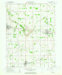 1962 Sweetser1963 Print · USGSGrant County in the early sixties was a hub of rural industry and local rail transport. Genealogists and historians can trace family roots at Thrailkill Cemetery, explore the rail sidings of Swayzee, or locate the Richland Chapel and Oak Hill High School.
 - 1962 Map of Roll, 1963 Print
 1962 Roll1963 Print · USGSBlackford and Wells counties in the early sixties remained a deeply rural landscape of grain fields and drainage canals. Family historians can trace ancestral sites like Oak Chapel, the Township Sch, and local burial grounds such as Balsley Cem and Center Cem.3 unique versions available
 - 1962 Map of Van Buren, 1963 Print
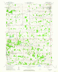 1962 Van Buren1963 Print · USGSGrant County is captured in the early sixties as a structured grid of family farms and railroad hamlets. Researchers can trace the legacy of small-town Indiana through landmarks like Landess, Roosevelt Sch, and the Locust Chapel.2 unique versions available
 - 1969 Map of Somerset, 1971 Print
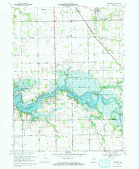 1969 Somerset1971 Print · USGSThe Wabash County countryside was being transformed by the rising Mississinewa Reservoir in the late sixties. Genealogists and local historians can trace the foundations of Somerset, locate the White Institute, and identify rural landmarks like Lebanon Ch and Treaty.3 unique versions available
 - 1969 Map of Warren, 1971 Print
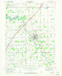 1969 Warren1971 Print · USGSWarren and its rural surroundings are captured in the late sixties, showing a landscape defined by the Salamonie River and local petroleum extraction. Researchers can trace family history at West Union Cem or locate the old Airfield and Milo settlement along the rail lines.2 unique versions available
 - 1969 Map of Mount Etna, 1971 Print
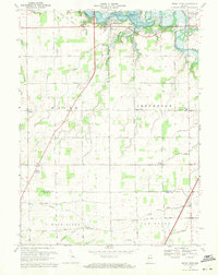 1969 Mount Etna1971 Print · USGSIndiana's rural heartland is captured here in the late sixties as the newly created Salamonie Reservoir reshaped the northern townships. Genealogists and local historians can locate early burial sites like Purviance Cem, and vanished school sites like Township Sch.2 unique versions available
 - 1969 Map of La Fontaine, 1972 Print
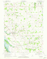 1969 La Fontaine1972 Print · USGSThe rural borderlands of Wabash and Grant counties are captured here in the late sixties as modern reservoirs began to shape the landscape. Local historians can trace family plots at Boundary Line Cem and Gardner Cem or follow the path of the Penn Central through La Fontaine.2 unique versions available
 - 1986 Map of Wabash
 1986 Wabash1986 Print · USGSThe Wabash Valley and surrounding Indiana farm country are captured here in the mid-eighties, showing a landscape reshaped by major reservoirs. Genealogists and local historians can trace the paths of the Old Indian Trail and the industrial reach of the Conrail line through towns like Lagro and Warren.2 unique versions available
 - 1986 Map of Muncie
 1986 Muncie1986 Print · USGSEast Central Indiana was a hub of manufacturing and higher education in the mid-eighties. Genealogists and historians can trace the streets of Muncie, locate rural Cem sites, and explore landmarks like Mounds State Park and Taylor Univ.3 unique versions available
 - 1992 Map of Marion, 1995 Print
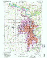 1992 Marion1995 Print · USGSMarion and its surrounding Grant County townships appear here during the mid-1990s as the riverfront and rail lines continue to shape the community. Researchers can locate dozens of civic landmarks including Marion College, the VA Hospital, and Grant Memorial Park.
 - 1992 Map of Sweetser, 1995 Print
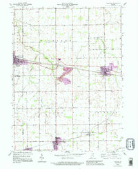 1992 Sweetser1995 Print · USGSThe rural-industrial landscape of Grant and Miami counties is captured in the early nineties. Researchers can trace the Central Railroad of Indianapolis past Swayzee and locate sites like Thrailkill Cem and Sims.
 - 1992 Map of Van Buren, 1995 Print
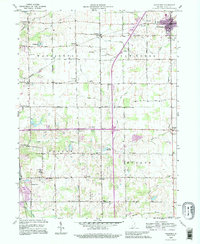 1992 Van Buren1995 Print · USGSGrant County farmland meets the modern Interstate era in this detailed survey of the Indiana countryside during the 1990s. Genealogists can trace family footprints at Fairview Cem or Landess Cem and locate rural landmarks like Locust Chapel and Roosevelt Sch.
Showing maps 1-25 of 85
Top cities of Grant County
- Marion historical maps
- Gas City historical maps
- Upland historical maps
- Fairmount historical maps
- Sims historical maps
- Jonesboro historical maps
See more
Frequently asked questions
- What are the different types of historical maps available for Grant County?
- What is the oldest map of Grant County?
- Where can I purchase historical maps of Grant County for my home or office?
- Where can I download high-res historical maps of Grant County?
- Are there historical topographic maps available for Grant County?
- Is there historical aerial imagery available for Grant County?
- Where are historical maps of Grant County sourced from?