Old Maps of Greene County, Indiana for Genealogy
Trace your family roots with 125 historic maps of Greene County. These high-res maps reveal old neighborhoods, homesites, landmarks, and streets — helping you uncover where your ancestors lived and how the area evolved over time.
- Explore historic neighborhoods: Identify where your relatives may have lived in the 1800s or 1900s.
- Compare maps over time: Trace the changes in streets, buildings, and landmarks for multi-generational research.
- Perfect for genealogy & ancestry research: Used by family historians and researchers to map out lineage and migration.
These maps are an incredible resource for exploring your personal connection to Greene County's past.
Greene County, IN maps
(125)- 1908 Map of Bloomington
 1908 Bloomington1908 Print · USGSMonroe and Greene Counties appear at the height of their early rail-and-quarry era during the first decade of the 1900s. Genealogists can locate family landmarks among dozens of rural schoolhouses like Parks School and old parish sites like Mt Ebal Church.2 unique versions available
 - 1908 Map of Bloomfield, 1954 Print
 1908 Bloomfield1954 Print · USGSGreene County is defined by the sweeping bends of the White River and a dense network of early railroads in the late 1960s. Researchers can locate many family-named landmarks and old church sites like Stalcup Cem, Hashtown, and Tulip Ch.
 - 1910 Map of Bloomington
 1910 Bloomington1910 Print · USGSMonroe County at the peak of its quarrying era reveals a landscape shaped by education, industry, and rail. Genealogists can trace family roots through Indiana University, Sanders PO, and the Greene County Chapel.6 unique versions available
 - 1935 Map of Oolitic
 1935 Oolitic1935 Print · USGSLawrence and Greene Counties are captured in the mid-1930s during a period of heavy limestone production and rural transition. Local historians can trace family roots through numerous country landmarks like Popcorn Church, Williams Bridge, and the Dark Hollow stone works.6 unique versions available
 - 1938 Map of Coal City
 1938 Coal City1938 Print · USGSSouthern Indiana at the end of the 1930s shows a landscape of small coal-mining towns and rural crossroads between the forks of the Eel River. Researchers can trace the path of the Wabash and Erie Canal and locate family roots at Coal City, Sink Cem, or Scaffold Prairie Ch.
 - 1938 Map of Switz City
 1938 Switz City1938 Print · USGSIn the late 1930s, Switz City functioned as a vital Indiana rail hub where two major lines crossed amidst a landscape shaped by drainage canals. Researchers can locate numerous family burial sites like Bohley Cem or trace early industry at a Coal Mine.
 - 1940 Map of Linton
 1940 Linton1940 Print · USGSLinton and its surrounding coalfields are captured in the late thirties, showcasing a landscape shaped by heavy industry and rail. Genealogists and historians can locate vanished country landmarks like Morris Chapel, Victoria, and Sassafras Sch among the early Strip Mine sites.2 unique versions available
 - 1940 Map of Jasonville
 1940 Jasonville1940 Print · USGSJasonville and the surrounding coalfields are captured in the late 1930s, showing a landscape defined by industry and rural community. Genealogists can locate family landmarks like Sanderson Cem, Little Flock Ch, and Listen Sch.2 unique versions available
 - 1942 Map of Oolitic
 1942 Oolitic1942 Print · USGSLawrence County limestone country is seen here in the mid-1930s, documenting the early stone industry and rail networks. Genealogists can trace family landmarks like Popcorn Cem, Bethel Ch, and industrial sites such as Patton Hill Quarry.2 unique versions available
 - 1943 Map of Lyons
 1943 Lyons1943 Print · USGSThe Greene and Daviess County borderlands in the 1940s are defined by the winding WHITE RIVER and a busy junction of coal-era railroads. Trace family roots at FRYE CEM or Old Slinkard Cem, and locate long-standing community centers like Mud Pike Ch and Elnora.2 unique versions available
 - 1943 Map of Sandborn
 1943 Sandborn1943 Print · USGSIn the early 1940s, this portion of Knox and Greene Counties was a busy corridor for coal mining and rail transport. Researchers can trace family history through local landmarks like Marco Cem, Pleasant Grove Ch, and the many Strip Mine works near Sponsler.2 unique versions available
 - 1947 Map of Switz City
 1947 Switz City1947 Print · USGSGreene County was a busy junction of rail and industry in the late 1930s, centered on the crossing of two major lines. Genealogists and researchers can trace family roots at Walker Cem, find the site of School No 6, or locate several historic Coal Mines.
 - 1947 Map of Linton
 1947 Linton1947 Print · USGSGreene County is seen during a period of industrial transition in the late 1940s, when coal mining and rail transport defined the local economy. Researchers can locate family-named landmarks and rural hubs such as Wright High Sch, Antioch Ch, and the settlement of Island City.3 unique versions available
 - 1948 Map of Coal City
 1948 Coal City1948 Print · USGSThe rural borderlands of Owen, Clay, and Greene Counties are shown here during the late 1940s, showcasing a landscape shaped by coal mining and transport. Researchers can trace the path of the Wabash and Erie Canal (Abandoned) and locate vanished landmarks like Stockton, Sink Cem, and the College Hill Sch.2 unique versions available
 - 1950 Map of Arney
 1950 Arney1950 Print · USGSMid-century Owen County life centered on the river junctions and rural townships. Trace the paths of the New York Central railroad and find historic river landmarks like Farmers Ferry and small settlements like Point Commerce.2 unique versions available
 - 1950 Map of Switz City, 1953 Print
 1950 Switz City1953 Print · USGSSwitz City in the early fifties was a vital rail crossroads where the Pennsylvania and Illinois Central lines met. Genealogists can locate numerous family burial sites like Buzan Cem and Miller Cem alongside early coal-industry Strip Mine sites.2 unique versions available
 - 1951 Map of Bloomfield
 1951 Bloomfield1951 Print · USGSGreene County is captured here in the early fifties, where the White River and Eel River converge amidst a busy network of mid-century railroads. Genealogists can trace family roots through numerous local sites like Stalcup Cem, Allen Chapel, and the community of Worthington.
 - 1953 Map of Coal City
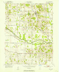 1953 Coal City1953 Print · USGSMid-century Owen and Clay counties are shown here during a peak era of surface mining and rail transport. Researchers can trace the Wabash and Erie Canal or locate rural landmarks like New Hope Ch and Tapawingo Lake.
 - 1953 Map of Indianapolis, 1965 Print
 1953 Indianapolis1965 Print · USGSCentral Indiana and the Illinois borderlands are captured in the mid-sixties, showing the growth of Indianapolis and its industrial rail corridors. Genealogists and historians can trace the development of outlying towns like Zionsville or Beech Grove and find landmarks such as Atterbury AAF and Turkey Run State Park.4 unique versions available
 - 1956 Map of Indianapolis
 1956 Indianapolis1956 Print · USGSCentral Indiana in the mid-fifties is captured during a period of industrial growth and military presence. Genealogists and historians can trace the rail networks of the New York Central or locate regional landmarks like Fort Benjamin Harrison and Camp Atterbury.
 - 1956 Map of Freedom, 1958 Print
 1956 Freedom1958 Print · USGSAcross the Owen and Greene County line in the mid-1950s, the river and rail network defined life for rural townships. Researchers can trace family roots through dozens of sites like Hedding Ch, McIndoo Cem, and the riverfront settlement of Freedom.5 unique versions available
 - 1956 Map of Stanford, 1958 Print
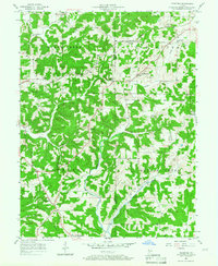 1956 Stanford1958 Print · USGSMid-century Monroe County comes to life in this survey of the wooded ridges and railroad valleys west of Bloomington. Genealogists and historians can trace family locations near Stanford, Hobbieville, and the Sanbourn Sch or locate the historic Harmony Ch.3 unique versions available
 - 1956 Map of Koleen, 1959 Print
 1956 Koleen1959 Print · USGSGreene County in the mid-fifties is characterized here by the contrast between rural ridge settlements and the massive Crane Naval Ammunition Depot. Researchers can trace family history through numerous landmarks like Clifty Chapel, Howell Cem, and the small community of Koleen.
 - 1956 Map of Solsberry, 1959 Print
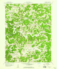 1956 Solsberry1959 Print · USGSGreene County is depicted here in the mid-fifties, showing a landscape defined by the Illinois Central railroad and winding creek valleys. Researchers can locate many rural landmarks including Solsberry, Combs Sch, and the Bingham Cem.3 unique versions available
 - 1956 Map of Vincennes, 1967 Print
 1956 Vincennes1967 Print · USGSSouthern Indiana and the Illinois borderlands are captured here in the mid-fifties, showing the region's dense network of river towns and rail lines. Researchers can trace historic river crossings along the Wabash River or locate landmarks like Wyandotte Cave and Lincoln State Park.4 unique versions available
Showing maps 1-25 of 125
Top cities of Greene County
- Linton historical maps
- Bloomfield historical maps
- Jasonville historical maps
- Worthington historical maps
- Lyons historical maps
- Switz City historical maps
See more
Frequently asked questions
- What are the different types of historical maps available for Greene County?
- What is the oldest map of Greene County?
- Where can I purchase historical maps of Greene County for my home or office?
- Where can I download high-res historical maps of Greene County?
- Are there historical topographic maps available for Greene County?
- Is there historical aerial imagery available for Greene County?
- Where are historical maps of Greene County sourced from?