Old Maps of Elizabeth, Indiana for Hiking & Exploration
Hike through history with 25 historic maps of Elizabeth. Explore old trails, ghost towns, and forgotten backroads — perfect for outdoor adventurers and local explorers.
- Rediscover forgotten places: Map out old mining camps, roads, and footpaths that no longer exist on modern maps.
- Layer with modern tools: Combine with LiDAR or satellite views to plan hikes through historical terrain.
- Made for exploration: Popular among hikers, overlanders, and local history lovers.
Use these maps to find adventure and explore the hidden past of Elizabeth.
Elizabeth, IN maps
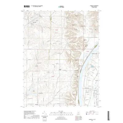
(25)- 1909 Map of Kosmosdale
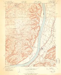
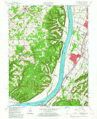
 1909 Kosmosdale1909 Print · USGSSouthwest of Louisville at the turn of the century, the river valley meets the steep slopes of Muldraughs Hill. Researchers can trace early rural life through several family-named schoolhouses and small settlements like Kosmosdale, Valley Sta, and the County Infirmary.
 - 1912 Map of Kosmosdale
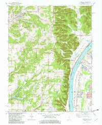
 1912 Kosmosdale1912 Print · USGSThe Ohio River valley and the Kentucky Knobs come alive in this pre-war survey, showing the expansion of southern Louisville and the rural hills of Jefferson and Bullitt counties. Researchers can locate vanished landmarks like Locust Point P.O. and the County Infirmary, or trace the old riverboat stops at Stewarts Landing.4 unique versions available
 - 1950 Map of Kosmosdale, 1959 Print
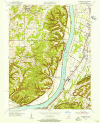
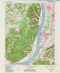
 1950 Kosmosdale1959 Print · USGSGreater Louisville and the Ohio River valley are captured here at mid-century, showing the city's industrial south side meeting rural river towns. Genealogists and historians can trace family locations through Lanesville Cem, the Waverly Hills Sanatorium, and Churchill Downs.
 - 1951 Map of Kosmosdale
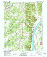
 1951 Kosmosdale1951 Print · USGSThe Ohio River valley south of Louisville was a busy corridor of rail and road commerce in the early fifties. Genealogists and historians can trace local landmarks like Kosmosdale Sch, Mill Creek Cem, and the boundaries of the Fort Knox Military Reservation.2 unique versions available
 - 1951 Map of Lanesville
 1951 Lanesville1951 Print · USGSHarrison County and the Ohio River valley appear here in the early fifties, showing a rural landscape of ridge-top farms and river landings. Genealogists can trace family names through sites like Shoemaker Cem, Lottick Corner, and Seven Springs Sch.2 unique versions available
 - 1955 Map of Kosmosdale, 1956 Print
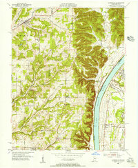
 1955 Kosmosdale1956 Print · USGSThe river valley south of Louisville comes alive in the mid-fifties, showing the vital corridors of the Illinois Central and Dixie Highway. Genealogists and historians can trace family locations near Bethany, Meadow Lawn, and the rural Elizabeth Ch.
 - 1955 Map of Lanesville, 1956 Print
 1955 Lanesville1956 Print · USGSHarrison County's river bluffs and rural townships are captured here in the mid-fifties, showing the rugged Indiana shoreline across from Kentucky. Researchers can trace ancestral sites at Lottick Corner, Hopewell Cem, and the old Locust Point PO.
 - 1956 Map of Louisville, 1971 Print
 1956 Louisville1971 Print · USGSThe Ohio River valley and the Kentucky Bluegrass are captured here during a period of rapid mid-century growth and industrial activity. Genealogists and historians can trace rail-centered towns and military land use at Fort Knox and the Jefferson Proving Ground.2 unique versions available
 - 1960 Map of Lanesville, 1961 Print
 1960 Lanesville1961 Print · USGSHarrison County, Indiana, and the Jefferson County shoreline are documented here in the early sixties. Genealogists can trace family names at Lottick Corner or locate ancestral sites like St Johns Church and the Tabler Cemetery near the river bluffs.2 unique versions available
 - 1960 Map of Kosmosdale, 1961 Print
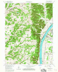
 1960 Kosmosdale1961 Print · USGSThe Ohio River valley near the Harrison and Jefferson County line is captured here during a period of significant growth. You can trace the development of residential neighborhoods like Meadow Lawn and Valley Station alongside older sites like Elizabeth Ch and Kosmosdale.3 unique versions available
 - 1964 Map of Louisville
 1964 Louisville1964 Print · USGSThe Ohio River valley and Kentucky Bluegrass are captured in the mid-1960s, showing a region balanced between industrial growth and its agrarian roots. Genealogists and historians can trace the development of county seats like Shelbyville and Paris, or locate established institutions such as Georgetown College and Bernheim Forest.
 - 1981 Map of Kosmosdale
 1981 Kosmosdale1981 Print · USGSThe Ohio River corridor south of Louisville in the early eighties shows a landscape of suburban expansion meeting heavy river-industry. Researchers can trace family roots at De Pauw Cem, locate the former site of Watson Lane Sch, or explore the rail networks of the Illinois Central Gulf.3 unique versions available
 - 1982 Map of Lanesville
 1982 Lanesville1982 Print · USGSHarrison County and the Ohio River shoreline are captured here in the early 1980s as rural crossroads and riverside settlements thrived. Family historians can trace local roots at Lanesville Cem, Lottick Corner, and St Johns Ch.2 unique versions available
 - 1985 Map of Lanesville, 1993 Print
 1985 Lanesville1993 Print · USGSThe Indiana bluffs and Kentucky riverbank are captured here during the mid-1980s, showcasing the transition from upland ridges to the industrial river corridor. Genealogists can trace family landmarks like Lanesville Cem, Heistand Cem, and the parish at St Johns Ch.
 - 1986 Map of Louisville
 1986 Louisville1986 Print · USGSMid-1980s Louisville and southern Indiana are shown here during a decade of significant suburban growth and infrastructure development. Researchers can trace the layout of Cave Hill Cemetery, the expansion of Standiford Field, and industrial sites like the Indiana Army Ammunition Plant.2 unique versions available
 - 2010 Map of Lanesville, 2010 Print
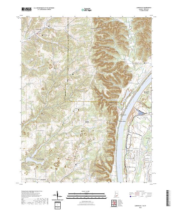
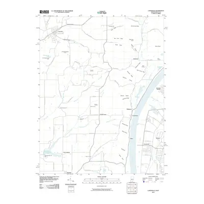 2010 Lanesville2010 Print · USGSCovers Elizabeth, including Louisville, Lanesville, and other nearby areas
 - 2011 Map of Kosmosdale, 2011 Print
 2011 Kosmosdale2011 Print · USGSCovers Elizabeth, including Louisville, Macedonia, and other nearby areas
 - 2013 Map of Kosmosdale, 2013 Print
 2013 Kosmosdale2013 Print · USGSCovers Elizabeth, including Louisville, Macedonia, and other nearby areas
 - 2013 Map of Lanesville, 2013 Print
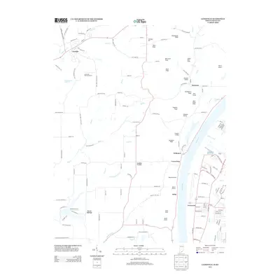 2013 Lanesville2013 Print · USGSCovers Elizabeth, including Louisville, Lanesville, and other nearby areas
 - 2016 Map of Kosmosdale, 2016 Print
 2016 Kosmosdale2016 Print · USGSCovers Elizabeth, including Louisville, Macedonia, and other nearby areas
 - 2016 Map of Lanesville, 2016 Print
 2016 Lanesville2016 Print · USGSCovers Elizabeth, including Louisville, Lanesville, and other nearby areas
 - 2019 Map of Kosmosdale, 2019 Print
 2019 Kosmosdale2019 Print · USGSCovers Elizabeth, including Louisville, Macedonia, and other nearby areas
 - 2019 Map of Lanesville, 2019 Print
 2019 Lanesville2019 Print · USGSCovers Elizabeth, including Louisville, Lanesville, and other nearby areas
 - 2022 Map of Kosmosdale, 2022 Print
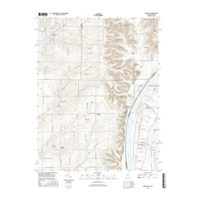
 2022 Kosmosdale2022 Print · USGSThe riverfront south of Louisville comes alive in this modern survey of the Kentucky-Indiana border. Genealogists can trace local roots through several burial grounds like McNutt Cemetery and Mill Creek Cemetery or explore the ridges of Rosewood.
 - 2022 Map of Lanesville, 2022 Print
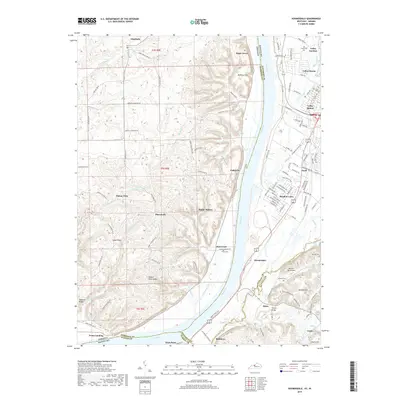
 2022 Lanesville2022 Print · USGSThe Indiana-Kentucky borderlands along the Ohio River appear here in the early 2020s, showing a landscape of deep ridges and rural family homesteads. Genealogists can locate numerous burial sites such as Tabler Cem and Saint Marys Catholic Cem near Lanesville.
End of results
Showing maps 1-25 of 25
Top cities near Elizabeth
- Louisville historical maps
- Jeffersonville historical maps
- New Albany historical maps
- Clarksville historical maps
- Shively historical maps
- Shepherdsville historical maps
See more
Frequently asked questions
- What are the different types of historical maps available for Elizabeth?
- What is the oldest map of Elizabeth?
- Where can I purchase historical maps of Elizabeth for my home or office?
- Where can I download high-res historical maps of Elizabeth?
- Are there historical topographic maps available for Elizabeth?
- Is there historical aerial imagery available for Elizabeth?
- Where are historical maps of Elizabeth sourced from?