1960s Maps of Huntington County, Indiana
Explore 13 historic maps of Huntington County from the 1960s. These maps offer a rare glimpse into what life looked like during the 1960s — showing old roads, neighborhoods, homes, and landmarks that have changed or disappeared over time.
Whether you're researching your family's past, planning a metal detecting trip, or studying how Huntington County's landscape evolved across the 1960s, these high-resolution maps are a powerful tool for exploring the history of this region.
- Focus on a specific era: All maps on this page are from the 1960s, giving you a focused view of this time period.
- See what’s changed: Compare century-old streets, trails, and buildings to today's modern landscape using overlays and satellite layers.
- Research with precision: Use these maps for genealogy, historical research, land use analysis, or educational projects.
- View, download, or print: Maps are fully viewable online in high resolution, and can be downloaded or printed for your own records.
Start exploring Huntington County's history through authentic maps from the 1960s. This is your window into the past.
Huntington County, IN maps
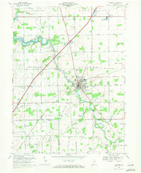
(13)- 1961 Map of Arcola, 1963 Print
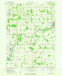
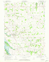
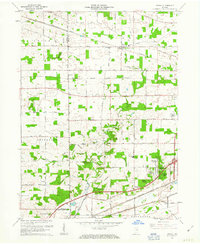 1961 Arcola1963 Print · USGSAllen County in the early sixties showcases a rural landscape evolving with new residential developments and established rail corridors. Genealogists can trace family heritage at St Patricks Cem, Bayliss Cem, or through the early settlement of Arcola and Dunfee.2 unique versions available
 - 1961 Map of Servia, 1963 Print
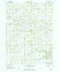 1961 Servia1963 Print · USGSWabash and Huntington Counties are captured here in the early sixties, showing a landscape of small farms and crossroads communities. Researchers can locate family landmarks such as Stockert Cem, Servia Landing Field, and the Erie-Lackawanna rail line.3 unique versions available
 - 1961 Map of Laud, 1963 Print
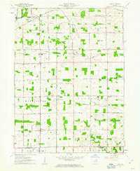 1961 Laud1963 Print · USGSWhitley and Huntington counties are shown here in the early sixties, highlighting a landscape of structured rural townships and rail-connected hamlets. Researchers can trace family history through the locations of St Catherine Ch, Jefferson Chapel, and the community of Laud.3 unique versions available
 - 1961 Map of Zanesville, 1963 Print
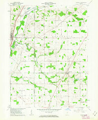 1961 Zanesville1963 Print · USGSZanesville and Roanoke are documented in the early sixties at a fascinating intersection of colonial-era surveying and mid-century rail infrastructure. Genealogists and historians can locate the Old Indian Treaty Boundary and several family landmarks like Shank Cem and Monson Chapel.
 - 1962 Map of South Whitley West, 1963 Print
 1962 South Whitley West1963 Print · USGSIndiana's Eel River valley comes into sharp focus during the early sixties as a thriving corridor of rail and river commerce. Genealogists and historians can trace the foundations of South Whitley, explore the grounds of Township Sch, or locate family plots in Glenwood Cem and Union Cem.2 unique versions available
 - 1962 Map of South Whitley East, 1963 Print
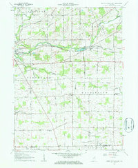 1962 South Whitley East1963 Print · USGSWhitley County agriculture and rail commerce thrived in the early sixties as the Eel River shaped the local economy. Genealogists can trace family roots through St Johns Ch, Eberhard Ch Cem, and the crossroads at Tunker.2 unique versions available
 - 1962 Map of Liberty Center, 1963 Print
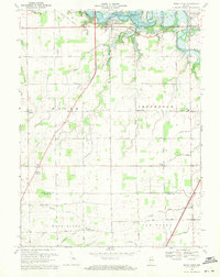
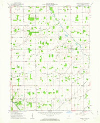 1962 Liberty Center1963 Print · USGSWells and Huntington counties in the early sixties reveal a landscape of family farms and rural crossroads. Genealogists can trace family roots through sites like Mossburg Cem, Boehmer Ch, and the settlement at Liberty Center.
 - 1969 Map of Majenica, 1971 Print
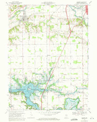
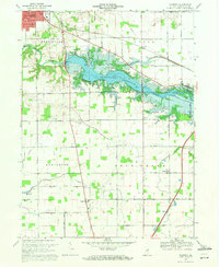 1969 Majenica1971 Print · USGSHuntington County at the end of the sixties reveals a landscape transformed by the new Huntington Reservoir and recreation areas. Researchers can trace rural family roots through the Loon Creek Ch and several local burial sites like Barnes Cem and Yankeetown Cem.3 unique versions available
 - 1969 Map of Warren, 1971 Print
 1969 Warren1971 Print · USGSWarren and its rural surroundings are captured in the late sixties, showing a landscape defined by the Salamonie River and local petroleum extraction. Researchers can trace family history at West Union Cem or locate the old Airfield and Milo settlement along the rail lines.2 unique versions available
 - 1969 Map of Andrews, 1971 Print
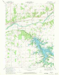
 1969 Andrews1971 Print · USGSHuntington County's landscape undergoes a significant shift in the late sixties as the newly formed Salamonie Reservoir alters the local geography. Family historians can trace rural roots through the German Settlement Cem, the town of Andrews, and landmarks like Pilcher Chapel.3 unique versions available
 - 1969 Map of Mount Etna, 1971 Print
 1969 Mount Etna1971 Print · USGSIndiana's rural heartland is captured here in the late sixties as the newly created Salamonie Reservoir reshaped the northern townships. Genealogists and local historians can locate early burial sites like Purviance Cem, and vanished school sites like Township Sch.2 unique versions available
 - 1969 Map of Lagro, 1971 Print
 1969 Lagro1971 Print · USGSWabash and Huntington counties meet here in the late sixties, where the rising waters of the Salamonie Reservoir reshape the valley. Genealogists can locate family landmarks like St Patricks Cem, Hopewell Ch, and the settlement of Lincolnville.3 unique versions available
 - 1969 Map of La Fontaine, 1972 Print
 1969 La Fontaine1972 Print · USGSThe rural borderlands of Wabash and Grant counties are captured here in the late sixties as modern reservoirs began to shape the landscape. Local historians can trace family plots at Boundary Line Cem and Gardner Cem or follow the path of the Penn Central through La Fontaine.2 unique versions available
End of results
Showing maps 1-13 of 13
Top cities of Huntington County
- Huntington historical maps
- Roanoke historical maps
- Warren historical maps
- Lancaster historical maps
- Andrews historical maps
- Mount Etna historical maps
Frequently asked questions
- What are the different types of historical maps available for Huntington County?
- What is the oldest map of Huntington County?
- Where can I purchase historical maps of Huntington County for my home or office?
- Where can I download high-res historical maps of Huntington County?
- Are there historical topographic maps available for Huntington County?
- Is there historical aerial imagery available for Huntington County?
- Where are historical maps of Huntington County sourced from?