1900s (20th Century) Maps of Edwardsport, Indiana
Explore 8 historic maps of Edwardsport from the 1900s (20th Century). These maps offer a rare glimpse into what life looked like during the 1900s — showing old roads, neighborhoods, homes, and landmarks that have changed or disappeared over time.
Whether you're researching your family's past, planning a metal detecting trip, or studying how Edwardsport's landscape evolved across the 1900s, these high-resolution maps are a powerful tool for exploring the history of this region.
- Focus on a specific era: All maps on this page are from the 1900s, giving you a focused view of this time period.
- See what’s changed: Compare century-old streets, trails, and buildings to today's modern landscape using overlays and satellite layers.
- Research with precision: Use these maps for genealogy, historical research, land use analysis, or educational projects.
- View, download, or print: Maps are fully viewable online in high resolution, and can be downloaded or printed for your own records.
Start exploring Edwardsport's history through authentic maps from the 1900s. This is your window into the past.
Edwardsport, IN maps
(8)- 1943 Map of Bicknell
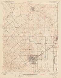 1943 Bicknell1943 Print · USGSIn the early 1940s, this portion of Knox County was a hub of coal production and rail activity centered on the growing city of Bicknell. Genealogists and historians can locate numerous family burial sites like Walker Cem and trace the local mining economy through labels like Sunshine Mine and Panhandle Mine.2 unique versions available
 - 1943 Map of Plainville
 1943 Plainville1943 Print · USGSDaviess and Knox Counties appear here in the early 1940s, where the winding loops of the White River dominate the agricultural landscape. Genealogists and local historians can trace family locations near Plainville, Westphalia, or the historic Vincennes Tract boundary.2 unique versions available
 - 1956 Map of Vincennes, 1967 Print
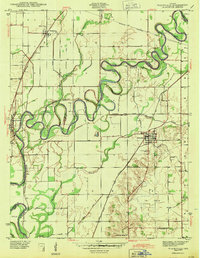
 1956 Vincennes1967 Print · USGSSouthern Indiana and the Illinois borderlands are captured here in the mid-fifties, showing the region's dense network of river towns and rail lines. Researchers can trace historic river crossings along the Wabash River or locate landmarks like Wyandotte Cave and Lincoln State Park.4 unique versions available
 - 1957 Map of Vincennes
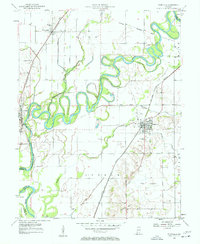
 1957 Vincennes1957 Print · USGSSouthwest Indiana and the Illinois borderlands come alive in the late 1950s, a period of heavy rail traffic and expanding state forests. Genealogists and historians can trace the riverfronts and rail lines of Vincennes, New Harmony, and the vast Crane Naval Ammunition Depot.
 - 1957 Map of Plainville, 1958 Print
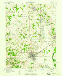
 1957 Plainville1958 Print · USGSDaviess and Knox counties are captured here in the late fifties, showcasing the intricate meanders of the White River. Genealogists and local historians can trace the foundations of Plainville and Westphalia, locating old Oil Wells, Salem Ch, and the Plainville Cem.3 unique versions available
 - 1958 Map of Vincennes
 1958 Vincennes1958 Print · USGSSouthern Indiana and the Illinois borderlands are captured during a mid-century period of heavy rail traffic and military activity. Researchers can trace the sprawling bounds of the Crane Naval Ammunition Depot or locate historic settlements like New Harmony and French Lick.2 unique versions available
 - 1958 Map of Bicknell, 1960 Print
 1958 Bicknell1960 Print · USGSKnox County was a hub of coal production and rail transport during the mid-century, with extensive excavations shaping the land. Researchers can trace the legacy of local families at Chambers Cem, explore the mining works near Johnstown, or locate the historic Bethel Ch.3 unique versions available
 - 1986 Map of Vincennes
 1986 Vincennes1986 Print · USGSThe Wabash River valley in the mid-1980s shows a landscape defined by deep-rooted river towns and heavy industry. Researchers can trace the legacy of regional rail lines like the Conrail system or locate landmarks such as Vincennes University and St Francisville Church.2 unique versions available
End of results
Showing maps 1-8 of 8
Top cities near Edwardsport
- Vincennes historical maps
- Washington historical maps
- Linton historical maps
- Bicknell historical maps
- Busseron historical maps
- Lyons historical maps
See more
Frequently asked questions
- What are the different types of historical maps available for Edwardsport?
- What is the oldest map of Edwardsport?
- Where can I purchase historical maps of Edwardsport for my home or office?
- Where can I download high-res historical maps of Edwardsport?
- Are there historical topographic maps available for Edwardsport?
- Is there historical aerial imagery available for Edwardsport?
- Where are historical maps of Edwardsport sourced from?