Old Maps of Kosciusko County, Indiana for Hiking & Exploration
Hike through history with 110 historic maps of Kosciusko County. Explore old trails, ghost towns, and forgotten backroads — perfect for outdoor adventurers and local explorers.
- Rediscover forgotten places: Map out old mining camps, roads, and footpaths that no longer exist on modern maps.
- Layer with modern tools: Combine with LiDAR or satellite views to plan hikes through historical terrain.
- Made for exploration: Popular among hikers, overlanders, and local history lovers.
Use these maps to find adventure and explore the hidden past of Kosciusko County.
Kosciusko County, IN maps
(110)- 1950 Map of Leesburg, 1952 Print
 1950 Leesburg1952 Print · USGSKosciusko County at the start of the fifties shows a lakefront landscape evolving through rail and air travel. Trace family roots at New Salem or Dutchtown, and explore the shoreline landings at Big Chapman Lake and the grounds of the Tippecanoe Country Club.2 unique versions available
 - 1950 Map of Pierceton, 1952 Print
 1950 Pierceton1952 Print · USGSIndiana's farm country and glacial lake districts are captured here in the early fifties, centered on the railroad town of Pierceton. Trace family roots at Washington-Union Cemetery, locate the Consolidated School, or explore the shores of Robinson and Sellers Lake.2 unique versions available
 - 1950 Map of North Webster, 1952 Print
 1950 North Webster1952 Print · USGSKosciusko County’s lake country was a thriving hub of summer camps and rural parishes at the start of the 1950s. Genealogists and local researchers can trace old family sites and shoreline developments near North Webster, Epworth Forest, and Morris Chapel.2 unique versions available
 - 1951 Map of Milford
 1951 Milford1951 Print · USGSKosciusko and Elkhart counties are captured in the early fifties at a peak of rail activity and lakeside development. Genealogists and rail historians can trace the crossing of three major lines at Milford Junction or locate family sites like Pleasant View Cem Ch and Bethany Sch.2 unique versions available
 - 1951 Map of Wawasee
 1951 Wawasee1951 Print · USGSKosciusko and Noble counties are captured here in the early fifties, showing the vibrant lakeside communities and rural townships. Genealogists can trace family landmarks and early schools like Judy School, Weybright Cem, and the Zion Church near the town of Syracuse.2 unique versions available
 - 1953 Map of Fort Wayne, 1963 Print
 1953 Fort Wayne1963 Print · USGSNortheast Indiana and its neighboring borderlands in Michigan and Ohio appear here during a peak era of rail and road expansion. Researchers can trace the massive rail networks of the Nickel Plate Road and Wabash or locate lakeside landmarks like Lake Wawasee and Clear Lake.4 unique versions available
 - 1953 Map of Chicago, 1964 Print
 1953 Chicago1964 Print · USGSThe southern Lake Michigan shoreline was rapidly modernizing in the mid-fifties, balancing heavy industry with its famous academic centers. Researchers can trace the footprints of Notre Dame University or locate vanished sites like the Kingsbury Ordnance Plant and Meigs Field.5 unique versions available
 - 1956 Map of Fort Wayne
 1956 Fort Wayne1956 Print · USGSThe tri-state borderlands of Indiana, Michigan, and Ohio are captured here in the mid-fifties, centered on the growing industrial hub of Fort Wayne. Researchers can trace the heavy rail lines of the New York Central and Pennsylvania alongside prominent water features like Lake Wawasee and the Maumee River.2 unique versions available
 - 1957 Map of Chicago
 1957 Chicago1957 Print · USGSThe industrial heartland and southern Great Lakes shoreline are captured here during the peak of mid-century growth. Researchers can trace the massive Gary Steel Works, the grounds of the University of Notre Dame, and the early paths of the Tri-State Tollway.
 - 1957 Map of Warsaw, 1959 Print
 1957 Warsaw1959 Print · USGSKosciusko County centers on the growing hub of Warsaw and the lakefront campus of Winona Lake during the late 1950s. Genealogists can trace family landmarks like Oakwood Cemetery, the County Home, and local schools including Consolidated Sch.4 unique versions available
 - 1958 Map of Nappanee West, 1960 Print
 1958 Nappanee West1960 Print · USGSNorthern Indiana farm country is captured here in the late fifties, showing the rural grid where Marshall and Elkhart counties meet. Genealogists can trace family footprints through Borkholder Sch, South Union Chapel, and Sarah Hershberger Road.3 unique versions available
 - 1958 Map of Nappanee East, 1960 Print
 1958 Nappanee East1960 Print · USGSNorthern Kosciusko County appears as a burgeoning agricultural and rail corridor in the late fifties. Genealogists can trace family landmarks like Wisler Ch, Providence Cem, and the small community of Gravelton along the railroad.2 unique versions available
 - 1958 Map of Bourbon, 1960 Print
 1958 Bourbon1960 Print · USGSNorthern Indiana farm country and the crossroads at Bourbon are captured here in the late fifties. Genealogists can trace family names at Odd Fellows Cem or locate the Township Sch and rural churches like Jerusalem Ch.4 unique versions available
 - 1959 Map of Atwood, 1960 Print
 1959 Atwood1960 Print · USGSKosciusko County in the late fifties reveals a landscape of productive farmland and small rail-oriented towns. Researchers can trace family history through sites like Graber Cem and Highland Cem or locate vintage landmarks like the Drive-in Theater near Atwood.3 unique versions available
 - 1959 Map of Mentone, 1961 Print
 1959 Mentone1961 Print · USGSThe Tippecanoe River valley was a busy agricultural corridor in the late fifties, defined by its complex drainage networks and rail connections. Local historians can trace old community centers like Old Tip Town and Sevastopol, or locate family sites near Summit Chapel and Sycamore Cem.3 unique versions available
 - 1961 Map of Silver Lake, 1963 Print
 1961 Silver Lake1963 Print · USGSThe lake country of Kosciusko County comes into focus in the early sixties, showing the intersection of rural agriculture and rail-side industry. Genealogists can trace family roots through sites like Graceland Cem, Silver Creek Ch, and the small settlement of Disko.2 unique versions available
 - 1961 Map of Lake Wawasee, 1963 Print
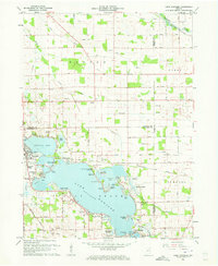 1961 Lake Wawasee1963 Print · USGSKosciusko County lakelife in the early sixties centers on Lake Wawasee and its surrounding communities. Researchers can trace family history through sites like Hire Cemetery, Juday School, and the lakeside settlements of Vawter Park and Pickwick Park.3 unique versions available
 - 1961 Map of Burket, 1963 Print
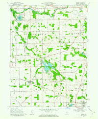 1961 Burket1963 Print · USGSKosciusko County’s agricultural and rail landscape is captured here in the early sixties as the Tippecanoe River winds through the northern townships. Researchers can trace the footprints of Palestine and Burket, locating family landmarks like Cooks Chapel, Township Sch, and Nye Cem.3 unique versions available
 - 1962 Map of North Manchester North, 1963 Print
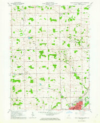 1962 North Manchester North1963 Print · USGSKosciusko and Wabash counties are captured here in the early sixties, showing the rural grid and rail towns of northern Indiana. Genealogists can trace family sites at Rose Hill Cem, West Eel River Ch, and the grounds of Manchester College.2 unique versions available
 - 1962 Map of South Whitley West, 1963 Print
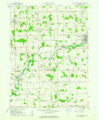 1962 South Whitley West1963 Print · USGSIndiana's Eel River valley comes into sharp focus during the early sixties as a thriving corridor of rail and river commerce. Genealogists and historians can trace the foundations of South Whitley, explore the grounds of Township Sch, or locate family plots in Glenwood Cem and Union Cem.2 unique versions available
 - 1962 Map of Milford, 1963 Print
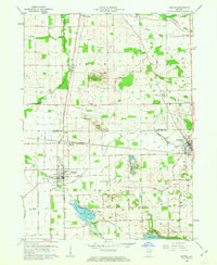 1962 Milford1963 Print · USGSNorthern Indiana's rail and river networks are in full view during the early sixties, centered on the crossing of major lines. Genealogists and local historians can trace the locations of Milford Cem, Bethany Sch, and family sites near Wabee Lake.3 unique versions available
 - 1962 Map of Akron, 1964 Print
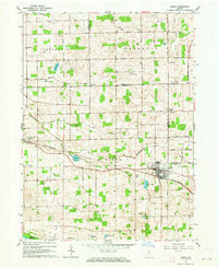 1962 Akron1964 Print · USGSAkron and the Fulton-Kosciusko county line are shown here in the early sixties, a period when rail service still anchored these agricultural townships. Researchers can locate family landmarks such as Bethlehem Ch, Mt Hope Athens Cem, and the small settlement of Athens.3 unique versions available
 - 1962 Map of North Webster, 1964 Print
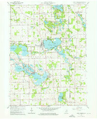 1962 North Webster1964 Print · USGSKosciusko County lakeland in the early sixties reveals a landscape of summer camps and sprawling shoreline settlements. Trace family roots and local history at Indian Village, Mock Cem, and the specialized Tri-County State Fish and Game Area.4 unique versions available
 - 1962 Map of Leesburg, 1964 Print
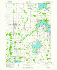 1962 Leesburg1964 Print · USGSKosciusko County lake country in the early sixties shows a landscape of lakeside retreats and traditional Indiana farmland. Researchers can trace the Old Indian Treaty Boundary and locate family landmarks like New Salem Church or Groves Cemetery.2 unique versions available
 - 1962 Map of Pierceton, 1964 Print
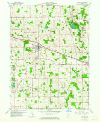 1962 Pierceton1964 Print · USGSNortheastern Indiana during the early 1960s shows a landscape of glacial lakes and small-town rail hubs. Trace the paths of the Pennsylvania Railroad and Lincoln Highway past Hillcrest Cem and Sellers Lake.2 unique versions available
Showing maps 1-25 of 110
Top cities of Kosciusko County
- Warsaw historical maps
- Winona Lake historical maps
- Syracuse historical maps
- Milford historical maps
- North Webster historical maps
- Silver Lake historical maps
See more
Frequently asked questions
- What are the different types of historical maps available for Kosciusko County?
- What is the oldest map of Kosciusko County?
- Where can I purchase historical maps of Kosciusko County for my home or office?
- Where can I download high-res historical maps of Kosciusko County?
- Are there historical topographic maps available for Kosciusko County?
- Is there historical aerial imagery available for Kosciusko County?
- Where are historical maps of Kosciusko County sourced from?